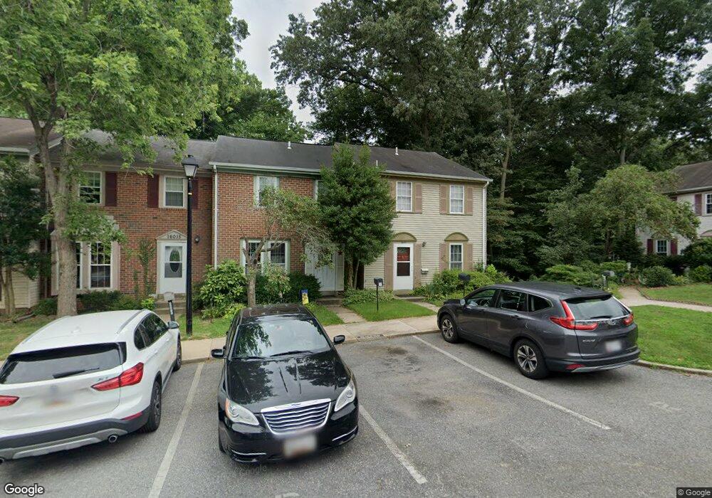
16011 Dorset Rd Laurel, MD 20707
Estimated Value: $339,620 - $377,000
3
Beds
3
Baths
1,890
Sq Ft
$189/Sq Ft
Est. Value
About This Home
This home is located at 16011 Dorset Rd, Laurel, MD 20707 and is currently estimated at $356,905, approximately $188 per square foot. 16011 Dorset Rd is a home located in Prince George's County with nearby schools including Scotchtown Hills Elementary School, Laurel High School, and Christian Academy of Laurel.
Ownership History
Date
Name
Owned For
Owner Type
Purchase Details
Closed on
Sep 1, 2009
Sold by
Vaughan David J and Vaughan Mary K
Bought by
Kushinsky Carl J and Glenn Craig A
Current Estimated Value
Home Financials for this Owner
Home Financials are based on the most recent Mortgage that was taken out on this home.
Original Mortgage
$236,045
Outstanding Balance
$155,076
Interest Rate
5.36%
Mortgage Type
FHA
Estimated Equity
$201,829
Purchase Details
Closed on
Jun 8, 2004
Sold by
Turner William J
Bought by
Vaughan David J and Unit 171
Create a Home Valuation Report for This Property
The Home Valuation Report is an in-depth analysis detailing your home's value as well as a comparison with similar homes in the area
Home Values in the Area
Average Home Value in this Area
Purchase History
| Date | Buyer | Sale Price | Title Company |
|---|---|---|---|
| Kushinsky Carl J | $240,400 | -- | |
| Vaughan David J | $185,000 | -- |
Source: Public Records
Mortgage History
| Date | Status | Borrower | Loan Amount |
|---|---|---|---|
| Open | Kushinsky Carl J | $236,045 |
Source: Public Records
Tax History Compared to Growth
Tax History
| Year | Tax Paid | Tax Assessment Tax Assessment Total Assessment is a certain percentage of the fair market value that is determined by local assessors to be the total taxable value of land and additions on the property. | Land | Improvement |
|---|---|---|---|---|
| 2025 | $4,346 | $233,000 | $69,900 | $163,100 |
| 2024 | $4,346 | $233,000 | $69,900 | $163,100 |
| 2023 | $3,842 | $233,000 | $69,900 | $163,100 |
| 2022 | $3,842 | $233,000 | $69,900 | $163,100 |
| 2021 | $8,095 | $208,667 | $0 | $0 |
| 2020 | $6,753 | $184,333 | $0 | $0 |
| 2019 | $3,134 | $160,000 | $48,000 | $112,000 |
| 2018 | $2,925 | $159,000 | $0 | $0 |
| 2017 | $2,918 | $158,000 | $0 | $0 |
| 2016 | -- | $157,000 | $0 | $0 |
| 2015 | $3,804 | $157,000 | $0 | $0 |
| 2014 | $3,804 | $157,000 | $0 | $0 |
Source: Public Records
Map
Nearby Homes
- 7709 Brooklyn Bridge Rd
- 7619 Woodbine Dr
- 7616 Woodbine Dr
- 7323 Split Rail Ln
- 15708 Dorset Rd Unit 203
- 15708 Dorset Rd Unit 304
- 7105 Split Rail Ln
- 15603 Dorset Rd Unit 101
- 15712 Dorset Rd Unit T3
- 1210 Westview Terrace
- 7419 Berryleaf Dr
- 16140 Kenny Rd
- 15443 Arbory Way
- 1106 Snowden Place
- 211 Patuxent Rd
- 7403 Berryleaf Dr
- 1103 Montgomery St
- Dorchester IV Plan at Cole's Manor
- Tidewater Plan at Cole's Manor
- Stratton Plan at Cole's Manor
- 16013 Dorset Rd
- 16015 Dorset Rd
- 16017 Dorset Rd
- 16019 Dorset Rd
- 16009 Dorset Rd
- 16007 Dorset Rd
- 16005 Dorset Rd
- 16003 Dorset Rd
- 16021 Dorset Rd
- 16001 Dorset Rd
- 16023 Dorset Rd
- 16027 Dorset Rd
- 16025 Dorset Rd
- 16035 Dorset Rd
- 16037 Dorset Rd
- 16029 Dorset Rd
- 16033 Dorset Rd
- 16041 Dorset Rd
- 16031 Dorset Rd
- 16039 Dorset Rd