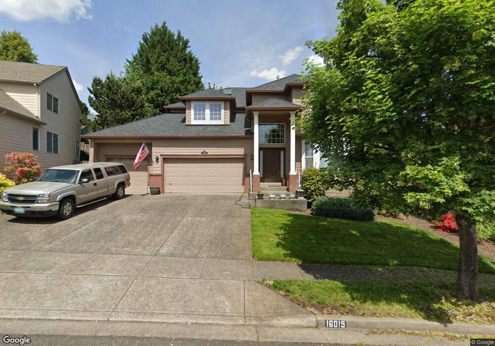
16015 SW Bobolink St Beaverton, OR 97007
Neighbors Southwest NeighborhoodEstimated Value: $715,000 - $776,000
3
Beds
3
Baths
2,561
Sq Ft
$291/Sq Ft
Est. Value
About This Home
This home is located at 16015 SW Bobolink St, Beaverton, OR 97007 and is currently estimated at $744,368, approximately $290 per square foot. 16015 SW Bobolink St is a home located in Washington County with nearby schools including Scholls Heights Elementary School, Conestoga Middle School, and Mountainside High School.
Ownership History
Date
Name
Owned For
Owner Type
Purchase Details
Closed on
Jun 16, 2022
Sold by
Kluempke Scott D
Bought by
Scott D Kluempke Living Trust
Current Estimated Value
Purchase Details
Closed on
Feb 11, 1998
Sold by
Matrix Development Corp
Bought by
Kluempke Scott D and Kluempke Cheryl L
Home Financials for this Owner
Home Financials are based on the most recent Mortgage that was taken out on this home.
Original Mortgage
$198,800
Interest Rate
7.02%
Create a Home Valuation Report for This Property
The Home Valuation Report is an in-depth analysis detailing your home's value as well as a comparison with similar homes in the area
Home Values in the Area
Average Home Value in this Area
Purchase History
| Date | Buyer | Sale Price | Title Company |
|---|---|---|---|
| Scott D Kluempke Living Trust | -- | None Listed On Document | |
| Kluempke Scott D | $248,525 | First American Title Ins Co |
Source: Public Records
Mortgage History
| Date | Status | Borrower | Loan Amount |
|---|---|---|---|
| Previous Owner | Kluempke Scott D | $198,800 |
Source: Public Records
Tax History Compared to Growth
Tax History
| Year | Tax Paid | Tax Assessment Tax Assessment Total Assessment is a certain percentage of the fair market value that is determined by local assessors to be the total taxable value of land and additions on the property. | Land | Improvement |
|---|---|---|---|---|
| 2026 | $8,842 | $431,640 | -- | -- |
| 2025 | $8,842 | $419,070 | -- | -- |
| 2024 | $8,348 | $406,870 | -- | -- |
| 2023 | $8,348 | $395,020 | $0 | $0 |
| 2022 | $7,990 | $395,020 | $0 | $0 |
| 2021 | $7,710 | $372,350 | $0 | $0 |
| 2020 | $7,475 | $361,510 | $0 | $0 |
| 2019 | $7,239 | $350,990 | $0 | $0 |
| 2018 | $7,008 | $340,770 | $0 | $0 |
| 2017 | $6,746 | $330,850 | $0 | $0 |
| 2016 | $6,511 | $321,220 | $0 | $0 |
| 2015 | $6,269 | $311,870 | $0 | $0 |
| 2014 | $6,136 | $302,790 | $0 | $0 |
Source: Public Records
Map
Nearby Homes
- 12365 Curlew Way
- 12450 Curlew Way
- 16140 SW Puffin Ct
- 12697 SW Canvasback Way
- 15598 SW Wren Ln
- 15900 SW Snowy Owl Ln
- 15702 SW Snowy Owl Ln
- 15557 SW Wren Ln
- 15620 SW Snowy Owl Ln
- 12420 SW Harlequin Dr
- 15410 SW Sparrow Loop
- 15465 SW Sparrow Loop Unit 102
- 12263 SW Bittern Terrace
- 12258 SW Bittern Terrace
- Sellwood Plan at Heights at Cooper Mountain
- Burlington Plan at Heights at Cooper Mountain
- Bainbridge Plan at Heights at Cooper Mountain
- Jade Plan at Heights at Cooper Mountain
- Pecan Plan at Heights at Cooper Mountain
- Endicott Plan at Heights at Cooper Mountain
- 16035 SW Bobolink St
- 15915 SW Loon Dr
- 15990 SW Black Bird Dr
- 15905 SW Loon Dr
- 15935 SW Bobolink St
- 16020 SW Black Bird Dr
- 16065 SW Bobolink St
- 16010 SW Bobolink St
- 16030 SW Bobolink St
- 15990 SW Bobolink St
- 12010 SW Finch St
- 16040 SW Black Bird Dr
- 16085 SW Bobolink St
- 16070 SW Bobolink St
- 12065 SW Turnstone Ave
- 15935 SW Loon Dr
- 15920 SW Loon Dr
- 16015 SW Black Bird Dr
- 16060 SW Black Bird Dr
- 15910 SW Loon Dr