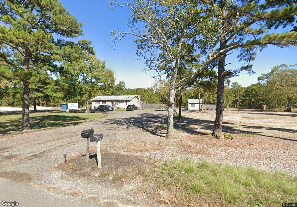
1602 Mays Landing Rd Hammonton, NJ 08037
Estimated Value: $162,000 - $341,000
--
Bed
--
Bath
1,248
Sq Ft
$167/Sq Ft
Est. Value
About This Home
This home is located at 1602 Mays Landing Rd, Hammonton, NJ 08037 and is currently estimated at $208,594, approximately $167 per square foot. 1602 Mays Landing Rd is a home located in Atlantic County with nearby schools including Folsom Elementary School and Life Mission Training Center.
Ownership History
Date
Name
Owned For
Owner Type
Purchase Details
Closed on
Sep 17, 2024
Sold by
1602 Mays Landing Llc
Bought by
Gillespie Robert
Current Estimated Value
Purchase Details
Closed on
Mar 5, 2024
Sold by
Mauger Norine
Bought by
1602 Mays Landing Llc
Home Financials for this Owner
Home Financials are based on the most recent Mortgage that was taken out on this home.
Original Mortgage
$150,000
Interest Rate
6.82%
Mortgage Type
New Conventional
Purchase Details
Closed on
Jun 19, 2019
Sold by
Gillespie Mary Ann and The Estate Of Emanuel Brown
Bought by
Mauger Norine
Create a Home Valuation Report for This Property
The Home Valuation Report is an in-depth analysis detailing your home's value as well as a comparison with similar homes in the area
Home Values in the Area
Average Home Value in this Area
Purchase History
| Date | Buyer | Sale Price | Title Company |
|---|---|---|---|
| Gillespie Robert | $152,100 | None Listed On Document | |
| 1602 Mays Landing Llc | $150,000 | Foundation Title | |
| Mauger Norine | -- | None Available |
Source: Public Records
Mortgage History
| Date | Status | Borrower | Loan Amount |
|---|---|---|---|
| Previous Owner | 1602 Mays Landing Llc | $150,000 |
Source: Public Records
Tax History Compared to Growth
Tax History
| Year | Tax Paid | Tax Assessment Tax Assessment Total Assessment is a certain percentage of the fair market value that is determined by local assessors to be the total taxable value of land and additions on the property. | Land | Improvement |
|---|---|---|---|---|
| 2025 | $3,696 | $168,600 | $84,300 | $84,300 |
| 2024 | $3,696 | $168,600 | $84,300 | $84,300 |
| 2023 | $3,647 | $168,600 | $84,300 | $84,300 |
| 2022 | $3,647 | $168,600 | $84,300 | $84,300 |
| 2021 | $3,616 | $168,600 | $84,300 | $84,300 |
| 2020 | $3,519 | $168,600 | $84,300 | $84,300 |
| 2019 | $3,382 | $168,600 | $84,300 | $84,300 |
| 2018 | $3,379 | $168,600 | $84,300 | $84,300 |
| 2017 | $3,606 | $111,300 | $35,200 | $76,100 |
| 2016 | $3,477 | $111,300 | $35,200 | $76,100 |
| 2015 | $3,396 | $111,300 | $35,200 | $76,100 |
| 2014 | $3,400 | $111,300 | $35,200 | $76,100 |
Source: Public Records
Map
Nearby Homes
- 1307 Black Horse Pike
- 2212 Evergreen Dr
- 2216 Evergreen Dr
- 7684 E Black Horse Pike
- 1528 Mays Landing Rd
- 1206 Black Horse Park
- 7640 Black Horse Pike
- 7640 Black Horse Pike
- 119 Boxwood Rd
- 1022 Black Horse Pike
- 451 9th St
- 720 6th Rd
- 00 11th St
- 909 8th St
- 2015 High Bank Rd
- 1362 Mays Landing Rd
- 7575 Weymouth Rd
- 0 9th St Unit 600946
- 523 6th Rd
- 1021 Route 54
- 1403 Black Horse Pike
- . Black Horse Pike
- 2013 Lake Dr
- 2011 Lake Dr
- 2007 Lake Dr
- 2017 Lake Dr
- 2005 Lake Dr
- 2015 Lake Dr
- 2019 Lake Dr
- 3100 N Pinewood Dr
- 2021 Lake Dr
- 2001 Lake Dr
- 2012 Lake Dr
- 2010 Lake Dr
- 3102 N Pinewood Dr
- 0 St Unit NJAC2020620
- 2006 Lake Dr
- 3004 8th St
- 3200 Oakwood Dr
- 3104 N Pinewood Dr