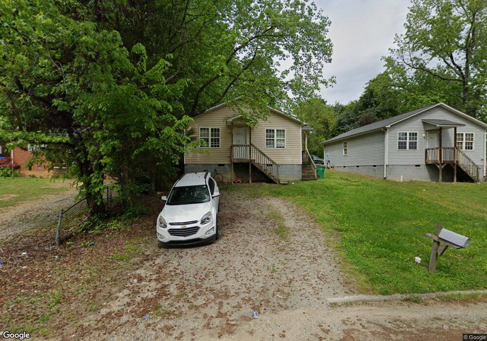
1602 Pershing St High Point, NC 27260
Greater High Point NeighborhoodEstimated Value: $130,000 - $162,000
3
Beds
2
Baths
962
Sq Ft
$155/Sq Ft
Est. Value
About This Home
This home is located at 1602 Pershing St, High Point, NC 27260 and is currently estimated at $149,056, approximately $154 per square foot. 1602 Pershing St is a home located in Guilford County with nearby schools including Fairview Elementary School, Ferndale Middle School, and High Point Central High School.
Ownership History
Date
Name
Owned For
Owner Type
Purchase Details
Closed on
Aug 3, 2020
Sold by
Hensley Rodney D and Hensley Lavinia B
Bought by
Hensley Investment Properties Inc
Current Estimated Value
Home Financials for this Owner
Home Financials are based on the most recent Mortgage that was taken out on this home.
Original Mortgage
$1,800,000
Outstanding Balance
$952,327
Interest Rate
3%
Mortgage Type
Construction
Estimated Equity
-$803,271
Create a Home Valuation Report for This Property
The Home Valuation Report is an in-depth analysis detailing your home's value as well as a comparison with similar homes in the area
Home Values in the Area
Average Home Value in this Area
Purchase History
| Date | Buyer | Sale Price | Title Company |
|---|---|---|---|
| Hensley Investment Properties Inc | -- | None Available |
Source: Public Records
Mortgage History
| Date | Status | Borrower | Loan Amount |
|---|---|---|---|
| Open | Hensley Investment Properties Inc | $1,800,000 |
Source: Public Records
Tax History
| Year | Tax Paid | Tax Assessment Tax Assessment Total Assessment is a certain percentage of the fair market value that is determined by local assessors to be the total taxable value of land and additions on the property. | Land | Improvement |
|---|---|---|---|---|
| 2025 | $1,102 | $80,000 | $7,000 | $73,000 |
| 2024 | $1,102 | $80,000 | $7,000 | $73,000 |
| 2023 | $1,102 | $80,000 | $7,000 | $73,000 |
| 2022 | $1,078 | $80,000 | $7,000 | $73,000 |
| 2021 | $960 | $69,700 | $4,000 | $65,700 |
| 2020 | $960 | $69,700 | $4,000 | $65,700 |
| 2019 | $960 | $69,700 | $0 | $0 |
| 2018 | $956 | $69,700 | $0 | $0 |
| 2017 | $956 | $69,700 | $0 | $0 |
| 2016 | $1,060 | $75,600 | $0 | $0 |
| 2015 | $1,066 | $75,600 | $0 | $0 |
| 2014 | $1,084 | $75,600 | $0 | $0 |
Source: Public Records
Map
Nearby Homes
- 1012 Jefferson St
- 1103 Jefferson St
- 650 Wesley Dr
- 1010 Grace St
- 812 E Russell Ave
- 640 Wesley Dr
- 705 Wise Ave
- 1021 Asheboro St
- 909 Randolph St
- 1114 Richland St
- 925 Randolph St
- 1015 Sharon St
- 1422 Valley Ridge Dr
- 1914 E Russell Ave
- 702 Park St
- 1314 Franklin Ave
- 526 White Oak St
- 507 E Grimes Ave
- 809 E Green Dr
- 423 Tate St
- 1600 Pershing St
- 1606 Pershing St
- 901 Jefferson St
- 1109 Wilson Place
- 1107 Wilson Place
- 1105 Wilson Place
- 907 Jefferson St
- 909 Jefferson St
- 1605 Pershing St
- 1103 Wilson Place
- 1607 Pershing St
- 1601 Pershing St Unit 1603
- 1004 Wilson Place
- 1002 Wilson Place
- 1609 Pershing St
- 1005 Pershing St
- 1519 Pershing St
- 911 Jefferson St
- 1611 Pershing St
- 1515 Pershing St
Your Personal Tour Guide
Ask me questions while you tour the home.