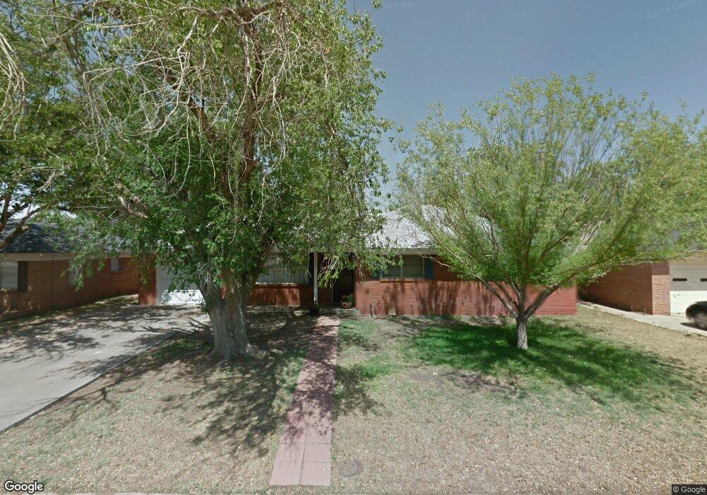
1602 Sparks St Midland, TX 79701
Estimated Value: $403,000 - $442,000
--
Bed
--
Bath
2,420
Sq Ft
$176/Sq Ft
Est. Value
About This Home
This home is located at 1602 Sparks St, Midland, TX 79701 and is currently estimated at $425,284, approximately $175 per square foot. 1602 Sparks St is a home located in Midland County with nearby schools including Fannin Elementary School, Midland High School, and Grace Lutheran Early Child Program.
Ownership History
Date
Name
Owned For
Owner Type
Purchase Details
Closed on
May 18, 2006
Sold by
Tippens Mary Y
Bought by
Th City Of Midland Texas
Current Estimated Value
Purchase Details
Closed on
Jun 5, 2002
Sold by
Seale Rodney L
Bought by
Torres Vidal B
Purchase Details
Closed on
Mar 1, 1987
Bought by
Torres Vidal B
Purchase Details
Closed on
Mar 10, 1978
Bought by
Torres Vidal B
Create a Home Valuation Report for This Property
The Home Valuation Report is an in-depth analysis detailing your home's value as well as a comparison with similar homes in the area
Home Values in the Area
Average Home Value in this Area
Purchase History
| Date | Buyer | Sale Price | Title Company |
|---|---|---|---|
| Th City Of Midland Texas | -- | Lone Star Abstract & Title C | |
| Torres Vidal B | -- | -- | |
| Torres Vidal B | -- | -- | |
| Torres Vidal B | -- | -- |
Source: Public Records
Tax History Compared to Growth
Tax History
| Year | Tax Paid | Tax Assessment Tax Assessment Total Assessment is a certain percentage of the fair market value that is determined by local assessors to be the total taxable value of land and additions on the property. | Land | Improvement |
|---|---|---|---|---|
| 2025 | $4,147 | $445,380 | $23,330 | $422,050 |
| 2024 | $4,156 | $455,080 | $23,330 | $431,750 |
| 2023 | $4,009 | $455,080 | $23,330 | $431,750 |
| 2022 | $6,136 | $409,770 | $23,330 | $386,440 |
| 2021 | $6,220 | $413,880 | $23,330 | $390,550 |
| 2020 | $4,731 | $393,160 | $23,330 | $369,830 |
| 2019 | $5,586 | $295,060 | $23,330 | $369,830 |
| 2018 | $5,215 | $268,230 | $23,330 | $337,540 |
| 2017 | $4,741 | $243,850 | $23,330 | $263,150 |
| 2016 | $4,318 | $221,680 | $23,330 | $198,350 |
| 2015 | -- | $221,680 | $23,330 | $198,350 |
| 2014 | -- | $221,530 | $23,330 | $198,200 |
Source: Public Records
Map
Nearby Homes
- 2300 W Golf Course Rd
- 2207 Boyd Ave
- 1426 Lanham St
- 1422 Lanham St
- 1604 N N St
- 6716 S County Road 1160 Unit A
- 1901 N Garfield St
- 2011 Community Ln
- 2203 Princeton Ave
- 2003 Community Ln
- 2208 Bedford Dr
- 1608 N L St
- 2008 Harvard Ave
- 2008 Bedford Dr
- 2009 Bedford Dr
- 1501 Bedford Dr
- 1607 Shell Ave
- 1605 Shell Ave
- 1606 Shell Ave
- 1605 N I St
- 1604 Sparks St
- 1600 Sparks St
- 1606 Sparks St
- 2300 Lockheed Dr
- 1607 N Garfield St
- 1605 N Garfield St
- 1416 Sparks St
- 1609 N Garfield St
- 1601 Sparks St
- 1601 N Garfield St
- 2301 W Golf Course Rd
- 2302 Lockheed Dr
- 1603 Sparks St
- 1419 Sparks St
- 1414 Sparks St
- 1509 N Garfield St
- 1417 Sparks St
- 2304 Lockheed Dr
- 2309 W Golf Course Rd
- 1602 N Garfield St