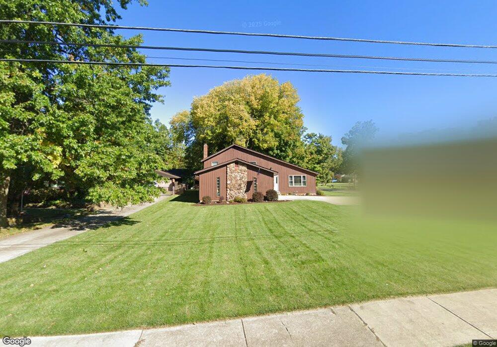
16022 Boston Rd Strongsville, OH 44136
Estimated Value: $349,190 - $418,000
4
Beds
2
Baths
2,120
Sq Ft
$180/Sq Ft
Est. Value
About This Home
This home is located at 16022 Boston Rd, Strongsville, OH 44136 and is currently estimated at $380,548, approximately $179 per square foot. 16022 Boston Rd is a home located in Cuyahoga County with nearby schools including Strongsville High School and Saint Ambrose Catholic School.
Ownership History
Date
Name
Owned For
Owner Type
Purchase Details
Closed on
Nov 21, 2022
Sold by
Schroeder Irene A and Schroeder Henry M
Bought by
Schroeder Henry M and Schroeder Irene A
Current Estimated Value
Purchase Details
Closed on
Jun 10, 1982
Sold by
Schroeder Henry M
Bought by
Irene A Schroeder
Purchase Details
Closed on
Jul 20, 1977
Sold by
Lahood John and Lahood Emile
Bought by
Schroeder Henry M
Purchase Details
Closed on
Oct 28, 1975
Sold by
Higgins Alan
Bought by
Lahood John and Lahood Emile
Purchase Details
Closed on
Jan 1, 1975
Bought by
Higgins Alan
Create a Home Valuation Report for This Property
The Home Valuation Report is an in-depth analysis detailing your home's value as well as a comparison with similar homes in the area
Home Values in the Area
Average Home Value in this Area
Purchase History
| Date | Buyer | Sale Price | Title Company |
|---|---|---|---|
| Schroeder Henry M | -- | None Listed On Document | |
| Irene A Schroeder | -- | -- | |
| Schroeder Henry M | $68,900 | -- | |
| Lahood John | $6,700 | -- | |
| Higgins Alan | -- | -- |
Source: Public Records
Tax History Compared to Growth
Tax History
| Year | Tax Paid | Tax Assessment Tax Assessment Total Assessment is a certain percentage of the fair market value that is determined by local assessors to be the total taxable value of land and additions on the property. | Land | Improvement |
|---|---|---|---|---|
| 2024 | $4,235 | $99,995 | $16,170 | $83,825 |
| 2023 | $3,912 | $71,650 | $18,520 | $53,130 |
| 2022 | $3,910 | $71,650 | $18,520 | $53,130 |
| 2021 | $3,879 | $71,650 | $18,520 | $53,130 |
| 2020 | $3,484 | $58,730 | $15,190 | $43,540 |
| 2019 | $3,382 | $167,800 | $43,400 | $124,400 |
| 2018 | $3,069 | $58,730 | $15,190 | $43,540 |
| 2017 | $2,794 | $50,860 | $13,690 | $37,170 |
| 2016 | $2,771 | $50,860 | $13,690 | $37,170 |
| 2015 | $2,810 | $50,860 | $13,690 | $37,170 |
| 2014 | $2,810 | $50,860 | $13,690 | $37,170 |
Source: Public Records
Map
Nearby Homes
- 15772 Boston Rd
- 15604-REAR Boston Rd
- 97 Weathervane Ln
- 19740 Benbow Rd
- 19694 Benbow Rd
- 15188 Trails Landing
- 16711 Beech Cir
- 14985 Camden Cir
- 3137 Blackburn Ln
- 19813 Cross Trail S
- 18987 Laurell Cir
- 18229 Howe Rd
- 19364 Ridgeline Ct
- 17745 Brick Mill Run
- 159 Sunflower Dr
- 17130 Golden Star Dr
- 291 Crestway Oval
- 16486 S Red Rock Dr
- 106 Briarleigh Dr
- 356 Lakewood Ave