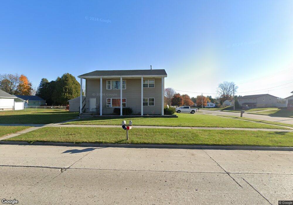
1603 Johnston Dr Manitowoc, WI 54220
Estimated Value: $269,000 - $307,560
--
Bed
3
Baths
1,440
Sq Ft
$200/Sq Ft
Est. Value
About This Home
This home is located at 1603 Johnston Dr, Manitowoc, WI 54220 and is currently estimated at $288,280, approximately $200 per square foot. 1603 Johnston Dr is a home located in Manitowoc County with nearby schools including Riverview Elementary School, Wilson Middle School, and Lincoln High School.
Ownership History
Date
Name
Owned For
Owner Type
Purchase Details
Closed on
Jul 31, 2009
Sold by
Polish Thunder Llc
Bought by
Eminar Llc
Current Estimated Value
Purchase Details
Closed on
Mar 30, 2007
Sold by
Dewane Kay
Bought by
Polish Thunder Llc
Purchase Details
Closed on
Oct 13, 2006
Sold by
Dewane Patrick A
Bought by
Dewane Kay
Home Financials for this Owner
Home Financials are based on the most recent Mortgage that was taken out on this home.
Original Mortgage
$191,207
Interest Rate
6.38%
Mortgage Type
Purchase Money Mortgage
Create a Home Valuation Report for This Property
The Home Valuation Report is an in-depth analysis detailing your home's value as well as a comparison with similar homes in the area
Home Values in the Area
Average Home Value in this Area
Purchase History
| Date | Buyer | Sale Price | Title Company |
|---|---|---|---|
| Eminar Llc | $210,000 | None Available | |
| Polish Thunder Llc | $188,100 | -- | |
| Dewane Kay | $88,000 | None Available |
Source: Public Records
Mortgage History
| Date | Status | Borrower | Loan Amount |
|---|---|---|---|
| Previous Owner | Dewane Kay | $191,207 |
Source: Public Records
Tax History Compared to Growth
Tax History
| Year | Tax Paid | Tax Assessment Tax Assessment Total Assessment is a certain percentage of the fair market value that is determined by local assessors to be the total taxable value of land and additions on the property. | Land | Improvement |
|---|---|---|---|---|
| 2024 | $4,490 | $256,000 | $19,000 | $237,000 |
| 2023 | $4,167 | $256,000 | $19,000 | $237,000 |
| 2022 | $3,635 | $189,500 | $19,000 | $170,500 |
| 2021 | $3,696 | $189,500 | $19,000 | $170,500 |
| 2020 | $2,947 | $141,000 | $19,000 | $122,000 |
| 2019 | $2,925 | $141,000 | $19,000 | $122,000 |
| 2018 | $2,877 | $141,000 | $19,000 | $122,000 |
| 2017 | $2,789 | $141,000 | $19,000 | $122,000 |
| 2016 | $2,911 | $141,000 | $19,000 | $122,000 |
| 2015 | $2,967 | $141,000 | $19,000 | $122,000 |
| 2014 | $2,892 | $141,000 | $19,000 | $122,000 |
| 2013 | $2,923 | $141,000 | $19,000 | $122,000 |
Source: Public Records
Map
Nearby Homes
- 1616 Fern Dr
- 1621 Galax Dr
- 315 E Magnolia Ave
- 743 Memorial Dr Unit E
- 1750 Mirro Dr
- 1335 Lynx Ln
- 1339 Wolf Run
- 1925 Creekwood Ct
- 2101 Hunters Ridge Ct
- Lot24 Mosie Ct
- LT0 Mosie Ct
- 318 Fenway Terrace
- 916 Hawthorne Ct
- 901 Hawthorne Ct
- 923 N 6th St
- 1118 Fairmont Ln
- 2510 Stoney Brook Ct
- 2508 Stoney Brook Ct
- 840 Lincoln Blvd
- 845 N 8th St
- 610 E Linden Ave
- 1611 Johnston Dr
- 612 E Linden Ave
- 1617 Johnston Dr
- 616 E Linden Ave
- 1621 Johnston Dr
- 601 E Linden Ave
- 607 E Linden Ave
- 620 E Linden Ave
- 1620 Fern Dr
- 615 E Linden Ave
- 1625 Johnston Dr
- 1610 Fern Dr
- 1611 Fern Dr
- 1538 Fern Dr
- 1615 Fern Dr
- 1633 Johnston Dr
- 1626 Fern Dr
- 1624 Fern Dr
- 702 E Linden Ave