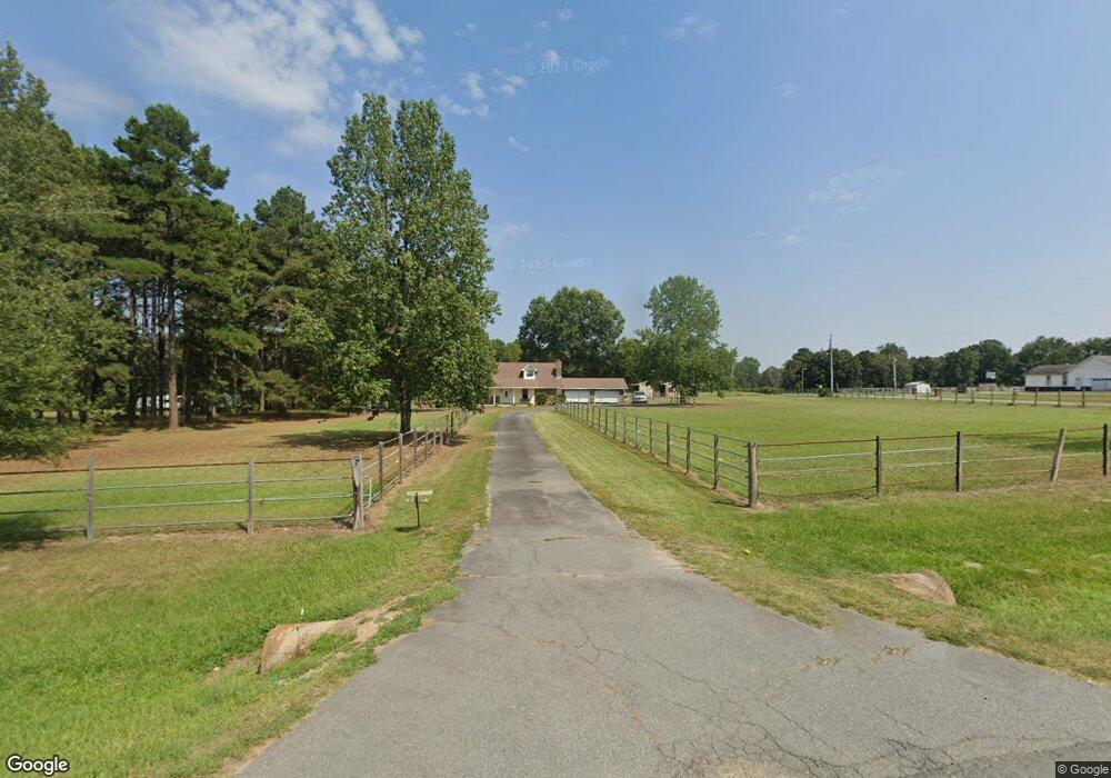
1603 N Highway 365 Redfield, AR 72132
Estimated Value: $246,656 - $334,000
--
Bed
1
Bath
2,196
Sq Ft
$130/Sq Ft
Est. Value
About This Home
This home is located at 1603 N Highway 365, Redfield, AR 72132 and is currently estimated at $285,164, approximately $129 per square foot. 1603 N Highway 365 is a home located in Jefferson County with nearby schools including Hardin Elementary School, White Hall Junior High School, and White Hall High School.
Ownership History
Date
Name
Owned For
Owner Type
Purchase Details
Closed on
Sep 8, 2005
Sold by
Young Judy and Gould Walter H
Bought by
Jackson Travis and Jackson Patsy
Current Estimated Value
Purchase Details
Closed on
Dec 30, 2003
Bought by
Young Judy
Purchase Details
Closed on
May 21, 1997
Bought by
Ashcraft Tina K and 1603 N Highway 365
Purchase Details
Closed on
Apr 17, 1991
Bought by
Bolt Gary and Bolt Wf
Purchase Details
Closed on
Jul 12, 1988
Bought by
Ashcraft Tina
Purchase Details
Closed on
May 19, 1983
Bought by
Crowson Joe and Crowson Wf
Create a Home Valuation Report for This Property
The Home Valuation Report is an in-depth analysis detailing your home's value as well as a comparison with similar homes in the area
Home Values in the Area
Average Home Value in this Area
Purchase History
| Date | Buyer | Sale Price | Title Company |
|---|---|---|---|
| Jackson Travis | -- | -- | |
| Young Judy | $133,000 | -- | |
| Ashcraft Tina K | -- | -- | |
| Bolt Gary | -- | -- | |
| Ashcraft Tina | -- | -- | |
| Crowson Joe | $10,000 | -- |
Source: Public Records
Tax History Compared to Growth
Tax History
| Year | Tax Paid | Tax Assessment Tax Assessment Total Assessment is a certain percentage of the fair market value that is determined by local assessors to be the total taxable value of land and additions on the property. | Land | Improvement |
|---|---|---|---|---|
| 2024 | $948 | $49,010 | $4,550 | $44,460 |
| 2023 | $1,023 | $49,010 | $4,550 | $44,460 |
| 2022 | $1,073 | $35,070 | $3,000 | $32,070 |
| 2021 | $1,073 | $35,070 | $3,000 | $32,070 |
| 2020 | $1,073 | $35,070 | $3,000 | $32,070 |
| 2019 | $992 | $35,070 | $3,000 | $32,070 |
| 2018 | $1,017 | $35,070 | $3,000 | $32,070 |
| 2017 | $1,017 | $27,980 | $3,000 | $24,980 |
| 2016 | $1,017 | $27,980 | $3,000 | $24,980 |
| 2015 | $1,010 | $27,980 | $3,000 | $24,980 |
| 2014 | -- | $27,980 | $3,000 | $24,980 |
Source: Public Records
Map
Nearby Homes
- 420 S Park Dr
- 1008 Parkside Dr
- 1004 Parkside Dr
- 00 Deer Brooke
- 0 Beaver Lake Rd
- 712 Michael Dr
- 718 Cara Jane Dr
- 1800 Chaney Rd
- 711 Cara Jane Dr
- 1008 Sheridan Rd
- 900 Sheridan Rd
- 702 Honeysuckle Hills Ct
- 203 Honeysuckle Hills Dr
- 1210 Donna Dr
- 0 E Hensley Rd
- 7844 Grant 58
- 33-3-13 Harper Rd
- 1 Harper Rd
- 1 Cozy Ln
- 1409 Osage Dr
- N Highway 365
- 1519 N Highway 365
- 1615 N Highway 365
- 1514 N Highway 365
- 1511 N Highway 365
- 1511 N Hwy 365
- 1507 Cherrywood Ave
- 1400 Cherrywood Ave
- 1503 Highway 365
- 1503 N Highway 365
- 1601 Budwood Ave
- 0 Cherrywood Ave
- 1408 Cherrywood Ave
- 1400 N Highway 365
- 1307 N Highway 365
- 1312 N Highway 365
- 1311 Cherrywood Ave
- 1312 Cherrywood Ave
- 1317 Budwood Ave
- 1300 N Highway 365