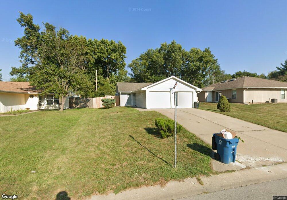
1603 N Lazy Branch Rd Independence, MO 64058
Estimated Value: $160,000 - $211,000
2
Beds
2
Baths
852
Sq Ft
$230/Sq Ft
Est. Value
About This Home
This home is located at 1603 N Lazy Branch Rd, Independence, MO 64058 and is currently estimated at $196,119, approximately $230 per square foot. 1603 N Lazy Branch Rd is a home located in Jackson County with nearby schools including Fort Osage High School.
Ownership History
Date
Name
Owned For
Owner Type
Purchase Details
Closed on
Nov 14, 2024
Sold by
Newton Joshua Aaron and Newton Julia Michelle
Bought by
Newton Jesse Joseph
Current Estimated Value
Purchase Details
Closed on
Aug 27, 2015
Sold by
Wells Fargo Bank National Association
Bought by
Newton Julia Michelle and Newton Joshua Aaron
Purchase Details
Closed on
Jul 14, 2015
Sold by
Nelson Connie J and Nelson Mary
Bought by
Wells Fargo Bank National Association
Purchase Details
Closed on
Aug 17, 2012
Sold by
Nelson Mary
Bought by
Nelson Connie J
Purchase Details
Closed on
Oct 25, 2011
Sold by
Nelson Connie J
Bought by
Nelson Connie J and Nelson Mary
Home Financials for this Owner
Home Financials are based on the most recent Mortgage that was taken out on this home.
Original Mortgage
$111,832
Interest Rate
4.13%
Mortgage Type
FHA
Purchase Details
Closed on
Jun 22, 2010
Sold by
Nelson Mary
Bought by
Nelson Connie J
Purchase Details
Closed on
Apr 29, 2009
Sold by
Nelson Connie J
Bought by
Nelson Connie J and Nelson Mary
Home Financials for this Owner
Home Financials are based on the most recent Mortgage that was taken out on this home.
Original Mortgage
$113,807
Interest Rate
4.77%
Mortgage Type
FHA
Purchase Details
Closed on
Apr 12, 2006
Sold by
Mcinnes Diana S
Bought by
Nelson Connie J
Home Financials for this Owner
Home Financials are based on the most recent Mortgage that was taken out on this home.
Original Mortgage
$79,960
Interest Rate
6.22%
Mortgage Type
Fannie Mae Freddie Mac
Purchase Details
Closed on
Aug 2, 1995
Sold by
H Campbell Constr Inc
Bought by
Mcinnes Diana S
Home Financials for this Owner
Home Financials are based on the most recent Mortgage that was taken out on this home.
Original Mortgage
$50,000
Interest Rate
7.51%
Mortgage Type
Purchase Money Mortgage
Create a Home Valuation Report for This Property
The Home Valuation Report is an in-depth analysis detailing your home's value as well as a comparison with similar homes in the area
Home Values in the Area
Average Home Value in this Area
Purchase History
| Date | Buyer | Sale Price | Title Company |
|---|---|---|---|
| Newton Jesse Joseph | -- | None Listed On Document | |
| Newton Jesse Joseph | -- | None Listed On Document | |
| Newton Julia Michelle | $57,500 | Bay National Title Co | |
| Wells Fargo Bank National Association | -- | None Available | |
| Nelson Connie J | -- | None Available | |
| Nelson Connie J | -- | First United Title Agency | |
| Nelson Connie J | -- | None Available | |
| Nelson Connie J | -- | First United Title Agency | |
| Nelson Connie J | -- | Heart Of America Title & Esc | |
| Mcinnes Diana S | -- | Realty Title Co |
Source: Public Records
Mortgage History
| Date | Status | Borrower | Loan Amount |
|---|---|---|---|
| Previous Owner | Nelson Connie J | $111,832 | |
| Previous Owner | Nelson Connie J | $113,807 | |
| Previous Owner | Nelson Connie J | $79,960 | |
| Previous Owner | Mcinnes Diana S | $50,000 |
Source: Public Records
Tax History Compared to Growth
Tax History
| Year | Tax Paid | Tax Assessment Tax Assessment Total Assessment is a certain percentage of the fair market value that is determined by local assessors to be the total taxable value of land and additions on the property. | Land | Improvement |
|---|---|---|---|---|
| 2025 | $2,041 | $23,368 | $5,863 | $17,505 |
| 2024 | $2,041 | $22,813 | $2,651 | $20,162 |
| 2023 | $2,022 | $22,813 | $4,309 | $18,504 |
| 2022 | $1,653 | $17,670 | $2,407 | $15,263 |
| 2021 | $1,655 | $17,670 | $2,407 | $15,263 |
| 2020 | $1,571 | $16,530 | $2,407 | $14,123 |
| 2019 | $1,667 | $17,902 | $2,407 | $15,495 |
| 2018 | $1,457 | $15,581 | $2,095 | $13,486 |
| 2017 | $1,457 | $15,581 | $2,095 | $13,486 |
| 2016 | $1,291 | $14,961 | $2,990 | $11,971 |
| 2014 | $1,272 | $14,668 | $2,932 | $11,736 |
Source: Public Records
Map
Nearby Homes
- 1511 Osage Trail
- 18901 E Lynchburg Place N
- 1713 N Arapaho Ct
- 18108 E Shoshone Dr
- 18104 E 17th St N
- 19204 E 15th St N
- 0 E 24 Highway Cir
- 18729 E 13th Terrace Ct N
- 19117 E 14th St N
- 17800 E Whitney Rd
- 19201 E 13th Terrace N
- 2006 N Concord Rd
- 2015 N Lazy Branch Rd
- 1124 N Ponca Dr
- 18001 E 12th St N
- 18100 E 11th Terrace Ct N
- 1117 N Swope Dr
- 2100 N York St
- 19704 E 14th Terrace N
- 1801 N Davidson Rd
- 1605 N Lazy Branch Rd
- 1607 N Lazy Branch Rd
- 1602 S Concord Ct
- 1604 S Concord Ct
- 1600 S Concord Ct
- 1604 N Lazy Branch Rd
- 1606 S Concord Ct
- 1606 N Lazy Branch Rd
- 18507 E Lexington Rd
- 1608 S Concord Ct
- 18505 E Lexington Rd
- 1611 N Lazy Branch Rd
- 1528 N Geronimo Dr
- 1608 N Lazy Branch Rd
- 1610 S Concord Ct
- 18501 E Lexington Rd
- 1610 N Lazy Branch Rd
- 1613 N Lazy Branch Rd
- 1605 S Concord Ct
- 1526 N Geronimo Dr