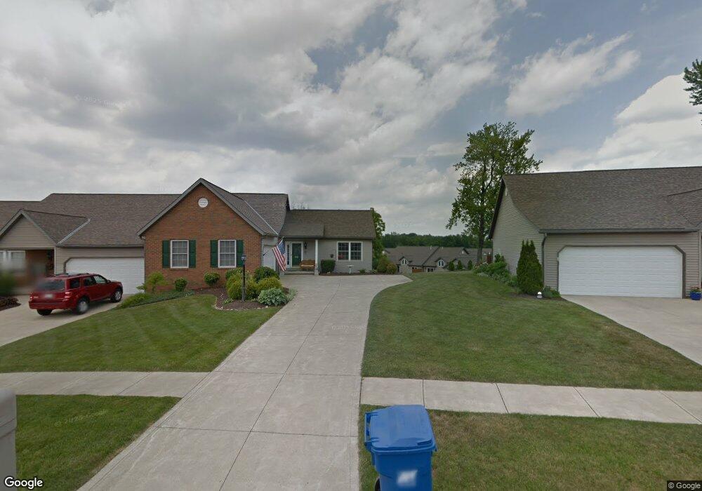
1603 Nantucket Dr Unit 1603 Mansfield, OH 44904
Estimated Value: $263,853 - $296,000
2
Beds
2
Baths
1,248
Sq Ft
$227/Sq Ft
Est. Value
About This Home
This home is located at 1603 Nantucket Dr Unit 1603, Mansfield, OH 44904 and is currently estimated at $283,463, approximately $227 per square foot. 1603 Nantucket Dr Unit 1603 is a home located in Richland County with nearby schools including Madison High School, Mansfield Christian School, and Mansfield Seventh-day Adventist School.
Ownership History
Date
Name
Owned For
Owner Type
Purchase Details
Closed on
Aug 17, 2023
Sold by
Linscott Howard R
Bought by
Howard R Linscott Living Trust and Linscott
Current Estimated Value
Purchase Details
Closed on
Oct 22, 2003
Sold by
Hunsinger Walter W and Hunsinger Linda K
Bought by
Linscott Howard R and Linscott Renee A
Create a Home Valuation Report for This Property
The Home Valuation Report is an in-depth analysis detailing your home's value as well as a comparison with similar homes in the area
Home Values in the Area
Average Home Value in this Area
Purchase History
| Date | Buyer | Sale Price | Title Company |
|---|---|---|---|
| Howard R Linscott Living Trust | -- | None Listed On Document | |
| Linscott Howard R | $140,900 | Chicago Title |
Source: Public Records
Tax History Compared to Growth
Tax History
| Year | Tax Paid | Tax Assessment Tax Assessment Total Assessment is a certain percentage of the fair market value that is determined by local assessors to be the total taxable value of land and additions on the property. | Land | Improvement |
|---|---|---|---|---|
| 2024 | $1,745 | $62,810 | $7,910 | $54,900 |
| 2023 | $1,745 | $62,810 | $7,910 | $54,900 |
| 2022 | $1,901 | $52,240 | $8,260 | $43,980 |
| 2021 | $1,900 | $52,240 | $8,260 | $43,980 |
| 2020 | $1,919 | $52,240 | $8,260 | $43,980 |
| 2019 | $1,736 | $44,280 | $7,000 | $37,280 |
| 2018 | $1,719 | $44,280 | $7,000 | $37,280 |
| 2017 | $1,684 | $44,280 | $7,000 | $37,280 |
| 2016 | $1,671 | $43,150 | $7,000 | $36,150 |
| 2015 | $1,671 | $43,150 | $7,000 | $36,150 |
| 2014 | $1,633 | $43,150 | $7,000 | $36,150 |
| 2012 | $766 | $43,150 | $7,000 | $36,150 |
Source: Public Records
Map
Nearby Homes
- 1687 Nantucket Dr
- 601 Karlson Dr
- 615 Bailey Dr
- 1740 Emerson Dr
- 623 Bailey Dr
- 1689 Middle Bellville Rd
- 1702 Middle Bellville Rd
- 646 Kennedy Dr
- 450 Marwood Dr
- 625 Logan Rd
- 129 Elderberry Dr
- 506 Logan Rd
- 0 Rippling Brook Dr
- 1790 Rippling Brook Dr
- 0 Yoha Dr
- 763 York St W
- 1690 Riva Ridge Dr Unit 1690
- 1680 S Main St
- 1949 Richwood Dr
- 65 Logan Rd
- 1601 Nantucket Dr Unit 1601
- 1599 Nantucket Dr Unit 1599
- 1597 Nantucket Dr Unit 1597
- 1669 Wilmington Point
- 1552 Cape Cod Dr Unit 1552
- 1605 Nantucket Dr
- 1554 Cape Cod Dr
- 1556 Cape Cod Dr
- 1607 Nantucket Dr Unit 1607
- 1550 Cape Cod Dr Unit 1550
- 1596 Nantucket Dr
- 1594 Nantucket Dr
- 1592 Nantucket Dr Unit 1592
- 1011 Nantucket Dr
- 1578 Cape Cod Dr
- 1576 Cape Cod Dr
- 1661 Wilmington Point
- 1580 Cape Cod Dr
- 1676 Wilmington Point Unit 1676
- 1590 Nantucket Dr