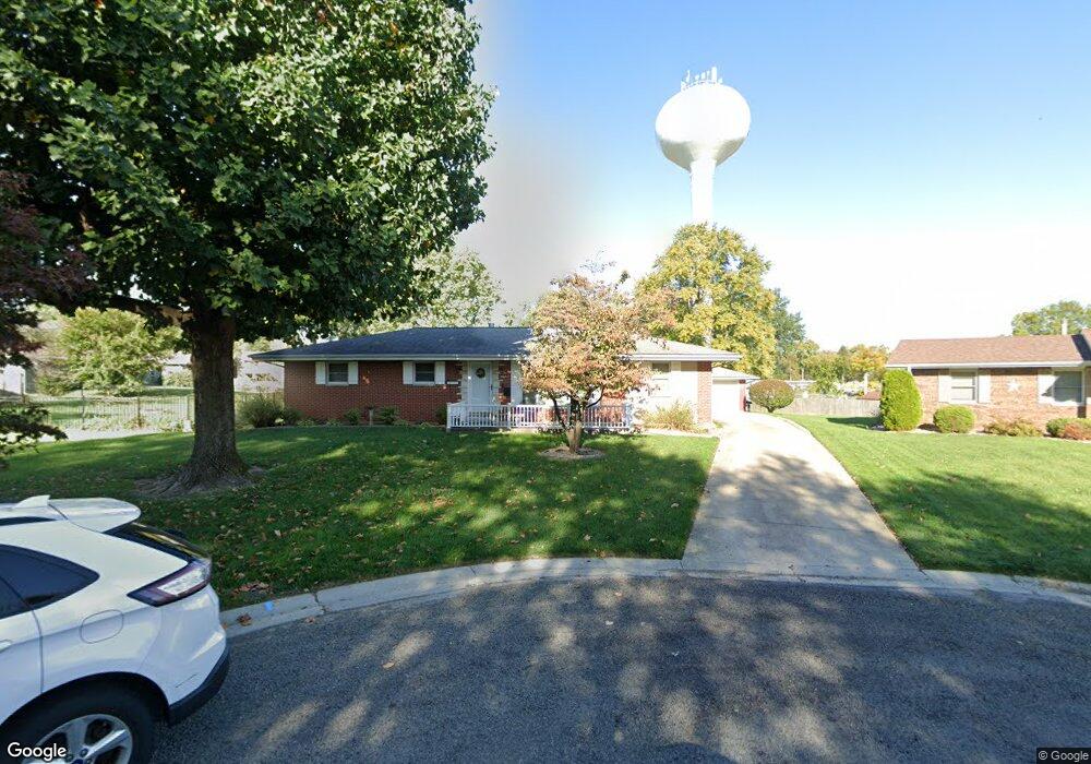
1603 Saratoga Dr Collinsville, IL 62234
Estimated Value: $178,391 - $6,484,000
--
Bed
1
Bath
1,118
Sq Ft
$1,599/Sq Ft
Est. Value
About This Home
This home is located at 1603 Saratoga Dr, Collinsville, IL 62234 and is currently estimated at $1,787,348, approximately $1,598 per square foot. 1603 Saratoga Dr is a home located in Madison County with nearby schools including John A Renfro Elementary School, Dorris Intermediate School, and Collinsville Middle School.
Ownership History
Date
Name
Owned For
Owner Type
Purchase Details
Closed on
Dec 11, 2024
Sold by
Ptzcw 3 Llc
Bought by
Wallis Petroleum Llc
Current Estimated Value
Home Financials for this Owner
Home Financials are based on the most recent Mortgage that was taken out on this home.
Original Mortgage
$135,000
Outstanding Balance
$133,948
Interest Rate
6.84%
Mortgage Type
Commercial
Estimated Equity
$1,653,400
Create a Home Valuation Report for This Property
The Home Valuation Report is an in-depth analysis detailing your home's value as well as a comparison with similar homes in the area
Home Values in the Area
Average Home Value in this Area
Purchase History
| Date | Buyer | Sale Price | Title Company |
|---|---|---|---|
| Wallis Petroleum Llc | $5,660,000 | None Available |
Source: Public Records
Mortgage History
| Date | Status | Borrower | Loan Amount |
|---|---|---|---|
| Open | Wallis Petroleum Llc | $135,000 |
Source: Public Records
Tax History Compared to Growth
Tax History
| Year | Tax Paid | Tax Assessment Tax Assessment Total Assessment is a certain percentage of the fair market value that is determined by local assessors to be the total taxable value of land and additions on the property. | Land | Improvement |
|---|---|---|---|---|
| 2024 | $1,828 | $74,580 | $15,100 | $59,480 |
| 2023 | $1,828 | $68,080 | $13,740 | $54,340 |
| 2022 | $1,882 | $62,960 | $12,710 | $50,250 |
| 2021 | $1,976 | $59,150 | $11,940 | $47,210 |
| 2020 | $1,996 | $56,430 | $11,390 | $45,040 |
| 2019 | $2,012 | $53,040 | $11,070 | $41,970 |
| 2018 | $2,028 | $50,240 | $10,480 | $39,760 |
| 2017 | $2,854 | $49,240 | $10,270 | $38,970 |
| 2016 | $2,235 | $49,240 | $10,270 | $38,970 |
| 2015 | $2,352 | $47,960 | $10,000 | $37,960 |
| 2014 | $2,352 | $47,960 | $10,000 | $37,960 |
| 2013 | $2,352 | $47,960 | $10,000 | $37,960 |
Source: Public Records
Map
Nearby Homes
- 414 Bunker Hill Dr
- 0 N Keebler Ave
- 1224 Cedar Ridge Ct
- 203 Greenfield Dr
- 22 Brookwood Dr
- 10 White Lily Dr
- 5 Brookwood Dr
- 1120 Williams St
- 308 Brown Ave
- 1210 Constance St
- 617 N Morrison Ave
- 0 Strong Ave
- 706 Illinois Ave
- 123 W Wickliffe Ave
- 123 Elliot St
- 501 Spring
- 102 Toni Ct
- 1227 Ridge Ave
- 1121 Carraway Ct
- 2007 Belt Line Rd
- 203 Chapel Dr
- 1605 Saratoga Dr
- 1601 Saratoga Dr
- 205 Chapel Dr
- 1604 Saratoga Dr
- 1602 Saratoga Dr
- 7 Crestmont Dr
- 191 Chapel Dr
- 207 Chapel Dr
- 202 Chapel Dr
- 204 Chapel Dr
- 1513 Saratoga Dr
- 111 Chapel Dr
- 109 Lexington Dr
- 111 Lexington Dr
- 190 Chapel Dr
- 107 Lexington Dr
- 208 Chapel Dr
- 109 Chapel Dr
- 1514 Saratoga Dr