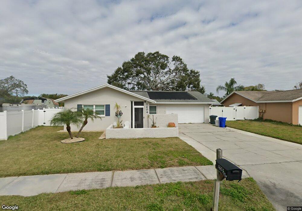
1604 Dale Cir N Dunedin, FL 34698
Estimated Value: $485,343 - $548,000
3
Beds
2
Baths
1,812
Sq Ft
$286/Sq Ft
Est. Value
About This Home
This home is located at 1604 Dale Cir N, Dunedin, FL 34698 and is currently estimated at $519,086, approximately $286 per square foot. 1604 Dale Cir N is a home located in Pinellas County with nearby schools including Garrison-Jones Elementary School, Dunedin Highland Middle School, and Dunedin High School.
Ownership History
Date
Name
Owned For
Owner Type
Purchase Details
Closed on
Apr 30, 2009
Sold by
Palmer Wayne A
Bought by
Brennom Mary L
Current Estimated Value
Purchase Details
Closed on
Jul 24, 2002
Sold by
Palmer Wayne A
Bought by
Palmer Wayner A Trust
Purchase Details
Closed on
Aug 19, 1999
Sold by
Eskew Michael L and Eskew Joyce M
Bought by
Palmer Wayne A and Palmer Lynne L
Home Financials for this Owner
Home Financials are based on the most recent Mortgage that was taken out on this home.
Original Mortgage
$80,000
Interest Rate
7.65%
Mortgage Type
Balloon
Purchase Details
Closed on
Jun 6, 1997
Sold by
Lahm Robert B and Lahm Laura W
Bought by
Eskew Michael L and Eskew Joyce M
Home Financials for this Owner
Home Financials are based on the most recent Mortgage that was taken out on this home.
Original Mortgage
$80,000
Interest Rate
8.13%
Mortgage Type
New Conventional
Create a Home Valuation Report for This Property
The Home Valuation Report is an in-depth analysis detailing your home's value as well as a comparison with similar homes in the area
Home Values in the Area
Average Home Value in this Area
Purchase History
| Date | Buyer | Sale Price | Title Company |
|---|---|---|---|
| Brennom Mary L | $105,000 | Attorney | |
| Palmer Wayner A Trust | -- | -- | |
| Palmer Wayne A | $113,000 | -- | |
| Eskew Michael L | $103,000 | -- | |
| Lahm Robert B | -- | -- |
Source: Public Records
Mortgage History
| Date | Status | Borrower | Loan Amount |
|---|---|---|---|
| Previous Owner | Lahm Robert B | $20,000 | |
| Previous Owner | Lahm Robert B | $80,000 | |
| Previous Owner | Lahm Robert B | $80,000 |
Source: Public Records
Tax History Compared to Growth
Tax History
| Year | Tax Paid | Tax Assessment Tax Assessment Total Assessment is a certain percentage of the fair market value that is determined by local assessors to be the total taxable value of land and additions on the property. | Land | Improvement |
|---|---|---|---|---|
| 2024 | $2,615 | $218,925 | -- | -- |
| 2023 | $2,615 | $212,549 | $0 | $0 |
| 2022 | $2,161 | $176,772 | $0 | $0 |
| 2021 | $2,183 | $171,623 | $0 | $0 |
| 2020 | $4,737 | $258,150 | $0 | $0 |
| 2019 | $4,429 | $247,195 | $91,515 | $155,680 |
| 2018 | $4,187 | $243,446 | $0 | $0 |
| 2017 | $3,868 | $220,636 | $0 | $0 |
| 2016 | $3,538 | $195,146 | $0 | $0 |
| 2015 | $3,407 | $188,253 | $0 | $0 |
| 2014 | $2,946 | $157,310 | $0 | $0 |
Source: Public Records
Map
Nearby Homes
- 1600 Dale Cir W
- 1609 Summit Way
- 1600 Amberlea Dr N
- 1725 Hitching Post Ln
- 1765 Hitching Post Ln
- 1393 Chesterfield Dr
- 1052 Concord Dr W
- 1311 Powderpuff Dr Unit 1009
- 1311 Powderpuff Dr Unit 4
- 1341 Azalea Dr Unit 1906
- 1500 County Road 1 Unit 24
- 1500 County Road 1 Unit 51
- 1500 County Road 1 Unit 210
- 1500 County Road 1 Unit 247
- 1500 County Road 1 Unit 79
- 1500 County Road 1 Unit 124
- 1007 Vineyard Ct
- 1291 Stony Brook Ln
- 1980 Tahitian Place Unit 13
- 1844 Teakwood Ln
- 1606 Dale Cir N
- 1617 Amberlea Dr S
- 1611 Amberlea Dr S
- 1275 Dale Cir W
- 1610 Dale Cir N
- 1285 Dale Cir W
- 1623 Amberlea Dr S
- 1605 Dale Cir N
- 1629 Amberlea Dr S
- 1605 Amberlea Dr S
- 1614 Dale Cir N
- 1603 Dale Cir N
- 1295 Dale Cir W
- 1163 Brook Dr W
- 1174 Brook Dr W
- 1635 Amberlea Dr S
- 1618 Dale Cir N
- 1616 Amberlea Dr S
- 1264 Dale Cir W
- 1297 Amberlea Dr S