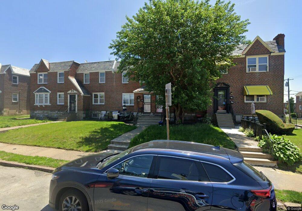
1604 E Walnut Ln Philadelphia, PA 19138
West Oak Lane NeighborhoodEstimated Value: $204,000 - $260,000
3
Beds
1
Bath
1,308
Sq Ft
$179/Sq Ft
Est. Value
About This Home
This home is located at 1604 E Walnut Ln, Philadelphia, PA 19138 and is currently estimated at $233,631, approximately $178 per square foot. 1604 E Walnut Ln is a home located in Philadelphia County with nearby schools including Pennypacker Samuel School, Martin Luther King High School, and West Oak Lane Charter School.
Ownership History
Date
Name
Owned For
Owner Type
Purchase Details
Closed on
Dec 10, 1997
Sold by
Black Lutheran Community Development Cor
Bought by
Mccoy Sabrina E
Current Estimated Value
Purchase Details
Closed on
Aug 15, 1997
Sold by
Hud
Bought by
Black Lutheran Community Development Cor
Purchase Details
Closed on
Jun 19, 1996
Sold by
Commonwealth Mtg Company Of America Lp
Bought by
Hud
Purchase Details
Closed on
Aug 28, 1995
Sold by
Green John D
Bought by
Commonwealth Mtg Corp Of America
Create a Home Valuation Report for This Property
The Home Valuation Report is an in-depth analysis detailing your home's value as well as a comparison with similar homes in the area
Home Values in the Area
Average Home Value in this Area
Purchase History
| Date | Buyer | Sale Price | Title Company |
|---|---|---|---|
| Mccoy Sabrina E | $62,000 | -- | |
| Black Lutheran Community Development Cor | $27,650 | -- | |
| Hud | -- | -- | |
| Commonwealth Mtg Corp Of America | $3,600 | -- |
Source: Public Records
Tax History Compared to Growth
Tax History
| Year | Tax Paid | Tax Assessment Tax Assessment Total Assessment is a certain percentage of the fair market value that is determined by local assessors to be the total taxable value of land and additions on the property. | Land | Improvement |
|---|---|---|---|---|
| 2025 | $2,399 | $209,800 | $41,960 | $167,840 |
| 2024 | $2,399 | $209,800 | $41,960 | $167,840 |
| 2023 | $2,399 | $171,400 | $34,280 | $137,120 |
| 2022 | $2,399 | $171,400 | $34,280 | $137,120 |
| 2021 | $1,845 | $0 | $0 | $0 |
| 2020 | $1,845 | $0 | $0 | $0 |
| 2019 | $1,926 | $0 | $0 | $0 |
| 2018 | $0 | $0 | $0 | $0 |
| 2017 | $1,666 | $0 | $0 | $0 |
| 2016 | $1,666 | $0 | $0 | $0 |
| 2015 | $1,595 | $0 | $0 | $0 |
| 2014 | -- | $119,000 | $12,446 | $106,554 |
| 2012 | -- | $17,856 | $2,455 | $15,401 |
Source: Public Records
Map
Nearby Homes
- 1544 Beverly Rd
- 1521 E Walnut Ln
- 1520 Beverly Rd
- 6635 Hollis St
- 1537 Beverly Rd
- 1559 E Pastorius St
- 1536 E Pastorius St
- 7349 E Walnut Ln
- 7277 E Walnut Ln
- 6661 Cornelius St
- 1505 Beverly Rd
- 6313 E Wister St
- 6332 E Wister St
- 6824 Rodney St
- 6620 Cornelius St
- 2070 E Haines St
- 1544 E Tulpehocken St
- 7001 Limekiln Pike
- 7243 Mansfield Ave
- 2029 Eastburn Ave
- 1602 E Walnut Ln
- 1606 E Walnut Ln
- 1608 E Walnut Ln
- 1600 E Walnut Ln
- 1610 E Walnut Ln
- 1612 E Walnut Ln
- 1603 Middleton St
- 1601 Middleton St
- 1614 E Walnut Ln
- 1607 Middleton St
- 1609 Middleton St
- 1554 E Walnut Ln
- 1605 Middleton St
- 1611 Middleton St
- 1616 E Walnut Ln
- 1613 Middleton St
- 1615 Middleton St
- 1617 Middleton St
- 1618 E Walnut Ln Unit 1B2BA
- 1618 E Walnut Ln Unit 3B3BA