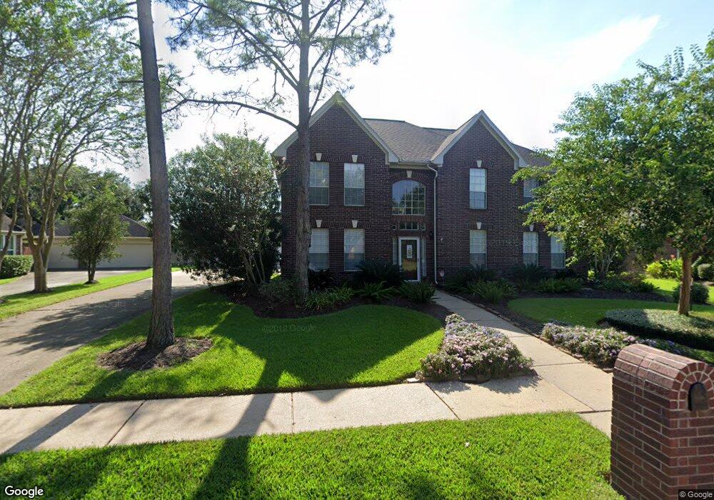
1604 Keystone Dr Friendswood, TX 77546
Estimated Value: $509,638 - $555,000
5
Beds
4
Baths
3,638
Sq Ft
$146/Sq Ft
Est. Value
About This Home
This home is located at 1604 Keystone Dr, Friendswood, TX 77546 and is currently estimated at $531,410, approximately $146 per square foot. 1604 Keystone Dr is a home located in Galveston County with nearby schools including C.W. Cline Elementary School, Windsong Elementary School, and Friendswood Junior High School.
Ownership History
Date
Name
Owned For
Owner Type
Purchase Details
Closed on
Nov 14, 2016
Sold by
Corwin George A and Corwin Victoria
Bought by
Rear Patrick H O and Rear Laura J O
Current Estimated Value
Home Financials for this Owner
Home Financials are based on the most recent Mortgage that was taken out on this home.
Original Mortgage
$350,550
Outstanding Balance
$281,431
Interest Rate
3.42%
Mortgage Type
New Conventional
Estimated Equity
$249,979
Create a Home Valuation Report for This Property
The Home Valuation Report is an in-depth analysis detailing your home's value as well as a comparison with similar homes in the area
Home Values in the Area
Average Home Value in this Area
Purchase History
| Date | Buyer | Sale Price | Title Company |
|---|---|---|---|
| Rear Patrick H O | -- | First American Title |
Source: Public Records
Mortgage History
| Date | Status | Borrower | Loan Amount |
|---|---|---|---|
| Open | Rear Patrick H O | $350,550 |
Source: Public Records
Tax History Compared to Growth
Tax History
| Year | Tax Paid | Tax Assessment Tax Assessment Total Assessment is a certain percentage of the fair market value that is determined by local assessors to be the total taxable value of land and additions on the property. | Land | Improvement |
|---|---|---|---|---|
| 2025 | $6,026 | $427,295 | -- | -- |
| 2024 | $6,026 | $388,450 | $29,360 | $359,090 |
| 2023 | $6,026 | $432,575 | $0 | $0 |
| 2022 | $7,498 | $393,250 | $0 | $0 |
| 2021 | $8,350 | $403,450 | $29,360 | $374,090 |
| 2020 | $7,830 | $325,000 | $29,360 | $295,640 |
| 2019 | $8,735 | $344,000 | $29,360 | $314,640 |
| 2018 | $9,186 | $359,650 | $29,360 | $330,290 |
| 2017 | $9,340 | $359,650 | $29,360 | $330,290 |
| 2016 | $7,545 | $336,230 | $29,360 | $306,870 |
| 2015 | $1,905 | $264,130 | $29,360 | $234,770 |
| 2014 | $1,899 | $257,060 | $29,360 | $227,700 |
Source: Public Records
Map
Nearby Homes
- 1608 Keystone Dr
- 1606 Falcon Ridge Blvd
- 1531 Briar Bend Dr
- 1783 Lake Crest Ln
- 1668 Turner Ct
- 1509 Windsor Dr
- 1802 Creekside Dr
- 505 Hunters Ln
- 1804 Sandy Lake Dr
- 1207 Yorkshire Dr
- 812 Sandringham Dr
- 506 Lakeside Ln
- 1906 Blue Quail Dr
- 1010 High Ridge Dr
- 3 Wilderness Trail
- 801 Lancaster Dr
- 1305 Edgewater Dr
- 1402 Osborne Dr
- 1217 Red Wing Dr
- 1012 Glenshannon Ave
- 1606 Keystone Dr
- 1602 Keystone Dr
- 1605 Brill Dr
- 1607 Brill Dr
- 1603 Brill Dr
- 1605 Keystone Dr
- 1609 Brill Dr
- 1600 Keystone Dr
- 1607 Keystone Dr
- 1601 Brill Dr
- 1601 Keystone Dr
- 1610 Keystone Dr
- 1611 Brill Dr
- 1609 Keystone Dr
- 1606 Brill Dr
- 1608 Brill Dr
- 1604 Brill Dr
- 1610 Brill Dr
- 1612 Keystone Dr
- 1613 Brill Dr