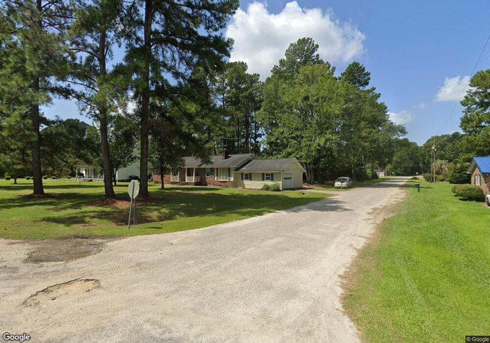
1604 Lindstedt Ln Holly Hill, SC 29059
Estimated Value: $213,000 - $275,000
3
Beds
2
Baths
1,727
Sq Ft
$143/Sq Ft
Est. Value
About This Home
This home is located at 1604 Lindstedt Ln, Holly Hill, SC 29059 and is currently estimated at $247,653, approximately $143 per square foot. 1604 Lindstedt Ln is a home located in Orangeburg County with nearby schools including Holly Hill Elementary School, Holly Hill Elementary, and Holly Hill-Roberts Middle.
Ownership History
Date
Name
Owned For
Owner Type
Purchase Details
Closed on
Jun 25, 2025
Sold by
Busse Phillip D
Bought by
Busse Phillip D and Busse Margaret S
Current Estimated Value
Purchase Details
Closed on
Mar 6, 2012
Sold by
Chewning Rinehart and Chewning Billie B
Bought by
Busse Phillip D
Home Financials for this Owner
Home Financials are based on the most recent Mortgage that was taken out on this home.
Original Mortgage
$115,696
Interest Rate
3.95%
Mortgage Type
VA
Create a Home Valuation Report for This Property
The Home Valuation Report is an in-depth analysis detailing your home's value as well as a comparison with similar homes in the area
Home Values in the Area
Average Home Value in this Area
Purchase History
| Date | Buyer | Sale Price | Title Company |
|---|---|---|---|
| Busse Phillip D | -- | None Listed On Document | |
| Busse Phillip D | -- | None Listed On Document | |
| Busse Phillip D | $112,000 | -- |
Source: Public Records
Mortgage History
| Date | Status | Borrower | Loan Amount |
|---|---|---|---|
| Previous Owner | Busse Phillip D | $115,696 |
Source: Public Records
Tax History Compared to Growth
Tax History
| Year | Tax Paid | Tax Assessment Tax Assessment Total Assessment is a certain percentage of the fair market value that is determined by local assessors to be the total taxable value of land and additions on the property. | Land | Improvement |
|---|---|---|---|---|
| 2024 | $1,449 | $9,489 | $1,503 | $7,986 |
| 2023 | $1,275 | $6,967 | $1,183 | $5,784 |
| 2022 | $1,252 | $6,967 | $1,183 | $5,784 |
| 2021 | $1,238 | $6,967 | $1,183 | $5,784 |
| 2020 | $1,219 | $6,967 | $0 | $0 |
| 2019 | $1,224 | $6,967 | $0 | $0 |
| 2018 | $1,171 | $6,145 | $0 | $0 |
| 2017 | $1,163 | $6,145 | $0 | $0 |
| 2016 | $1,147 | $6,145 | $0 | $0 |
| 2015 | $1,114 | $6,145 | $0 | $0 |
| 2014 | $1,114 | $6,146 | $1,184 | $4,962 |
| 2013 | -- | $4,409 | $789 | $3,620 |
Source: Public Records
Map
Nearby Homes
- 0 Lindstedt Ln
- 264 Walters Rd
- 1691 Bennett Cir
- 0 Bunch Ford Rd Unit 25021235
- 310 Bunch Ford Rd
- BRANDON Plan at Evergreen
- CALI Plan at Evergreen
- HELENA Plan at Evergreen
- DOWNING Plan at Evergreen
- SULLIVAN Plan at Evergreen
- 220 Brooks Dr
- 210 Bunch Ford Rd
- 130 Culbertson Ct
- 114 Culbertson Ct
- 414 Brooks Dr
- 128 Culbertson Ct
- 129 Culbertson Cir
- 132 Brooks Dr
- 1301 Bennett Cir
- 208 Bunch Ford Rd
- 1612 Linstedt Ln
- 1612 Lindstedt Dr
- 1548 Linstedt Ln
- 1614 Lindstedt Ln
- 1618 Lindstedt Ln
- 1544 Bennett Cir
- 1607 Linstedt Ln
- 1600 Bennett Cir
- 1551 Linstedt Ln
- Tbd Lindstedt Ln
- 1474 Bennett Cir
- 1614 Bennett Cir
- 1549 Bennett Cir
- 1601 Bennett Cir
- 1454 Bennett Cir
- 1525 Bennett Cir
- 1634 Bennett Cir
- 1611 Bennett Cir
- 415 Brooks Dr
- 1621 Bennett Cir