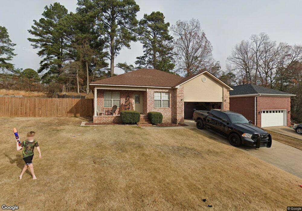
1604 Michael Dr Benton, AR 72019
Benton AreaEstimated Value: $198,000 - $223,000
About This Home
This home is located at 1604 Michael Dr, Benton, AR 72019 and is currently estimated at $206,800, approximately $152 per square foot. 1604 Michael Dr is a home located in Saline County with nearby schools including Perrin Elementary School, Benton Middle School, and Benton Junior High School.
Ownership History
We collect this data history from publicly available records. To have your information removed, we recommend requesting removal directly through your county’s website.
Purchase Details
Purchase Details
Purchase Details
Home Financials for this Owner
Home Financials are based on the most recent Mortgage that was taken out on this home.Purchase Details
Home Financials for this Owner
Home Financials are based on the most recent Mortgage that was taken out on this home.Purchase Details
Home Financials for this Owner
Home Financials are based on the most recent Mortgage that was taken out on this home.Purchase Details
Home Values in the Area
Average Home Value in this Area
Purchase History
We collect this data history from publicly available records. To have your information removed, we recommend requesting removal directly through your county’s website.
| Date | Buyer | Sale Price | Title Company |
|---|---|---|---|
| -- | None Listed On Document | ||
| -- | -- | ||
| $127,900 | Lenders Title Co | ||
| $122,000 | -- | ||
| $115,000 | -- | ||
| -- | -- |
Mortgage History
We collect this data history from publicly available records. To have your information removed, we recommend requesting removal directly through your county’s website.
| Date | Status | Borrower | Loan Amount |
|---|---|---|---|
| Previous Owner | $7,674 | ||
| Previous Owner | $122,800 | ||
| Previous Owner | $119,885 | ||
| Previous Owner | $112,014 |
Tax History
We collect this data history from publicly available records. To have your information removed, we recommend requesting removal directly through your county’s website.
| Year | Tax Paid | Tax Assessment Tax Assessment Total Assessment is a certain percentage of the fair market value that is determined by local assessors to be the total taxable value of land and additions on the property. | Land | Improvement |
|---|---|---|---|---|
| 2025 | $1,646 | $32,569 | $5,720 | $26,849 |
| 2024 | $1,685 | $32,569 | $5,720 | $26,849 |
| 2023 | $1,150 | $32,569 | $5,720 | $26,849 |
| 2022 | $1,129 | $32,569 | $5,720 | $26,849 |
| 2021 | $1,057 | $25,850 | $4,400 | $21,450 |
| 2020 | $1,057 | $25,850 | $4,400 | $21,450 |
| 2019 | $1,057 | $25,850 | $4,400 | $21,450 |
| 2018 | $1,080 | $25,850 | $4,400 | $21,450 |
| 2017 | $1,049 | $25,850 | $4,400 | $21,450 |
| 2016 | $1,366 | $24,090 | $4,400 | $19,690 |
| 2015 | $992 | $24,090 | $4,400 | $19,690 |
| 2014 | $1,001 | $24,090 | $4,400 | $19,690 |
Map
- 1304 Nature Way
- 4000 Congo
- 1126 Grand Teton Dr
- 1124 Grand Teton Dr
- 4025 Elizabeth Ct
- 1120 Grand Teton Dr
- 4016 Elizabeth Ct
- 1200 Nature Way
- 5011 Del Rey Ct
- 1108 Grand Teton Dr
- 1103 Grand Teton Dr
- 3800 Beaver Cir
- 909 Grand Teton Dr
- 00 Congo Rd
- 1002 Nature Way
- 3505 Pelton
- 5022 Maple Leaf Dr
- 1583 Bighorn Dr
- 908 Cimarron Cove
- 2724 Crooked Stick
- 4405 Glenda Ln
- 4401 Glenda Ln
- 4410 Glenda Ln
- 0 Michael Dr Unit 17033821
- 4404 Glenda Ln
- 1615 Michael Dr
- 4327 Glenda Ln
- 0 Glenda Ln
- 4418 Glenda Ln
- 1614 Michael Dr
- 4406 Angela Ct
- 4422 Glenda Ln
- 4326 Glenda Ln
- 4322 Angela Ct
- 1620 Michael Dr
- 4322 Glenda Ln
- 1626 Michael Dr
- 4316 Angela Ct
- 4403 Angela Ct
- 4317 Glenda Ln
Ask me questions while you tour the home.