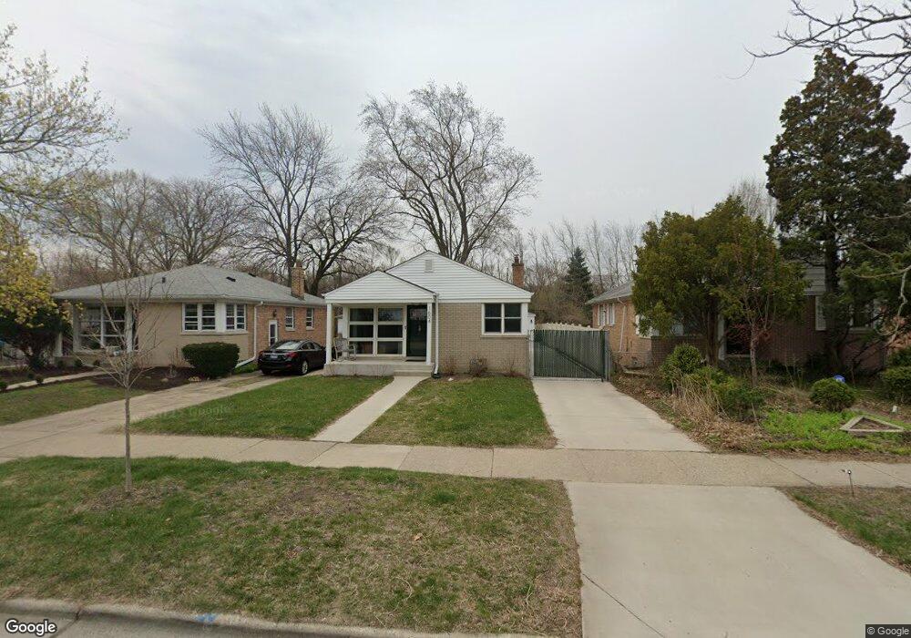
1604 Mulford St Evanston, IL 60202
Estimated Value: $373,000 - $423,000
3
Beds
1
Bath
968
Sq Ft
$410/Sq Ft
Est. Value
About This Home
This home is located at 1604 Mulford St, Evanston, IL 60202 and is currently estimated at $396,984, approximately $410 per square foot. 1604 Mulford St is a home located in Cook County with nearby schools including Dawes Elementary School, Chute Middle School, and Evanston Township High School.
Ownership History
Date
Name
Owned For
Owner Type
Purchase Details
Closed on
Aug 11, 2021
Sold by
Raymond Philip W and Raymond Elizabeth A
Bought by
Raymond Philip W and Raymond Elizabeth A
Current Estimated Value
Purchase Details
Closed on
Jul 1, 2004
Sold by
Nelson Elizabeth A
Bought by
Nelson Raymond Philip W and Nelson Raymond Elizabeth A
Purchase Details
Closed on
Sep 30, 1997
Sold by
Pais Theodore and Pais Florence
Bought by
Nelson Elizabeth A
Home Financials for this Owner
Home Financials are based on the most recent Mortgage that was taken out on this home.
Original Mortgage
$130,500
Outstanding Balance
$21,132
Interest Rate
7.54%
Estimated Equity
$375,852
Create a Home Valuation Report for This Property
The Home Valuation Report is an in-depth analysis detailing your home's value as well as a comparison with similar homes in the area
Home Values in the Area
Average Home Value in this Area
Purchase History
| Date | Buyer | Sale Price | Title Company |
|---|---|---|---|
| Raymond Philip W | -- | None Available | |
| Nelson Raymond Philip W | -- | -- | |
| Nelson Elizabeth A | $96,666 | -- |
Source: Public Records
Mortgage History
| Date | Status | Borrower | Loan Amount |
|---|---|---|---|
| Open | Nelson Elizabeth A | $130,500 |
Source: Public Records
Tax History Compared to Growth
Tax History
| Year | Tax Paid | Tax Assessment Tax Assessment Total Assessment is a certain percentage of the fair market value that is determined by local assessors to be the total taxable value of land and additions on the property. | Land | Improvement |
|---|---|---|---|---|
| 2024 | $6,140 | $31,000 | $9,408 | $21,592 |
| 2023 | $5,846 | $31,000 | $9,408 | $21,592 |
| 2022 | $5,846 | $31,000 | $9,408 | $21,592 |
| 2021 | $5,539 | $26,590 | $4,998 | $21,592 |
| 2020 | $5,573 | $26,590 | $4,998 | $21,592 |
| 2019 | $5,579 | $29,677 | $4,998 | $24,679 |
| 2018 | $5,390 | $22,852 | $4,116 | $18,736 |
| 2017 | $5,265 | $22,852 | $4,116 | $18,736 |
| 2016 | $5,217 | $22,852 | $4,116 | $18,736 |
| 2015 | $4,374 | $18,708 | $4,851 | $13,857 |
| 2014 | $4,347 | $18,708 | $4,851 | $13,857 |
| 2013 | $4,231 | $18,708 | $4,851 | $13,857 |
Source: Public Records
Map
Nearby Homes
- 309 Darrow Ave
- 347 Florence Ave
- 401 Dewey Ave
- 1406 Brummel St
- 419 Florence Ave
- 1615 W Howard St Unit 303
- 325 Dodge Ave
- 1726 Dobson St
- 215 Brown Ave
- 1214 Hull Terrace
- 1217 Hull Terrace Unit 3A
- 2011 Brummel St
- 1810 South Blvd
- 1200 Dobson St
- 235 Richmond St
- 220 Richmond St
- 2130 Brummel St
- 1408 Seward St
- 1927 Warren St
- 7546 N Oakley Ave
- 1608 Mulford St
- 1600 Mulford St
- 1610 Mulford St
- 1614 Mulford St
- 1617 Mulford St
- 1616 Mulford St
- 1620 Mulford St
- 1522 Mulford St
- 212 Florence Ave
- 1624 Mulford St
- 1518 Mulford St
- 1527 Mulford St
- 1628 Mulford St
- 1514 Mulford St
- 210 Florence Ave
- 1521 Mulford St
- 213 Dewey Ave
- 1630 Mulford St
- 1512 Mulford St Unit ID1306466P
- 1517 Mulford St