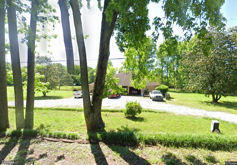
1605 Brownsferry St Athens, AL 35611
Estimated Value: $315,000 - $415,000
--
Bed
1
Bath
3,488
Sq Ft
$109/Sq Ft
Est. Value
About This Home
This home is located at 1605 Brownsferry St, Athens, AL 35611 and is currently estimated at $380,032, approximately $108 per square foot. 1605 Brownsferry St is a home with nearby schools including Athens Intermediate School, SPARK Academy at Cowart Elementary, and Athens Middle School.
Ownership History
Date
Name
Owned For
Owner Type
Purchase Details
Closed on
Oct 6, 2023
Sold by
White Nicole
Bought by
White Nicole
Current Estimated Value
Purchase Details
Closed on
Oct 5, 2006
Sold by
Federal National Mortgage Association
Bought by
White Nicole
Home Financials for this Owner
Home Financials are based on the most recent Mortgage that was taken out on this home.
Original Mortgage
$130,000
Interest Rate
6.45%
Purchase Details
Closed on
Apr 5, 2005
Sold by
Counihan Timothy C
Bought by
Federal National Mortgage Association
Create a Home Valuation Report for This Property
The Home Valuation Report is an in-depth analysis detailing your home's value as well as a comparison with similar homes in the area
Home Values in the Area
Average Home Value in this Area
Purchase History
| Date | Buyer | Sale Price | Title Company |
|---|---|---|---|
| White Nicole | $248,000 | Attorney Only | |
| White Nicole | -- | -- | |
| Federal National Mortgage Association | -- | -- |
Source: Public Records
Mortgage History
| Date | Status | Borrower | Loan Amount |
|---|---|---|---|
| Previous Owner | White Nicole | $130,000 |
Source: Public Records
Tax History Compared to Growth
Tax History
| Year | Tax Paid | Tax Assessment Tax Assessment Total Assessment is a certain percentage of the fair market value that is determined by local assessors to be the total taxable value of land and additions on the property. | Land | Improvement |
|---|---|---|---|---|
| 2024 | -- | $25,800 | $0 | $0 |
| 2023 | $0 | $26,320 | $0 | $0 |
| 2022 | $0 | $22,360 | $0 | $0 |
| 2021 | $0 | $19,140 | $0 | $0 |
| 2020 | $0 | $18,460 | $0 | $0 |
| 2019 | $464 | $17,360 | $0 | $0 |
| 2018 | $642 | $16,040 | $0 | $0 |
| 2017 | $420 | $16,040 | $0 | $0 |
| 2016 | $420 | $160,300 | $0 | $0 |
| 2015 | $420 | $16,040 | $0 | $0 |
| 2014 | $410 | $0 | $0 | $0 |
Source: Public Records
Map
Nearby Homes
- 1505 Nella Dr
- 1509 Nella Dr
- 1501 Reynard St
- 1709 Lillian Dr
- 1412 Bridgewater Place
- 409 Suffield St
- 107 Virginia Dr
- 16088 Lucas Ferry Rd
- Lot 1 Browns Ferry St
- 8336 Us Highway 72 W
- 203 Gordon Dr
- 1504 Pinedale St
- 313 Christopher Dr
- Lot 17 Acorn Hill Cir
- 17805 Tipper Ln
- 17793 Tipper Ln
- 2113 Stanford St
- 17781 Tipper Ln
- 17759 Tipper Ln
- 16231 W Glenn Valley Dr
- 1606 Brownsferry St
- 1604 Brownsferry St
- 101 Sunset Dr
- 103 Sunset Dr
- 1602 Brownsferry St
- 1602 Browns Ferry St
- 102 Sunset Dr
- 105 Sunset Dr
- 1600 Brownsferry St
- 1507 Nella Dr
- 105 Debeth Plaza S
- 305 Campbell Dr
- 103 Debeth Plaza S
- 201 Sunset Dr
- 101 Sunrise Dr
- 107 Debeth Plaza S
- 1516 Brownsferry St
- 1515 Brownsferry St
- 304-306 Campbell Dr
- 1506 Nella Dr