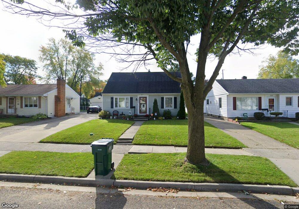
1605 Loraine Ave Lansing, MI 48910
Colonial Village NeighborhoodEstimated Value: $153,876 - $190,000
--
Bed
--
Bath
1,105
Sq Ft
$155/Sq Ft
Est. Value
About This Home
This home is located at 1605 Loraine Ave, Lansing, MI 48910 and is currently estimated at $171,469, approximately $155 per square foot. 1605 Loraine Ave is a home located in Ingham County with nearby schools including Averill Elementary School, Attwood School, and J.W. Sexton High School.
Ownership History
Date
Name
Owned For
Owner Type
Purchase Details
Closed on
Nov 26, 2003
Sold by
Sustrich Patrick and Sustrich Lara
Bought by
Diebolt Theresa
Current Estimated Value
Home Financials for this Owner
Home Financials are based on the most recent Mortgage that was taken out on this home.
Original Mortgage
$121,150
Outstanding Balance
$56,648
Interest Rate
6.01%
Mortgage Type
Purchase Money Mortgage
Estimated Equity
$114,821
Purchase Details
Closed on
Dec 14, 2001
Sold by
Kiersey Laurie A and Wood Laurie A
Bought by
Sustrich Patrick and Sustrich Lara
Home Financials for this Owner
Home Financials are based on the most recent Mortgage that was taken out on this home.
Original Mortgage
$88,400
Interest Rate
6.53%
Mortgage Type
Purchase Money Mortgage
Purchase Details
Closed on
Oct 9, 1998
Sold by
Hernandez Brenda
Bought by
Wood Laurie A
Purchase Details
Closed on
Jun 5, 1996
Sold by
Brady John E and Joyce M
Bought by
Hernandez Brenda
Create a Home Valuation Report for This Property
The Home Valuation Report is an in-depth analysis detailing your home's value as well as a comparison with similar homes in the area
Home Values in the Area
Average Home Value in this Area
Purchase History
| Date | Buyer | Sale Price | Title Company |
|---|---|---|---|
| Diebolt Theresa | $124,900 | Midstate Title Co | |
| Sustrich Patrick | $110,500 | Midstate Title Company | |
| Wood Laurie A | $85,000 | -- | |
| Hernandez Brenda | $72,900 | -- |
Source: Public Records
Mortgage History
| Date | Status | Borrower | Loan Amount |
|---|---|---|---|
| Open | Diebolt Theresa | $121,150 | |
| Previous Owner | Sustrich Patrick | $88,400 |
Source: Public Records
Tax History Compared to Growth
Tax History
| Year | Tax Paid | Tax Assessment Tax Assessment Total Assessment is a certain percentage of the fair market value that is determined by local assessors to be the total taxable value of land and additions on the property. | Land | Improvement |
|---|---|---|---|---|
| 2025 | $3,115 | $69,200 | $8,600 | $60,600 |
| 2024 | $25 | $69,700 | $8,600 | $61,100 |
| 2023 | $2,921 | $62,200 | $8,600 | $53,600 |
| 2022 | $2,633 | $56,400 | $7,400 | $49,000 |
| 2021 | $2,578 | $51,900 | $5,700 | $46,200 |
| 2020 | $2,562 | $49,800 | $5,700 | $44,100 |
| 2019 | $2,456 | $43,800 | $5,700 | $38,100 |
| 2018 | $2,302 | $43,000 | $5,700 | $37,300 |
| 2017 | $2,204 | $43,000 | $5,700 | $37,300 |
| 2016 | $2,107 | $39,300 | $5,700 | $33,600 |
| 2015 | $2,107 | $38,400 | $11,342 | $27,058 |
| 2014 | $2,107 | $37,700 | $8,876 | $28,824 |
Source: Public Records
Map
Nearby Homes
- 1618 Loraine Ave
- 1607 Holly Way
- 1404 Kelsey Ave
- 1120 Kelsey Ave
- 1420 Poxson Ave
- 2118 Marion Ave
- 2039 Holly Way
- 2515 S Martin Luther King Junior Blvd
- 1032 Kelsey Ave
- 3125 Boston Blvd
- 2812 Pleasant Grove Rd
- 2310 Stirling Ave
- 2421 Stirling Ave
- 924 Loa St
- 1312 W Mount Hope Ave
- 2920 Pleasant Grove Rd Unit 1
- 1315 Goodrich St
- 2112 Stirling Ave
- 815 Woodbine Ave
- 2409 Victor Ave
- 1527 Loraine Ave
- 1609 Loraine Ave
- 1602 W Rundle Ave
- 1521 Loraine Ave
- 1606 W Rundle Ave
- 1526 W Rundle Ave
- 1611 Loraine Ave
- 1610 W Rundle Ave
- 1522 W Rundle Ave
- 1602 Loraine Ave
- 1517 Loraine Ave
- 1616 W Rundle Ave
- 1608 Loraine Ave
- 1524 Loraine Ave
- 1516 W Rundle Ave
- 1623 Loraine Ave
- 1518 Loraine Ave
- 1622 W Rundle Ave
- 1511 Loraine Ave
- 1510 W Rundle Ave