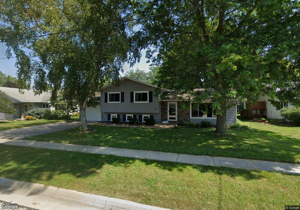
1605 River Dr Watertown, WI 53094
Estimated Value: $325,000 - $374,000
--
Bed
--
Bath
--
Sq Ft
0.31
Acres
About This Home
This home is located at 1605 River Dr, Watertown, WI 53094 and is currently estimated at $343,302. 1605 River Dr is a home located in Jefferson County with nearby schools including Watertown High School, eCampus Academy Charter School, and Trinity-St. Luke's Lutheran Elementary School.
Ownership History
Date
Name
Owned For
Owner Type
Purchase Details
Closed on
Jul 23, 2020
Sold by
Steuerwald Layna S
Bought by
Goddwill Andrew S and Goddwill Heidi L
Current Estimated Value
Home Financials for this Owner
Home Financials are based on the most recent Mortgage that was taken out on this home.
Original Mortgage
$213,400
Outstanding Balance
$189,229
Interest Rate
3.1%
Mortgage Type
New Conventional
Estimated Equity
$154,073
Purchase Details
Closed on
May 1, 2007
Sold by
Mares Ismael R and Mares Kristine K
Bought by
Steuerwald David F and Steuerwald Layna S
Home Financials for this Owner
Home Financials are based on the most recent Mortgage that was taken out on this home.
Original Mortgage
$131,000
Interest Rate
6.22%
Mortgage Type
New Conventional
Create a Home Valuation Report for This Property
The Home Valuation Report is an in-depth analysis detailing your home's value as well as a comparison with similar homes in the area
Home Values in the Area
Average Home Value in this Area
Purchase History
| Date | Buyer | Sale Price | Title Company |
|---|---|---|---|
| Goddwill Andrew S | $220,000 | Frontier Title & Closing Ser | |
| Steuerwald Layna S | -- | Frontier Title & Closing Ser | |
| Steuerwald David F | $191,000 | None Available |
Source: Public Records
Mortgage History
| Date | Status | Borrower | Loan Amount |
|---|---|---|---|
| Open | Goddwill Andrew S | $213,400 | |
| Previous Owner | Steuerwald David F | $131,000 |
Source: Public Records
Tax History Compared to Growth
Tax History
| Year | Tax Paid | Tax Assessment Tax Assessment Total Assessment is a certain percentage of the fair market value that is determined by local assessors to be the total taxable value of land and additions on the property. | Land | Improvement |
|---|---|---|---|---|
| 2024 | $5,028 | $336,600 | $52,700 | $283,900 |
| 2023 | $4,641 | $273,300 | $46,700 | $226,600 |
| 2022 | $4,674 | $273,300 | $46,700 | $226,600 |
| 2021 | $4,014 | $166,100 | $28,500 | $137,600 |
| 2020 | $4,046 | $166,100 | $28,500 | $137,600 |
| 2019 | $3,928 | $166,100 | $28,500 | $137,600 |
| 2018 | $3,840 | $166,100 | $28,500 | $137,600 |
| 2017 | $3,687 | $166,100 | $28,500 | $137,600 |
| 2016 | $3,633 | $166,100 | $28,500 | $137,600 |
| 2015 | $3,700 | $166,100 | $28,500 | $137,600 |
| 2014 | $3,752 | $166,100 | $28,500 | $137,600 |
| 2013 | $3,822 | $166,100 | $28,500 | $137,600 |
Source: Public Records
Map
Nearby Homes
- 1313 Utah St
- 1314 Waldron St
- 1301 Utah St
- 1418 S 9th St
- 908 Franklin St
- 1215 Utah St
- 131 Cedar Ct
- 1507 S 10th St
- 758 Johnson St
- 750 Johnson St
- The Saybrook Plan at Rock River Ridge
- The Atwater Plan at Rock River Ridge
- The Hudson Plan at Rock River Ridge
- The Coral Plan at Rock River Ridge
- The Drake Plan at Rock River Ridge
- The Addison Plan at Rock River Ridge
- The Bradford Plan at Rock River Ridge
- The Catalina Plan at Rock River Ridge
- The Adrian Plan at Rock River Ridge
- The McKinley Plan at Rock River Ridge