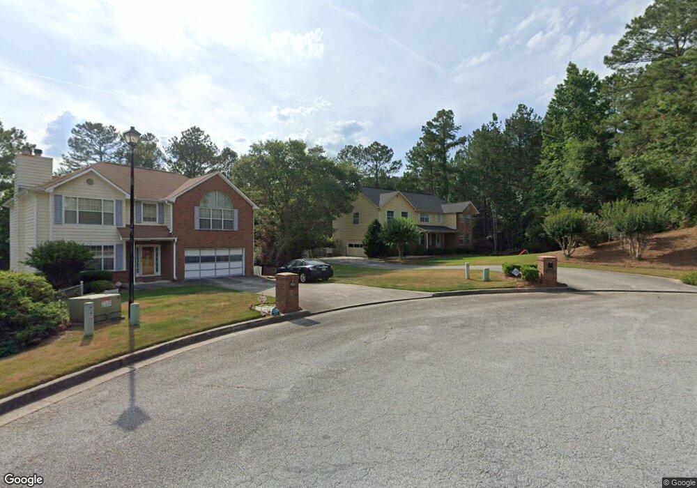
1605 Rolling Stone Dr Unit 2 Lithonia, GA 30058
Estimated Value: $325,000 - $368,587
3
Beds
3
Baths
2,818
Sq Ft
$123/Sq Ft
Est. Value
About This Home
This home is located at 1605 Rolling Stone Dr Unit 2, Lithonia, GA 30058 and is currently estimated at $346,647, approximately $123 per square foot. 1605 Rolling Stone Dr Unit 2 is a home located in DeKalb County with nearby schools including Rock Chapel Elementary School, Lithonia Middle School, and Lithonia High School.
Ownership History
Date
Name
Owned For
Owner Type
Purchase Details
Closed on
May 14, 2025
Sold by
Milligan Joseph
Bought by
Joseph Milligan Trust Ua Dated May 14 20 and Milligan Joseph Seymour Tr
Current Estimated Value
Purchase Details
Closed on
Feb 26, 1993
Sold by
Herman Homes Inc
Bought by
Milligan Joseph
Home Financials for this Owner
Home Financials are based on the most recent Mortgage that was taken out on this home.
Original Mortgage
$128,300
Interest Rate
8.06%
Create a Home Valuation Report for This Property
The Home Valuation Report is an in-depth analysis detailing your home's value as well as a comparison with similar homes in the area
Home Values in the Area
Average Home Value in this Area
Purchase History
| Date | Buyer | Sale Price | Title Company |
|---|---|---|---|
| Joseph Milligan Trust Ua Dated May 14 20 | -- | -- | |
| Milligan Joseph | $135,100 | -- |
Source: Public Records
Mortgage History
| Date | Status | Borrower | Loan Amount |
|---|---|---|---|
| Previous Owner | Milligan Joseph | $128,300 |
Source: Public Records
Tax History
| Year | Tax Paid | Tax Assessment Tax Assessment Total Assessment is a certain percentage of the fair market value that is determined by local assessors to be the total taxable value of land and additions on the property. | Land | Improvement |
|---|---|---|---|---|
| 2025 | $3,968 | $138,240 | $13,040 | $125,200 |
| 2024 | $4,152 | $141,480 | $13,040 | $128,440 |
| 2023 | $4,152 | $137,000 | $13,040 | $123,960 |
| 2022 | $3,586 | $119,080 | $13,040 | $106,040 |
| 2021 | $3,114 | $98,600 | $13,040 | $85,560 |
| 2020 | $2,697 | $80,320 | $13,040 | $67,280 |
| 2019 | $2,488 | $73,400 | $13,040 | $60,360 |
| 2018 | $1,988 | $69,320 | $13,040 | $56,280 |
| 2017 | $2,300 | $65,600 | $13,040 | $52,560 |
| 2016 | $1,760 | $51,560 | $13,040 | $38,520 |
| 2014 | $1,063 | $31,320 | $13,040 | $18,280 |
Source: Public Records
Map
Nearby Homes
- 1736 Mossy Rock Cove
- 8241 Mckenzie Place
- 8571 Secretariat Dr
- 8573 Secretariat Dr
- 8577 Secretariat Dr
- 8579 Secretariat Dr
- 8578 Preakness Pass
- 8580 Secretariat Dr
- 8581 Secretariat Dr
- 8580 Preakness Pass
- 8580 Seabiscuit Rd
- 8581 Preakness Pass
- 8582 Preakness Pass
- 8582 Seabiscuit Rd
- 8583 Preakness Pass
- 8584 Preakness Pass
- 8585 Preakness Pass
- 8586 Preakness Pass
- 7429 Pleasant Hill Rd
- 8592 Secretariat Dr
- 1615 Rolling Stone Dr Unit 2
- 1627 Rolling Stone Dr
- 1630 Rolling Stone Dr Unit 2
- 1635 Rolling Stone Dr
- 8316 Bedrock Run Unit II
- 1650 Rolling Stone Dr Unit 2
- 8296 Bedrock Run Unit II
- 8306 Bedrock Run
- 1674 Rolling Stone Dr
- 1667 Rolling Stone Dr
- 1675 Rolling Stone Dr Unit 2
- 1684 Rolling Stone Dr Unit 2
- 1736 Harmony Trace
- 1732 Harmony Trace
- 1685 Rolling Stone Dr
- 1731 Harmony Trace
- 8612 Pleasant Hill Way
- 8615 Pleasant Hill Way
- 1706 Mossy Rock Cove
- 1700 Mossy Rock Cove Unit 2
Your Personal Tour Guide
Ask me questions while you tour the home.