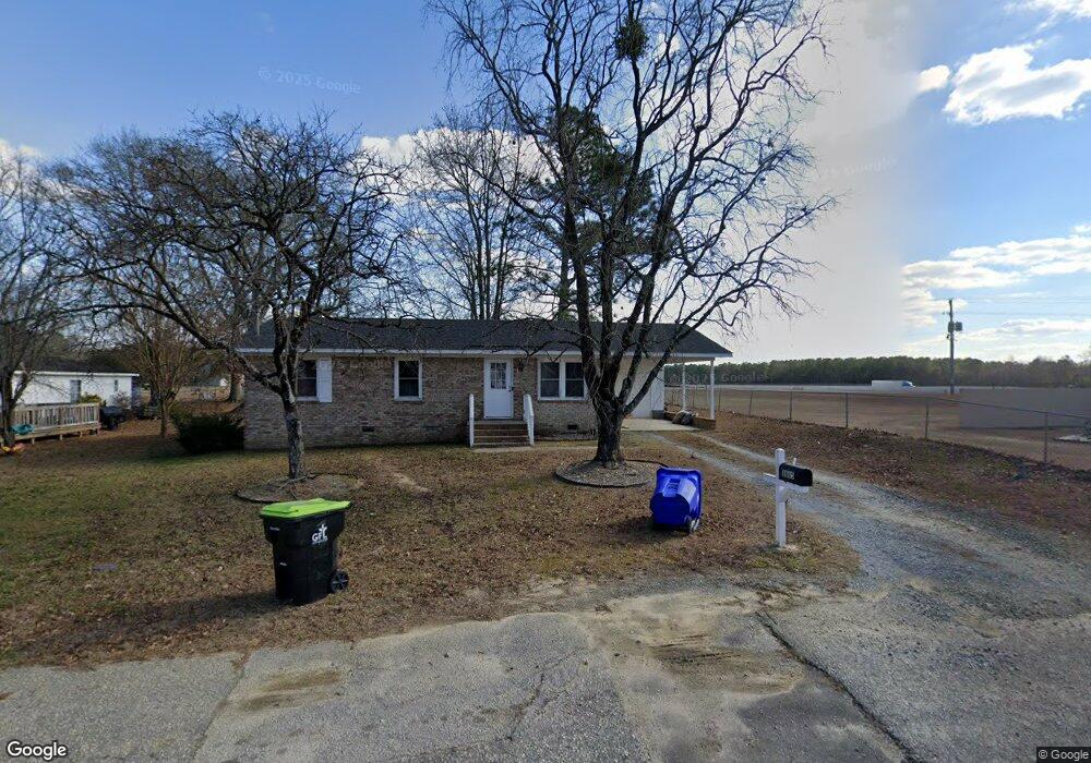
1605 S Maynard St Benson, NC 27504
Estimated Value: $197,000 - $228,000
About This Home
This home is located at 1605 S Maynard St, Benson, NC 27504 and is currently estimated at $215,200, approximately $201 per square foot. 1605 S Maynard St is a home located in Johnston County with nearby schools including Benson Elementary School, Benson Middle School, and South Johnston High School.
Ownership History
We collect this data history from publicly available records. To have your information removed, we recommend requesting removal directly through your county’s website.
Purchase Details
Home Financials for this Owner
Home Financials are based on the most recent Mortgage that was taken out on this home.Purchase Details
Purchase Details
Home Values in the Area
Average Home Value in this Area
Purchase History
We collect this data history from publicly available records. To have your information removed, we recommend requesting removal directly through your county’s website.
| Date | Buyer | Sale Price | Title Company |
|---|---|---|---|
| $144,000 | None Available | ||
| $63,000 | None Available | ||
| -- | None Available |
Mortgage History
We collect this data history from publicly available records. To have your information removed, we recommend requesting removal directly through your county’s website.
| Date | Status | Borrower | Loan Amount |
|---|---|---|---|
| Open | $136,800 |
Tax History
We collect this data history from publicly available records. To have your information removed, we recommend requesting removal directly through your county’s website.
| Year | Tax Paid | Tax Assessment Tax Assessment Total Assessment is a certain percentage of the fair market value that is determined by local assessors to be the total taxable value of land and additions on the property. | Land | Improvement |
|---|---|---|---|---|
| 2025 | $2,476 | $219,090 | $44,290 | $174,800 |
| 2024 | $1,307 | $102,130 | $20,250 | $81,880 |
| 2023 | $1,307 | $102,130 | $20,250 | $81,880 |
| 2022 | $1,307 | $102,130 | $20,250 | $81,880 |
| 2021 | $1,307 | $102,130 | $20,250 | $81,880 |
| 2020 | $1,054 | $81,710 | $20,250 | $61,460 |
| 2019 | $1,054 | $81,710 | $20,250 | $61,460 |
| 2018 | $0 | $80,660 | $22,150 | $58,510 |
| 2017 | $1,065 | $80,660 | $22,150 | $58,510 |
| 2016 | $1,057 | $80,660 | $22,150 | $58,510 |
| 2015 | $1,057 | $80,660 | $22,150 | $58,510 |
| 2014 | -- | $80,660 | $22,150 | $58,510 |
Map
- 0 Chicopee Rd Unit 10097773
- 4943 U S 301
- 215 W Brocklyn St
- 514 S Lincoln St
- 520 S Lincoln St
- 00 Massengill Farm Rd
- 310 Chicopee Rd
- 305 Chuck Wagon Way Unit 146p
- 308 Chuck Wagon Way Unit 115p
- 306 Chuck Wagon Way Unit 116p
- 127 S Mule Way Unit 105
- 401 W Brocklyn St
- 323 W Woodall St
- 421 Plentiful Way Unit 111
- 0 S Dunn St
- 206 S Wall St
- 2674 Hodges Chapel Rd
- 2686 Hodges Chapel Rd
- 310 S Eastwood Dr Unit (Lot 10)
- 310 Pierre Dr
- 1603 S Maynard St
- 202 E King Cir
- 106 E King Cir
- 1602 S Maynard St
- 1604 S Maynard St
- 203 E King Cir
- 205 E King Cir
- 104 E King Cir
- 207 E King Cir
- 105 E King Cir
- 301 E King Cir
- 303 E King Cir
- 103 E King Cir
- 202 E Kennedy Cir
- 204 E Kennedy Cir
- 200 E Kennedy Cir
- 1508 Chicopee Rd
- 300 E Kennedy Cir
- 106 E Kennedy Cir
- 302 E Kennedy Cir
Ask me questions while you tour the home.