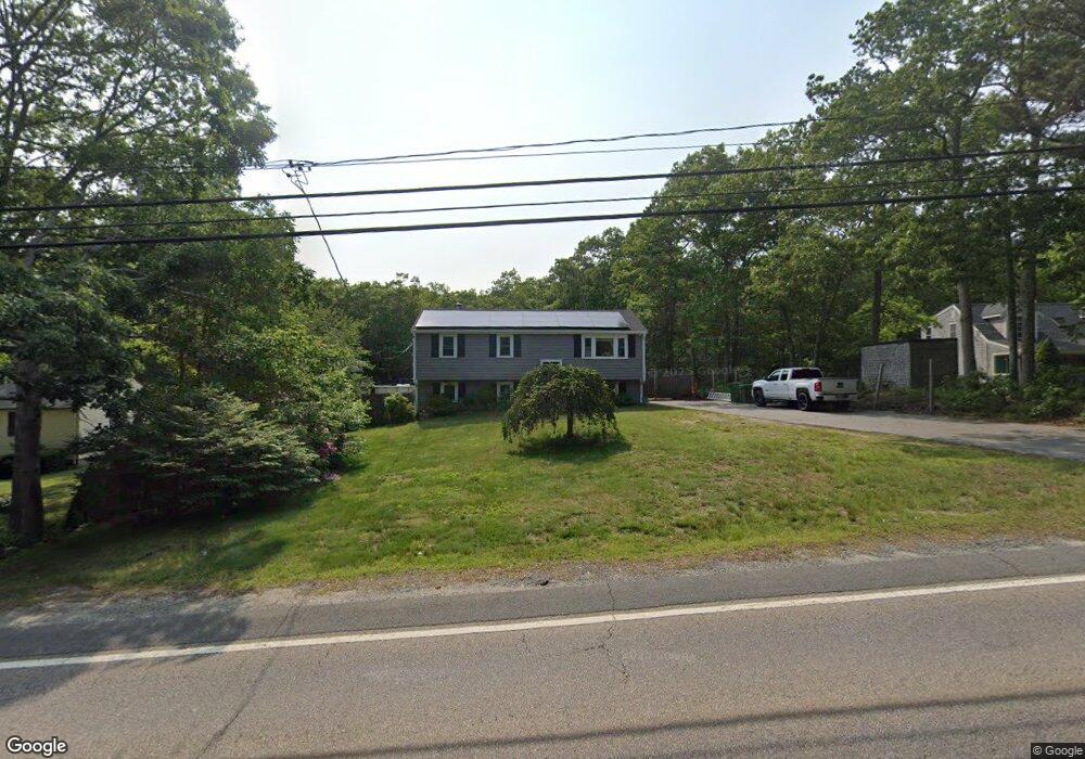
1605 State Rd Plymouth, MA 02360
Estimated Value: $518,000 - $588,000
3
Beds
1
Bath
960
Sq Ft
$568/Sq Ft
Est. Value
About This Home
This home is located at 1605 State Rd, Plymouth, MA 02360 and is currently estimated at $545,509, approximately $568 per square foot. 1605 State Rd is a home located in Plymouth County with nearby schools including Indian Brook, Plymouth South Middle School, and Plymouth South High School.
Ownership History
Date
Name
Owned For
Owner Type
Purchase Details
Closed on
Jul 1, 2005
Sold by
Pilote Rt and Cote
Bought by
Kearney Michael J and Kearney Erin L
Current Estimated Value
Home Financials for this Owner
Home Financials are based on the most recent Mortgage that was taken out on this home.
Original Mortgage
$234,620
Outstanding Balance
$123,028
Interest Rate
5.73%
Mortgage Type
Purchase Money Mortgage
Estimated Equity
$422,481
Purchase Details
Closed on
Aug 30, 2004
Sold by
Cote David A
Bought by
Pilote Rt and Cote
Home Financials for this Owner
Home Financials are based on the most recent Mortgage that was taken out on this home.
Original Mortgage
$85,000
Interest Rate
6.02%
Mortgage Type
Purchase Money Mortgage
Purchase Details
Closed on
Mar 23, 1999
Sold by
Benson Donna J
Bought by
Pilote Rt and Cote
Create a Home Valuation Report for This Property
The Home Valuation Report is an in-depth analysis detailing your home's value as well as a comparison with similar homes in the area
Home Values in the Area
Average Home Value in this Area
Purchase History
| Date | Buyer | Sale Price | Title Company |
|---|---|---|---|
| Kearney Michael J | $293,900 | -- | |
| Pilote Rt | -- | -- | |
| Cote David A | -- | -- | |
| Pilote Rt | $51,125 | -- |
Source: Public Records
Mortgage History
| Date | Status | Borrower | Loan Amount |
|---|---|---|---|
| Open | Pilote Rt | $234,620 | |
| Closed | Pilote Rt | $58,780 | |
| Previous Owner | Pilote Rt | $85,000 |
Source: Public Records
Tax History Compared to Growth
Tax History
| Year | Tax Paid | Tax Assessment Tax Assessment Total Assessment is a certain percentage of the fair market value that is determined by local assessors to be the total taxable value of land and additions on the property. | Land | Improvement |
|---|---|---|---|---|
| 2025 | $5,351 | $421,700 | $202,300 | $219,400 |
| 2024 | $4,979 | $386,900 | $182,300 | $204,600 |
| 2023 | $4,822 | $351,700 | $167,300 | $184,400 |
| 2022 | $4,714 | $305,500 | $157,100 | $148,400 |
| 2021 | $4,441 | $274,800 | $157,100 | $117,700 |
| 2020 | $4,452 | $272,300 | $157,100 | $115,200 |
| 2019 | $4,309 | $260,500 | $147,100 | $113,400 |
| 2018 | $4,010 | $243,600 | $132,100 | $111,500 |
| 2017 | $3,876 | $233,800 | $132,100 | $101,700 |
| 2016 | $3,641 | $223,800 | $122,100 | $101,700 |
| 2015 | $3,400 | $218,800 | $117,100 | $101,700 |
| 2014 | $3,324 | $219,700 | $122,100 | $97,600 |
Source: Public Records
Map
Nearby Homes
- 47 Pleasant Harbour Rd
- 30 Nautical Way
- 35 Nautical Way
- 43 Pond View Cir
- 12 Mayflower Dr
- 35 Trask Rd
- 451 Ship Pond Rd
- 475 Ship Pond Rd
- 296 Center Hill Rd
- 5 Trask Rd
- 322R Center Hill Rd
- 107 Shore Dr
- 32 Shore Dr
- 1924 State Rd
- 26 Goelette Dr
- 25 Great Woods Rd
- 11 Ellisville Dr
- 128 Pine Mountain Dr
- 1029 Old Sandwich Rd
- 27 Ocean Walk Dr Unit 204
- 1609 State Rd
- 1601 State Rd
- 1613 State Rd
- 1604 State Rd
- 1610 State Rd
- 6 Shoals Ave
- 6 Shoals Ave
- 1622 State Rd
- 24 Shoals Ave
- 1594 State Rd
- 1602 State Rd
- 1628 State Rd
- 38-16 Pleasant Harbour Rd
- 132 Barnfield Dr
- 126 Barnfield Dr
- 7 Pleasant Harbour Rd
- 10 Pleasant Harbour Rd
- 34 Shoals Ave
- 1588 State Rd
- 29 Shoals Ave