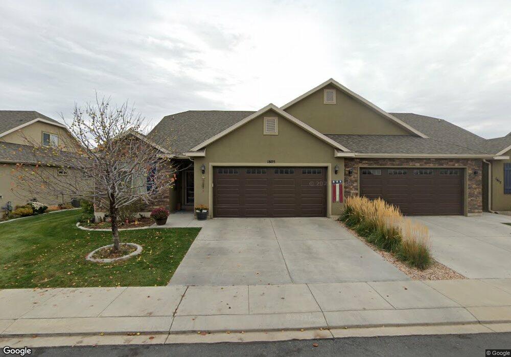
1605 W 480 N Unit 37 Lindon, UT 84042
Estimated Value: $504,000 - $524,000
3
Beds
2
Baths
2,339
Sq Ft
$220/Sq Ft
Est. Value
About This Home
This home is located at 1605 W 480 N Unit 37, Lindon, UT 84042 and is currently estimated at $515,663, approximately $220 per square foot. 1605 W 480 N Unit 37 is a home located in Utah County with nearby schools including Lindon Elementary School, Oak Canyon Junior High School, and Pleasant Grove High School.
Ownership History
Date
Name
Owned For
Owner Type
Purchase Details
Closed on
Jun 9, 2014
Sold by
Lindon Creekside Llc
Bought by
Rudd Thomas E
Current Estimated Value
Home Financials for this Owner
Home Financials are based on the most recent Mortgage that was taken out on this home.
Original Mortgage
$396,984
Outstanding Balance
$302,748
Interest Rate
4.27%
Mortgage Type
Reverse Mortgage Home Equity Conversion Mortgage
Estimated Equity
$212,915
Create a Home Valuation Report for This Property
The Home Valuation Report is an in-depth analysis detailing your home's value as well as a comparison with similar homes in the area
Home Values in the Area
Average Home Value in this Area
Purchase History
| Date | Buyer | Sale Price | Title Company |
|---|---|---|---|
| Rudd Thomas E | -- | United Title Services |
Source: Public Records
Mortgage History
| Date | Status | Borrower | Loan Amount |
|---|---|---|---|
| Open | Rudd Thomas E | $396,984 |
Source: Public Records
Tax History Compared to Growth
Tax History
| Year | Tax Paid | Tax Assessment Tax Assessment Total Assessment is a certain percentage of the fair market value that is determined by local assessors to be the total taxable value of land and additions on the property. | Land | Improvement |
|---|---|---|---|---|
| 2025 | $2,319 | $284,955 | $149,300 | $368,800 |
| 2024 | $2,319 | $285,395 | $0 | $0 |
| 2023 | $313 | $287,870 | $0 | $0 |
| 2022 | $249 | $297,990 | $0 | $0 |
| 2021 | $155 | $335,000 | $135,000 | $200,000 |
| 2020 | $415 | $335,000 | $135,000 | $200,000 |
| 2019 | $1,694 | $335,000 | $135,000 | $200,000 |
| 2018 | $1,653 | $308,100 | $135,000 | $173,100 |
| 2017 | $413 | $161,205 | $0 | $0 |
| 2016 | $813 | $138,710 | $0 | $0 |
| 2015 | -- | $150,700 | $0 | $0 |
| 2014 | $819 | $70,919 | $0 | $0 |
Source: Public Records
Map
Nearby Homes
- 337 N Brookview Dr
- 556 N Buffalo Grass Ln
- 566 N Buffalo Grass Ln
- 554 N Buffalo Grass Ln
- 570 N Buffalo Grass Ln
- 564 N Buffalo Grass Ln
- 564 N Buffalo Grass Ln Unit 1250
- 558 N Buffalo Grass Ln
- 575 N Buffalo Grass Ln
- 574 N Cornstalk Ln
- 582 N Cornstalk Ln
- 568 N Buffalo Grass Ln
- 560 N Buffalo Grass Ln
- 605 N Buffalo Grass Ln
- 600 N Cornstalk Ln
- 572 N Buffalo Grass Ln
- 1362 W Valley Dr
- 611 N Briarwood Ln
- 1309 W Sweet Corn Ln
- Kirkwood Farmhouse Plan at Anderson Farms
- 1617 W 480 N Unit 36
- 1589 W 480 N Unit 38
- 1589 W 480 N
- 1629 W 480 N Unit 35
- 1577 W 480 N
- 1598 W 430 N
- 1610 W 430 N Unit 51
- 1584 W 430 N Unit 49
- 1584 W 430 N
- 1612 W 480 N
- 1612 W 480 N Unit 1
- 1596 W 480 N Unit 2
- 1596 W 480 N
- 1568 W 430 N Unit 48
- 1647 W 480 N Unit 30
- 1647 W 480 N Unit 34
- 1624 W 430 N
- 1582 W 480 N Unit 3
- 1582 W 480 N
- 1561 W 480 N Unit 40