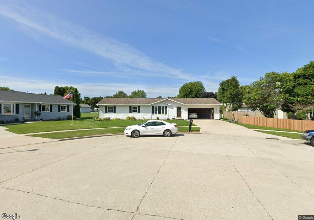
1606 Atlanta Ct Manitowoc, WI 54220
Estimated Value: $265,541 - $287,000
--
Bed
--
Bath
1,152
Sq Ft
$240/Sq Ft
Est. Value
About This Home
This home is located at 1606 Atlanta Ct, Manitowoc, WI 54220 and is currently estimated at $276,385, approximately $239 per square foot. 1606 Atlanta Ct is a home located in Manitowoc County with nearby schools including Jackson Elementary School, Wilson Middle School, and Lincoln High School.
Ownership History
Date
Name
Owned For
Owner Type
Purchase Details
Closed on
Jun 28, 2013
Sold by
Dissmore Gary R and Dissmore Shellie D
Bought by
Ducat Rick J and Ducat Victoria S
Current Estimated Value
Home Financials for this Owner
Home Financials are based on the most recent Mortgage that was taken out on this home.
Original Mortgage
$119,700
Outstanding Balance
$85,925
Interest Rate
3.62%
Mortgage Type
New Conventional
Estimated Equity
$190,460
Create a Home Valuation Report for This Property
The Home Valuation Report is an in-depth analysis detailing your home's value as well as a comparison with similar homes in the area
Home Values in the Area
Average Home Value in this Area
Purchase History
| Date | Buyer | Sale Price | Title Company |
|---|---|---|---|
| Ducat Rick J | $126,000 | First American Title |
Source: Public Records
Mortgage History
| Date | Status | Borrower | Loan Amount |
|---|---|---|---|
| Open | Ducat Rick J | $119,700 |
Source: Public Records
Tax History Compared to Growth
Tax History
| Year | Tax Paid | Tax Assessment Tax Assessment Total Assessment is a certain percentage of the fair market value that is determined by local assessors to be the total taxable value of land and additions on the property. | Land | Improvement |
|---|---|---|---|---|
| 2024 | $3,528 | $213,500 | $24,700 | $188,800 |
| 2023 | $3,242 | $213,500 | $24,700 | $188,800 |
| 2022 | $2,908 | $160,000 | $24,700 | $135,300 |
| 2021 | $2,915 | $160,000 | $24,700 | $135,300 |
| 2020 | $2,673 | $134,500 | $24,700 | $109,800 |
| 2019 | $2,634 | $134,500 | $24,700 | $109,800 |
| 2018 | $2,591 | $134,500 | $24,700 | $109,800 |
| 2017 | $2,562 | $134,500 | $24,700 | $109,800 |
| 2016 | $2,658 | $134,500 | $24,700 | $109,800 |
| 2015 | $2,734 | $134,500 | $24,700 | $109,800 |
| 2014 | $2,664 | $134,500 | $24,700 | $109,800 |
| 2013 | $2,697 | $134,500 | $24,700 | $109,800 |
Source: Public Records
Map
Nearby Homes
- 1625 Atlanta Cir
- 1825 Waldo Blvd
- 1414 Nagle Ave
- 1316 N 23rd St
- 1025 N 15th St
- 1101 Nagle Ave
- 928 N 16th St
- 1008 N 23rd St
- 1920 Ravenswood Ln
- 1922 Ravenswood Ln
- 1926 Ravenswood Ln
- 1928 Ravenswood Ln
- 1934 Ravenswood Ln
- 1936 Ravenswood Ln
- 919 N 14th St
- 1518 Torrison Dr
- Lt99 N 18th St
- 511 Oak St
- 840 Lincoln Blvd
- 1127 Tanglewood Rd
- 1602 Atlanta Ct
- 1907 Lexington Dr
- 1901 Lexington Dr
- 1908 Menasha Ave
- 1816 Menasha Ave
- 1613 Atlanta Ct
- 1609 Atlanta Ct
- 1915 Lexington Dr
- 1914 Menasha Ave
- 1810 Menasha Ave
- 1601 Atlanta Ct
- 1605 Atlanta Ct
- 1615 Atlanta Ct
- 1617 Atlanta Ct
- 1921 Lexington Dr
- 1920 Menasha Ave
- 1802 Menasha Ave
- 1902 Lexington Dr
- 1908 Lexington Dr
- 1927 Lexington Dr