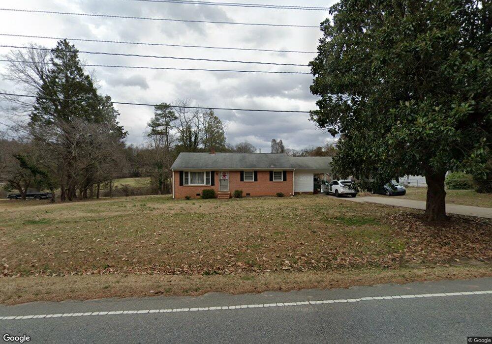
1606 Deep River Rd High Point, NC 27265
Greater High Point NeighborhoodEstimated Value: $171,000 - $253,000
2
Beds
1
Bath
1,260
Sq Ft
$162/Sq Ft
Est. Value
About This Home
This home is located at 1606 Deep River Rd, High Point, NC 27265 and is currently estimated at $204,058, approximately $161 per square foot. 1606 Deep River Rd is a home located in Guilford County with nearby schools including Montlieu Academy of Technology, Welborn Academy of Science & Technology, and T.W. Andrews High School.
Ownership History
Date
Name
Owned For
Owner Type
Purchase Details
Closed on
Feb 19, 2015
Sold by
Coble Marilyn C
Bought by
Amh Properties Llc
Current Estimated Value
Purchase Details
Closed on
Feb 1, 2012
Sold by
Coble Marilyn C and Coble Harold D
Bought by
Coble Marilyn C
Purchase Details
Closed on
Oct 26, 1999
Sold by
Killingsworth Ted E and Killingsworth Leah W
Bought by
Coble Harold D and Coble Marilyn Carmichael
Purchase Details
Closed on
Sep 27, 1998
Sold by
Carmichael David L and Carmichael Bettie D
Bought by
Coble Harold D and Coble Marilyn C
Home Financials for this Owner
Home Financials are based on the most recent Mortgage that was taken out on this home.
Original Mortgage
$20,000
Interest Rate
6.92%
Mortgage Type
Seller Take Back
Create a Home Valuation Report for This Property
The Home Valuation Report is an in-depth analysis detailing your home's value as well as a comparison with similar homes in the area
Home Values in the Area
Average Home Value in this Area
Purchase History
| Date | Buyer | Sale Price | Title Company |
|---|---|---|---|
| Amh Properties Llc | $50,000 | None Available | |
| Coble Marilyn C | -- | Chicago Title Insurance Co | |
| Coble Harold D | -- | -- | |
| Coble Harold D | -- | -- |
Source: Public Records
Mortgage History
| Date | Status | Borrower | Loan Amount |
|---|---|---|---|
| Previous Owner | Coble Harold D | $20,000 |
Source: Public Records
Tax History
| Year | Tax Paid | Tax Assessment Tax Assessment Total Assessment is a certain percentage of the fair market value that is determined by local assessors to be the total taxable value of land and additions on the property. | Land | Improvement |
|---|---|---|---|---|
| 2025 | $1,543 | $112,000 | $24,000 | $88,000 |
| 2024 | $1,543 | $112,000 | $24,000 | $88,000 |
| 2023 | $1,543 | $112,000 | $24,000 | $88,000 |
| 2022 | $1,510 | $112,000 | $24,000 | $88,000 |
| 2021 | $1,232 | $89,400 | $15,000 | $74,400 |
| 2020 | $1,232 | $89,400 | $15,000 | $74,400 |
| 2019 | $1,232 | $89,400 | $0 | $0 |
| 2018 | $1,226 | $89,400 | $0 | $0 |
| 2017 | $1,226 | $89,400 | $0 | $0 |
| 2016 | $1,042 | $74,300 | $0 | $0 |
| 2015 | $1,048 | $74,300 | $0 | $0 |
| 2014 | $1,065 | $74,300 | $0 | $0 |
Source: Public Records
Map
Nearby Homes
- 2373 Dukes Hollow Ct
- 3226 Derby Cir
- 2462 Dukes Hollow Ct
- 423 Dogwood Cir
- 1711 Hanover Ct
- 3100 Stratford Ct
- 2507 Suffolk Ave
- 1717 Carolina St
- 2007 Carlisle Way
- 2700 Edenridge Dr
- 2005 Carlisle Way
- 2511 Copperleaf Ct
- 2706 Edenridge Dr
- 2674 Splitbrooke Dr
- 2507 E Lexington Ave
- 1402 Darden St
- 1227 Greensboro Rd
- 2606 Wexford Place
- 1509 & 1511 Wiltshire St
- 2802 Breckenridge Ct
- 1604 Deep River Rd
- 1602 Deep River Rd
- 1610 Deep River Rd
- 1620 Audubon St
- 1622 Audubon St
- 1624 Audubon St
- 1626 Audubon St
- 1520 Deep River Rd
- 2044 Waterstone Ln
- 2042 Waterstone Ln
- 2040 Waterstone Ln
- 2038 Waterstone Ln
- 2036 Waterstone Ln
- 306 Summit Rd
- 2045 Waterstone Ln
- 2043 Waterstone Ln
- 309 Summit Rd
- 2034 Waterstone Ln
- 2041 Waterstone Ln
- 308 Summit Rd
Your Personal Tour Guide
Ask me questions while you tour the home.