Estimated Value: $58,433 - $130,000
Studio
--
Bath
946
Sq Ft
$85/Sq Ft
Est. Value
About This Home
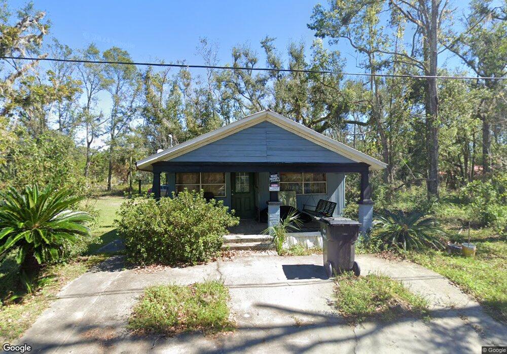
This home is located at 1606 Givens St, Perry, FL 32348 and is currently estimated at $80,608, approximately $85 per square foot. 1606 Givens St is a home located in Taylor County with nearby schools including Perry Primary School, Taylor County Elementary School, and Taylor County Middle School.
Ownership History
Date
Name
Owned For
Owner Type
Purchase Details
Closed on
Sep 15, 2023
Sold by
Miller Lucy and Mcneal Conrad
Bought by
Mcneal Phillip Colon
Current Estimated Value
Purchase Details
Closed on
Jun 22, 2010
Sold by
Clark Joe Louis and Clark Earlene
Bought by
Miller Lucy and Mcneal Conrad
Home Financials for this Owner
Home Financials are based on the most recent Mortgage that was taken out on this home.
Original Mortgage
$2,000
Interest Rate
4.83%
Mortgage Type
Seller Take Back
Create a Home Valuation Report for This Property
The Home Valuation Report is an in-depth analysis detailing your home's value as well as a comparison with similar homes in the area
Home Values in the Area
Average Home Value in this Area
Purchase History
| Date | Buyer | Sale Price | Title Company |
|---|---|---|---|
| Mcneal Phillip Colon | $100 | None Listed On Document | |
| Mcneal Phillip Colon | $100 | None Listed On Document | |
| Miller Lucy | $27,000 | Frith Abstract & Title Co |
Source: Public Records
Mortgage History
| Date | Status | Borrower | Loan Amount |
|---|---|---|---|
| Previous Owner | Miller Lucy | $2,000 |
Source: Public Records
Tax History
| Year | Tax Paid | Tax Assessment Tax Assessment Total Assessment is a certain percentage of the fair market value that is determined by local assessors to be the total taxable value of land and additions on the property. | Land | Improvement |
|---|---|---|---|---|
| 2025 | $289 | $40,240 | $4,200 | $36,040 |
| 2024 | $600 | $40,240 | $4,200 | $36,040 |
| 2023 | $600 | $28,440 | $0 | $0 |
| 2022 | $549 | $33,230 | $4,200 | $29,030 |
| 2021 | $497 | $26,960 | $4,200 | $22,760 |
| 2020 | $437 | $21,380 | $4,200 | $17,180 |
| 2019 | $440 | $21,400 | $4,200 | $17,200 |
| 2018 | $434 | $21,310 | $4,200 | $17,110 |
| 2017 | $439 | $20,340 | $4,200 | $16,140 |
| 2016 | $445 | $20,700 | $4,200 | $16,500 |
| 2015 | $429 | $20,700 | $4,200 | $16,500 |
| 2014 | -- | $22,132 | $0 | $0 |
Source: Public Records
Map
Nearby Homes
- 607 U S Highway 19
- 0 U S Highway 19 Unit 390248
- 0 U S Highway 19 Unit 795534
- 1100 S Wilder St
- 1124 S Orange St
- 1124 S Orange St Unit 2
- 1212 S Center St
- 202 Puckett Rd
- 914 W Malloy Ave
- 0 US Highway 27 Unit 796363
- 611 W Green St
- 205 Susan St
- 415 W Main St
- 27 Colorado Land and Grazing
- 219 Magnolia Rd
- 1118 W Green St
- 707 Puckett Rd
- 317 N Orange St
- Lots 1-3 N Jeff Davis Ave
- 517 Judson Dr
- 1601 S Woodward St
- 1605 S Woodward St
- 1526 Givens St
- 606 W Colson St
- 1613 S Woodward St
- 1611 Givens St
- 1614 Givens St
- 1519 S Woodard St
- 1615 Givens St
- 610 W Colson St
- 1520 Givens St
- 1517 S Woodard St
- 1517 S Woodard St
- 1612 S Woodward St
- 1612 S Woodard St
- 1617 S Woodward St
- 1519 S Campbell St
- 1515 S Woodard St
- 1622 S Woodard St
- 1514 S Bryant St