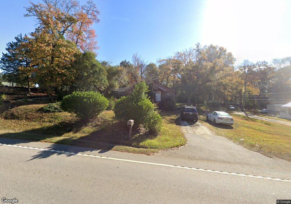
1606 Us Highway 29 West Point, GA 31833
Estimated Value: $88,413 - $143,000
3
Beds
1
Bath
1,468
Sq Ft
$78/Sq Ft
Est. Value
About This Home
This home is located at 1606 Us Highway 29, West Point, GA 31833 and is currently estimated at $113,853, approximately $77 per square foot. 1606 Us Highway 29 is a home with nearby schools including West Point Elementary School, Long Cane Elementary School, and Berta Weathersbee Elementary School.
Ownership History
Date
Name
Owned For
Owner Type
Purchase Details
Closed on
Jan 25, 2021
Sold by
Oleson Gregory Blair
Bought by
Brumfield Alyson P and Parker Sarah Michelle
Current Estimated Value
Home Financials for this Owner
Home Financials are based on the most recent Mortgage that was taken out on this home.
Original Mortgage
$37,500
Outstanding Balance
$34,547
Interest Rate
4.62%
Mortgage Type
New Conventional
Estimated Equity
$79,306
Purchase Details
Closed on
Jul 7, 1986
Sold by
Beall
Bought by
Oleson Gregory and Oleson Deborah G
Purchase Details
Closed on
Dec 7, 1979
Bought by
Beall
Purchase Details
Closed on
Aug 12, 1975
Purchase Details
Closed on
Jan 1, 1973
Purchase Details
Closed on
Jan 1, 1921
Create a Home Valuation Report for This Property
The Home Valuation Report is an in-depth analysis detailing your home's value as well as a comparison with similar homes in the area
Home Values in the Area
Average Home Value in this Area
Purchase History
| Date | Buyer | Sale Price | Title Company |
|---|---|---|---|
| Brumfield Alyson P | $50,000 | -- | |
| Oleson Gregory | $29,500 | -- | |
| Beall | -- | -- | |
| -- | -- | -- | |
| -- | -- | -- | |
| -- | -- | -- |
Source: Public Records
Mortgage History
| Date | Status | Borrower | Loan Amount |
|---|---|---|---|
| Open | Brumfield Alyson P | $37,500 |
Source: Public Records
Tax History Compared to Growth
Tax History
| Year | Tax Paid | Tax Assessment Tax Assessment Total Assessment is a certain percentage of the fair market value that is determined by local assessors to be the total taxable value of land and additions on the property. | Land | Improvement |
|---|---|---|---|---|
| 2024 | $1,217 | $34,400 | $1,880 | $32,520 |
| 2023 | $1,239 | $34,800 | $1,880 | $32,920 |
| 2022 | $558 | $33,200 | $1,880 | $31,320 |
| 2021 | $579 | $19,200 | $1,880 | $17,320 |
| 2020 | $462 | $15,320 | $1,880 | $13,440 |
| 2019 | $410 | $13,600 | $1,880 | $11,720 |
| 2018 | $428 | $14,200 | $1,680 | $12,520 |
| 2017 | $428 | $14,200 | $1,680 | $12,520 |
| 2016 | $378 | $12,519 | $1,680 | $10,839 |
| 2015 | $385 | $12,751 | $1,912 | $10,839 |
| 2014 | $369 | $12,180 | $1,912 | $10,268 |
| 2013 | -- | $13,046 | $1,912 | $11,134 |
Source: Public Records
Map
Nearby Homes
- 508 Pine St
- 1505 Wisteria Dr
- 1903 Ridgewood Dr
- 0 Ga Highway 0116 Unit 10619139
- 1008 E 12th St
- 0 Sunset Dr Unit 10451831
- 106 Sunset Dr
- 0 Arrowhead Dr Unit 10451860
- 713 Avenue H
- 1410 Roper Ave
- 1314 4th Ave
- 804 E 6th St
- 509 Cleveland St
- 311 E 4th St
- 712 4th Ave
- 210 N 14th St
- 8035 County Road 289
- 112 Hillcrest Rd
- 111 Tudor Way
- 404 Brookwood Dr
- 1604 Us Highway 29
- 1608 Us Highway 29
- 1610 Us Highway 29
- 1609 Us Highway 29
- 1603 Us Highway 29 Unit 284/5
- 1603 Us Highway 29 Unit 284/5
- 1603 Us Highway 29
- 1603 Us Highway 29
- 1603 Us Highway 29
- 1603 Us Highway 29
- 1603 Us Highway 29
- 1603 Us Highway 29
- 1603 Us Highway 29
- 1603 Us Highway 29
- 1603 Us Highway 29
- 1700 Malco Dr
- 406 Sheppard St
- 1702 Malco Dr
- 1704 Malco Dr
- 1602 Agate St