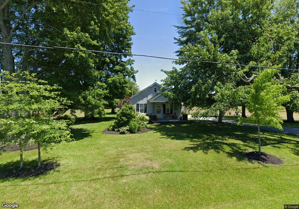
16062 Driver Collins Rd Mount Orab, OH 45154
Estimated Value: $142,000 - $238,000
3
Beds
1
Bath
1,388
Sq Ft
$132/Sq Ft
Est. Value
About This Home
This home is located at 16062 Driver Collins Rd, Mount Orab, OH 45154 and is currently estimated at $182,750, approximately $131 per square foot. 16062 Driver Collins Rd is a home located in Brown County with nearby schools including Western Brown High School.
Ownership History
Date
Name
Owned For
Owner Type
Purchase Details
Closed on
Mar 22, 2017
Sold by
Newberry Bethany
Bought by
Newberry Bethany
Current Estimated Value
Purchase Details
Closed on
Jul 7, 2008
Sold by
Hirons Thomas Joe and Hirons Sandy
Bought by
Newberry Bethany
Home Financials for this Owner
Home Financials are based on the most recent Mortgage that was taken out on this home.
Original Mortgage
$82,450
Outstanding Balance
$53,406
Interest Rate
6.15%
Mortgage Type
Purchase Money Mortgage
Estimated Equity
$129,344
Create a Home Valuation Report for This Property
The Home Valuation Report is an in-depth analysis detailing your home's value as well as a comparison with similar homes in the area
Home Values in the Area
Average Home Value in this Area
Purchase History
| Date | Buyer | Sale Price | Title Company |
|---|---|---|---|
| Newberry Bethany | -- | None Available | |
| Newberry Bethany | $85,000 | Attorney |
Source: Public Records
Mortgage History
| Date | Status | Borrower | Loan Amount |
|---|---|---|---|
| Open | Newberry Bethany | $82,450 |
Source: Public Records
Tax History Compared to Growth
Tax History
| Year | Tax Paid | Tax Assessment Tax Assessment Total Assessment is a certain percentage of the fair market value that is determined by local assessors to be the total taxable value of land and additions on the property. | Land | Improvement |
|---|---|---|---|---|
| 2024 | $893 | $31,840 | $3,330 | $28,510 |
| 2023 | $893 | $24,880 | $2,560 | $22,320 |
| 2022 | $744 | $24,880 | $2,560 | $22,320 |
| 2021 | $733 | $24,880 | $2,560 | $22,320 |
| 2020 | $658 | $21,640 | $2,230 | $19,410 |
| 2019 | $707 | $21,640 | $2,230 | $19,410 |
| 2018 | $701 | $21,640 | $2,230 | $19,410 |
| 2017 | $566 | $17,370 | $3,850 | $13,520 |
| 2016 | $566 | $17,370 | $3,850 | $13,520 |
| 2015 | $569 | $17,370 | $3,850 | $13,520 |
| 2014 | $569 | $17,020 | $3,500 | $13,520 |
| 2013 | $567 | $17,020 | $3,500 | $13,520 |
Source: Public Records
Map
Nearby Homes
- 15721 Brooks Malott Rd
- 15503 Crawford-Day Rd
- 15422 U S 68
- 0 Bardwell W Unit 1854344
- 0 Snider-Malott Rd
- 5092 County Highway 8-C
- 3447 Snider-Malott Rd
- 5176 E Greenbush Rd
- 3056 Hannah Dr
- 1 Bodman Rd
- 0 Lindsey Rd Unit 1819033
- 14663 Day Rd
- 0 State Route 32 Unit 1795308
- 3517 Bardwell Buford Rd
- 16285 Malady Rd
- 100 Robin Ave
- 15316 Bodman Rd
- 3498 Upper 5 Mile West Rd
- 204 Katelin Ln
- 505 Linda Way
- 16015 Driver Collins Rd
- 4315 Greenbush East Rd
- 4315 Greenbush Rd E
- 4087 Greenbush East Rd
- 4015 County Highway 8-C
- 4318 Greenbush East Rd
- 4318 Greenbush East Rd
- 4015 Greenbush East Rd
- 4354 Greenbush East Rd
- 4358 Greenbush East Rd
- 4358 Greenbush Rd E
- 3983 Greenbush Rd E
- 3983 Greenbush East Rd
- 4378 Greenbush East Rd
- 4378 Greenbush Rd E
- 0 Pleasant Hill Rd Unit 1564115
- 0 Commissioners Way Unit 1128872
- 2 Martinique Dr
- 10 E Kress Rd
- 9 E Kress Rd