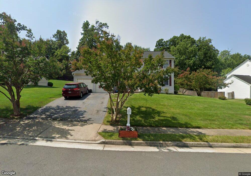
16069 Olmstead Ln Woodbridge, VA 22191
Estimated Value: $658,000 - $797,000
4
Beds
4
Baths
2,546
Sq Ft
$277/Sq Ft
Est. Value
About This Home
This home is located at 16069 Olmstead Ln, Woodbridge, VA 22191 and is currently estimated at $704,514, approximately $276 per square foot. 16069 Olmstead Ln is a home located in Prince William County with nearby schools including Leesylvania Elementary School, Potomac Middle School, and Potomac High School.
Ownership History
Date
Name
Owned For
Owner Type
Purchase Details
Closed on
May 17, 2005
Sold by
Mazhar Farid
Bought by
Allen Clinton
Current Estimated Value
Home Financials for this Owner
Home Financials are based on the most recent Mortgage that was taken out on this home.
Original Mortgage
$416,000
Outstanding Balance
$218,436
Interest Rate
5.95%
Mortgage Type
New Conventional
Estimated Equity
$486,078
Purchase Details
Closed on
Sep 30, 1999
Sold by
K Hovnanian At Pc Propert
Bought by
Lee Harvey R
Home Financials for this Owner
Home Financials are based on the most recent Mortgage that was taken out on this home.
Original Mortgage
$202,950
Interest Rate
8.18%
Mortgage Type
Purchase Money Mortgage
Create a Home Valuation Report for This Property
The Home Valuation Report is an in-depth analysis detailing your home's value as well as a comparison with similar homes in the area
Home Values in the Area
Average Home Value in this Area
Purchase History
| Date | Buyer | Sale Price | Title Company |
|---|---|---|---|
| Allen Clinton | $520,000 | -- | |
| Lee Harvey R | $199,000 | -- |
Source: Public Records
Mortgage History
| Date | Status | Borrower | Loan Amount |
|---|---|---|---|
| Open | Allen Clinton | $416,000 | |
| Previous Owner | Lee Harvey R | $202,950 |
Source: Public Records
Tax History Compared to Growth
Tax History
| Year | Tax Paid | Tax Assessment Tax Assessment Total Assessment is a certain percentage of the fair market value that is determined by local assessors to be the total taxable value of land and additions on the property. | Land | Improvement |
|---|---|---|---|---|
| 2025 | $5,815 | $649,700 | $251,700 | $398,000 |
| 2024 | $5,815 | $584,700 | $226,700 | $358,000 |
| 2023 | $5,945 | $571,400 | $220,100 | $351,300 |
| 2022 | $6,057 | $546,900 | $209,600 | $337,300 |
| 2021 | $5,615 | $459,800 | $176,200 | $283,600 |
| 2020 | $6,705 | $432,600 | $166,100 | $266,500 |
| 2019 | $7,040 | $454,200 | $174,800 | $279,400 |
| 2018 | $5,259 | $435,500 | $164,900 | $270,600 |
| 2017 | $5,175 | $419,800 | $158,500 | $261,300 |
| 2016 | $5,042 | $412,800 | $155,400 | $257,400 |
| 2015 | $4,633 | $417,800 | $157,000 | $260,800 |
| 2014 | $4,633 | $370,500 | $138,400 | $232,100 |
Source: Public Records
Map
Nearby Homes
- 16309 Sandy Ridge Ct
- 16068 Hayes Ln
- 16830 Tidewater Ct
- 2114 Jellico Ct
- 16660 Bolling Brook Ct
- 16363 Rusty Rudder Dr
- 2620 Cast Off Loop
- 16862 Reef Knot Way
- 2679 Cast Off Loop
- 2424 Five Fathom Cir
- 2119 Callao Ct
- 2433 Battery Hill Cir
- 15641 Horseshoe Ln Unit 641
- 15526 Chicacoan Dr
- 16559 Bramblewood Ln
- 16518 Bobster Ct
- 15417 Bald Eagle Ln
- 2610 Grayton Ln
- 15680 Avocet Loop
- 16249 Chase Eagle Ln
- 16067 Olmstead Ln
- 16073 Olmstead Ln
- 16065 Olmstead Ln
- 16070 Olmstead Ln
- 16068 Olmstead Ln
- 16075 Olmstead Ln
- 16074 Olmstead Ln
- 16066 Olmstead Ln
- 2140 Jennings St
- 2142 Jennings St
- 16063 Olmstead Ln
- 2138 Jennings St
- 16078 Olmstead Ln
- 16077 Olmstead Ln
- 2134 Jennings St
- 16064 Olmstead Ln
- 2144 Jennings St
- 16137 Kennedy St
- 2130 Jennings St
- 2146 Jennings St