Estimated Value: $420,000 - $477,000
5
Beds
3
Baths
2,016
Sq Ft
$224/Sq Ft
Est. Value
About This Home
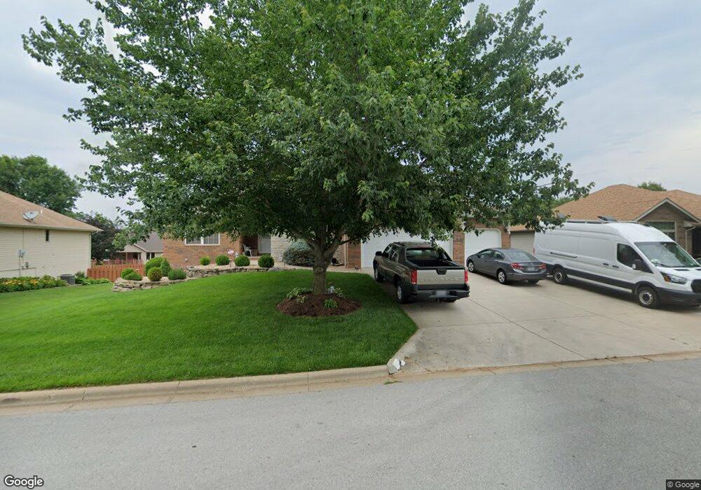
This home is located at 1607 E Barnes St, Ozark, MO 65721 and is currently estimated at $450,576, approximately $223 per square foot. 1607 E Barnes St is a home located in Christian County with nearby schools including East Elementary School, Ozark Junior High School, and Ozark Middle School.
Ownership History
Date
Name
Owned For
Owner Type
Purchase Details
Closed on
Apr 22, 2022
Sold by
William Paul White Trust
Bought by
Thuro Family Trust
Current Estimated Value
Purchase Details
Closed on
Aug 23, 2018
Sold by
White William Paul
Bought by
The William Paul White Family Trust
Purchase Details
Closed on
Aug 11, 2015
Sold by
Griffith Mary K
Bought by
Griffith Mary K and Mary K Griffith Family Triust
Purchase Details
Closed on
Jul 6, 2015
Sold by
The Raymond E Prickett And Woodie L Pric
Bought by
Griffith Mary K
Create a Home Valuation Report for This Property
The Home Valuation Report is an in-depth analysis detailing your home's value as well as a comparison with similar homes in the area
Home Values in the Area
Average Home Value in this Area
Purchase History
| Date | Buyer | Sale Price | Title Company |
|---|---|---|---|
| Thuro Family Trust | -- | Hogan Land Title | |
| The William Paul White Family Trust | -- | None Available | |
| White William Paul | -- | None Available | |
| Griffith Mary K | -- | None Available | |
| Griffith Mary K | -- | Great American Title |
Source: Public Records
Tax History
| Year | Tax Paid | Tax Assessment Tax Assessment Total Assessment is a certain percentage of the fair market value that is determined by local assessors to be the total taxable value of land and additions on the property. | Land | Improvement |
|---|---|---|---|---|
| 2025 | $3,264 | $55,920 | -- | -- |
| 2024 | $3,264 | $52,210 | -- | -- |
| 2023 | $3,264 | $52,210 | $0 | $0 |
| 2022 | $3,128 | $49,930 | $0 | $0 |
| 2021 | $3,028 | $49,930 | $0 | $0 |
| 2020 | $2,560 | $42,660 | $0 | $0 |
| 2019 | $2,560 | $42,660 | $0 | $0 |
| 2018 | $2,462 | $41,290 | $0 | $0 |
| 2017 | $2,462 | $41,290 | $0 | $0 |
| 2016 | $2,422 | $41,290 | $0 | $0 |
| 2015 | $2,422 | $41,290 | $41,290 | $0 |
| 2014 | $2,392 | $41,250 | $0 | $0 |
| 2013 | $23 | $41,250 | $0 | $0 |
| 2011 | $23 | $82,500 | $0 | $0 |
Source: Public Records
Map
Nearby Homes
- 1001 N 13th Ave
- 1611 E Hayloft Dr
- Tract 5 E Hawkins Ct
- 1003 E Parkview St
- 608 N 10th Ave
- Tract 4 E Country Crest Rd
- 1100 E Fieldstone Dr
- Tract 2 Country Crest Rd
- 709 E Bryant Ave
- 1100 E Robertson St
- 605 E Elm St
- 606 E Walnut St
- 605 E Oak St
- 604 N Lincoln Ct
- 5 W Jackson St
- 600 S 10th Ave
- 1003 E Lark St
- 1209 E Jay St
- 404 E Oak St
- 810 S 14th Ave
- 1607 E Barnes St
- 1609 E Barnes
- 1605 E Barnes St
- 1606 E Bingham St
- 1606 E Barnes St
- 1604 E Bingham St
- 1611 E Barnes St
- 1603 E Barnes St
- 1604 E Barnes
- 1608 E Barnes
- 1610 E Bingham St
- 1602 E Bingham St
- 1602 E Barnes
- 1610 E Barnes
- 1507 E Barnes
- 1703 E Barnes
- 1607 E Bingham St
- 1702 E Bingham St
- 1605 E Bingham St
- 1508 E Bingham St
Your Personal Tour Guide
Ask me questions while you tour the home.