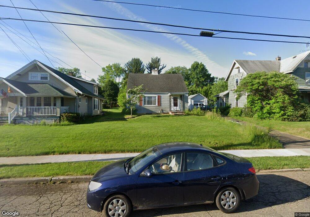
1607 Walnut Rd SW Massillon, OH 44647
Lawndale NeighborhoodEstimated Value: $131,000 - $164,000
3
Beds
2
Baths
1,512
Sq Ft
$94/Sq Ft
Est. Value
About This Home
This home is located at 1607 Walnut Rd SW, Massillon, OH 44647 and is currently estimated at $141,437, approximately $93 per square foot. 1607 Walnut Rd SW is a home located in Stark County with nearby schools including Massillon Intermediate School, Massillon Junior High School, and Washington High School.
Ownership History
Date
Name
Owned For
Owner Type
Purchase Details
Closed on
Aug 4, 2008
Sold by
Ralston Robert E
Bought by
Owens Mary Martha
Current Estimated Value
Home Financials for this Owner
Home Financials are based on the most recent Mortgage that was taken out on this home.
Original Mortgage
$70,875
Outstanding Balance
$46,926
Interest Rate
6.51%
Mortgage Type
FHA
Estimated Equity
$94,511
Create a Home Valuation Report for This Property
The Home Valuation Report is an in-depth analysis detailing your home's value as well as a comparison with similar homes in the area
Home Values in the Area
Average Home Value in this Area
Purchase History
| Date | Buyer | Sale Price | Title Company |
|---|---|---|---|
| Owens Mary Martha | $75,000 | Attorney |
Source: Public Records
Mortgage History
| Date | Status | Borrower | Loan Amount |
|---|---|---|---|
| Open | Owens Mary Martha | $70,875 |
Source: Public Records
Tax History Compared to Growth
Tax History
| Year | Tax Paid | Tax Assessment Tax Assessment Total Assessment is a certain percentage of the fair market value that is determined by local assessors to be the total taxable value of land and additions on the property. | Land | Improvement |
|---|---|---|---|---|
| 2025 | -- | $35,740 | $13,930 | $21,810 |
| 2024 | -- | $35,740 | $13,930 | $21,810 |
| 2023 | $1,371 | $35,950 | $11,170 | $24,780 |
| 2022 | $1,395 | $35,950 | $11,170 | $24,780 |
| 2021 | $1,418 | $35,950 | $11,170 | $24,780 |
| 2020 | $1,114 | $28,850 | $9,140 | $19,710 |
| 2019 | $1,099 | $28,860 | $9,140 | $19,720 |
| 2018 | $1,093 | $28,860 | $9,140 | $19,720 |
| 2017 | $900 | $24,200 | $6,860 | $17,340 |
| 2016 | $915 | $24,200 | $6,860 | $17,340 |
| 2015 | $903 | $24,200 | $6,860 | $17,340 |
| 2014 | $886 | $23,400 | $6,620 | $16,780 |
| 2013 | $447 | $23,400 | $6,620 | $16,780 |
Source: Public Records
Map
Nearby Homes
- 315 14th St SW
- 728 Hillside Place SW
- 101 14th St NW
- 309 15th St NW
- 1301 Lincoln Way NW
- 827 9th St SW
- 878 Liberty Ct SW
- 2488 Carlene Ave SW
- 50 26th St NW
- 123 26th St NW
- 718 Bebb Ave SW
- 517 Grosvenor Ave NW
- 540 Carver St NW
- 2527 Lincoln Way NW
- 504 5th St SW
- 533 Webb Ave SW
- 532 4th St SW
- 1104 4th St SW
- 1737 Leslie St NW
- 2790 Lee Ave NW
- 1601 Walnut Rd SW
- 1613 Walnut Rd SW
- 1541 Walnut Rd SW
- 1617 Walnut Rd SW
- 1537 Walnut Rd SW
- 1623 Walnut Rd SW
- 718 17th St SW
- 724 17th St SW
- 1533 Walnut Rd SW
- 1610 Walnut Rd SW
- 1606 Byron Ave SW
- 1610 Byron Ave SW
- 1600 Byron Ave SW
- 706 17th St SW
- 1600 Walnut Rd SW
- 730 17th St SW
- 1540 Byron Ave SW
- 1529 Walnut Rd SW
- 1629 Tremont Ave SW
- 1617 Tremont Ave SW