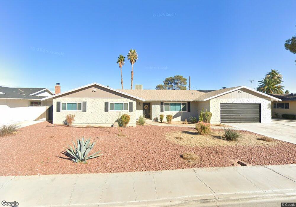
1608 Bluestone Dr Las Vegas, NV 89108
Twin Lakes NeighborhoodEstimated Value: $521,000 - $585,000
4
Beds
2
Baths
2,696
Sq Ft
$203/Sq Ft
Est. Value
About This Home
This home is located at 1608 Bluestone Dr, Las Vegas, NV 89108 and is currently estimated at $548,313, approximately $203 per square foot. 1608 Bluestone Dr is a home located in Clark County with nearby schools including Twin Lakes Elementary School, J. Harold Brinley Middle School, and Western High School.
Ownership History
Date
Name
Owned For
Owner Type
Purchase Details
Closed on
Sep 7, 2022
Sold by
Alan C Taylor And Delease Brown Family L
Bought by
Brown Taylor Revocable Trust
Current Estimated Value
Purchase Details
Closed on
Mar 30, 2022
Sold by
Taylor And Brown Family Trust
Bought by
Brown Taylor Revocable Trust
Purchase Details
Closed on
Nov 15, 2021
Sold by
Taylor Alan C and Brown Delease
Bought by
Taylor Alan C and Brown Delease
Home Financials for this Owner
Home Financials are based on the most recent Mortgage that was taken out on this home.
Original Mortgage
$286,000
Interest Rate
3.09%
Mortgage Type
New Conventional
Purchase Details
Closed on
Sep 8, 2020
Sold by
Taylor Alan C
Bought by
Taylor Alan C and Brown Delease
Purchase Details
Closed on
Jun 25, 2020
Sold by
Brown Delease
Bought by
Taylor Alan C
Home Financials for this Owner
Home Financials are based on the most recent Mortgage that was taken out on this home.
Original Mortgage
$289,000
Interest Rate
3.2%
Mortgage Type
New Conventional
Purchase Details
Closed on
Nov 15, 2018
Sold by
Brown Delease
Bought by
Taylor Alan Craig
Home Financials for this Owner
Home Financials are based on the most recent Mortgage that was taken out on this home.
Original Mortgage
$250,000
Interest Rate
4.8%
Mortgage Type
New Conventional
Purchase Details
Closed on
Nov 30, 2017
Sold by
Taylor Alan C
Bought by
Taylor Alan C and Brown Delease
Purchase Details
Closed on
Mar 26, 2015
Sold by
The Doris Anderson Family Trust
Bought by
Taylor Alan Craig
Purchase Details
Closed on
Aug 5, 2011
Sold by
Anderson Doris T
Bought by
Anderson Doris Taylor and The Doris Anderson Family Trust
Purchase Details
Closed on
Apr 23, 2005
Sold by
Anderson Doris N and Taylor Alan C
Bought by
Anderson Doris
Home Financials for this Owner
Home Financials are based on the most recent Mortgage that was taken out on this home.
Original Mortgage
$188,000
Interest Rate
5.87%
Mortgage Type
Unknown
Purchase Details
Closed on
Feb 17, 2003
Sold by
Anderson Doris N
Bought by
Anderson Doris N and Taylor Alan C
Create a Home Valuation Report for This Property
The Home Valuation Report is an in-depth analysis detailing your home's value as well as a comparison with similar homes in the area
Home Values in the Area
Average Home Value in this Area
Purchase History
| Date | Buyer | Sale Price | Title Company |
|---|---|---|---|
| Brown Taylor Revocable Trust | -- | -- | |
| Brown Taylor Revocable Trust | -- | None Listed On Document | |
| Taylor Alan C | -- | Old Republic Title | |
| Taylor Alan C | -- | None Available | |
| Taylor Alan C | -- | Stewart Title Guaranty Co | |
| Taylor Alan C | -- | Stewart Title Guaranty Co | |
| Taylor Alan Craig | -- | Old Republic Title | |
| Taylor Alan C | -- | None Available | |
| Taylor Alan Craig | -- | None Available | |
| Anderson Doris Taylor | -- | None Available | |
| Anderson Doris | -- | -- | |
| Anderson Doris N | -- | -- |
Source: Public Records
Mortgage History
| Date | Status | Borrower | Loan Amount |
|---|---|---|---|
| Previous Owner | Taylor Alan C | $286,000 | |
| Previous Owner | Taylor Alan C | $289,000 | |
| Previous Owner | Taylor Alan Craig | $250,000 | |
| Previous Owner | Anderson Doris | $188,000 |
Source: Public Records
Tax History Compared to Growth
Tax History
| Year | Tax Paid | Tax Assessment Tax Assessment Total Assessment is a certain percentage of the fair market value that is determined by local assessors to be the total taxable value of land and additions on the property. | Land | Improvement |
|---|---|---|---|---|
| 2025 | $1,749 | $81,719 | $37,100 | $44,619 |
| 2024 | $1,698 | $81,719 | $37,100 | $44,619 |
| 2023 | $1,325 | $79,657 | $39,550 | $40,107 |
| 2022 | $1,649 | $75,467 | $39,550 | $35,917 |
| 2021 | $1,601 | $70,075 | $34,650 | $35,425 |
| 2020 | $1,484 | $66,838 | $30,450 | $36,388 |
| 2019 | $1,440 | $64,490 | $27,650 | $36,840 |
| 2018 | $1,398 | $59,639 | $23,100 | $36,539 |
| 2017 | $2,007 | $61,220 | $23,100 | $38,120 |
| 2016 | $1,325 | $58,076 | $18,200 | $39,876 |
| 2015 | $1,322 | $54,643 | $14,350 | $40,293 |
| 2014 | -- | $37,974 | $9,800 | $28,174 |
Source: Public Records
Map
Nearby Homes
- 4228 Gaye Ln
- 1732 Yellow Rose St
- 4406 Parkchester Cir
- 1885 Valley Dr
- 1817 Ann Greta Dr
- 1825 Stonehaven Dr
- 1825 Ann Greta Dr
- 1300 Oak Tree Ln
- 3616 Roseglen Ct
- 1912 Parkchester Dr
- 3871 Mountain Trail
- 1920 Parkchester Dr
- 1832 N Decatur Blvd Unit 104
- 1802 N Decatur Blvd Unit 203
- 1824 N Decatur Blvd Unit 101
- 1836 N Decatur Blvd Unit 203
- 1858 N Decatur Blvd Unit 204
- 1842 N Decatur Blvd Unit 101
- 4200 Coran Ln
- 1325 Pyramid Dr
- 1612 Bluestone Dr
- 1604 Bluestone Dr
- 4221 Flame Cir
- 4220 Stonebridge Ln
- 1613 Bluestone Dr
- 1616 Bluestone Dr
- 1609 Bluestone Dr
- 1617 Bluestone Dr
- 4220 Flame Cir
- 4217 Flame Cir
- 4216 Stonebridge Ln
- 4225 Stonebridge Ln
- 1621 Bluestone Dr
- 1620 Bluestone Dr
- 1605 Bluestone Dr
- 4216 Flame Cir
- 4229 Stonebridge Ln
- 4229 Stonebridge Ln Unit n/a
- 100 Casa Grande Dr
- 4221 Stonebridge Ln