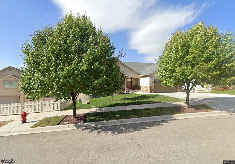
1608 S 790 W Payson, UT 84651
Estimated Value: $577,000 - $681,000
5
Beds
3
Baths
2,936
Sq Ft
$212/Sq Ft
Est. Value
About This Home
This home is located at 1608 S 790 W, Payson, UT 84651 and is currently estimated at $622,010, approximately $211 per square foot. 1608 S 790 W is a home located in Utah County with nearby schools including Spring Lake Elementary, Payson Junior High School, and Payson High School.
Ownership History
Date
Name
Owned For
Owner Type
Purchase Details
Closed on
Aug 14, 2024
Sold by
Mitchell Mark and Mitchell Alyssa
Bought by
Bringhurst Benjamin R and Bringhurst Rachel N
Current Estimated Value
Home Financials for this Owner
Home Financials are based on the most recent Mortgage that was taken out on this home.
Original Mortgage
$441,000
Outstanding Balance
$436,086
Interest Rate
6.95%
Mortgage Type
New Conventional
Estimated Equity
$185,924
Purchase Details
Closed on
Sep 7, 2021
Sold by
Morgan Christopher W and Morgan Emma L
Bought by
Mitchell Mark and Mitchell Alyssa
Home Financials for this Owner
Home Financials are based on the most recent Mortgage that was taken out on this home.
Original Mortgage
$380,000
Interest Rate
2.7%
Mortgage Type
New Conventional
Purchase Details
Closed on
May 21, 2020
Sold by
Morgan William and Morgan Beverly
Bought by
Morgan Christopher W and Morgan Emma L
Home Financials for this Owner
Home Financials are based on the most recent Mortgage that was taken out on this home.
Original Mortgage
$329,173
Interest Rate
3.3%
Mortgage Type
New Conventional
Purchase Details
Closed on
Apr 9, 2020
Sold by
Morgan William
Bought by
Morgan William and Morgan Beverly
Home Financials for this Owner
Home Financials are based on the most recent Mortgage that was taken out on this home.
Original Mortgage
$329,173
Interest Rate
3.3%
Mortgage Type
New Conventional
Purchase Details
Closed on
Oct 29, 2014
Sold by
Dawe Anthony Gordon
Bought by
Dawe Anthony Gordon and Dawe Ann E
Home Financials for this Owner
Home Financials are based on the most recent Mortgage that was taken out on this home.
Original Mortgage
$167,000
Interest Rate
4.2%
Mortgage Type
New Conventional
Purchase Details
Closed on
Oct 4, 2013
Sold by
Michael L Robinson Properties Lc
Bought by
Dawe Antony Gordon
Purchase Details
Closed on
Sep 2, 2005
Sold by
Rdjs Development Llc
Bought by
Michael L Robinson Properties Lc
Create a Home Valuation Report for This Property
The Home Valuation Report is an in-depth analysis detailing your home's value as well as a comparison with similar homes in the area
Home Values in the Area
Average Home Value in this Area
Purchase History
| Date | Buyer | Sale Price | Title Company |
|---|---|---|---|
| Bringhurst Benjamin R | -- | First American Title Insurance | |
| Mitchell Mark | -- | Stewart Title Ins Agcy Inc | |
| Morgan Christopher W | -- | Utah First Title Insurance A | |
| Morgan William | -- | None Available | |
| Dawe Anthony Gordon | -- | Pro Title & Escrow Inc | |
| Dawe Antony Gordon | -- | North American Title | |
| Michael L Robinson Properties Lc | -- | Mountain West Title Company |
Source: Public Records
Mortgage History
| Date | Status | Borrower | Loan Amount |
|---|---|---|---|
| Open | Bringhurst Benjamin R | $441,000 | |
| Previous Owner | Mitchell Mark | $380,000 | |
| Previous Owner | Morgan Christopher W | $329,173 | |
| Previous Owner | Dawe Anthony Gordon | $167,000 |
Source: Public Records
Tax History
| Year | Tax Paid | Tax Assessment Tax Assessment Total Assessment is a certain percentage of the fair market value that is determined by local assessors to be the total taxable value of land and additions on the property. | Land | Improvement |
|---|---|---|---|---|
| 2025 | $2,479 | $298,320 | -- | -- |
| 2024 | $2,479 | $252,340 | $0 | $0 |
| 2023 | $2,519 | $257,070 | $0 | $0 |
| 2022 | $2,537 | $254,650 | $0 | $0 |
| 2021 | $2,149 | $345,900 | $109,600 | $236,300 |
| 2020 | $2,037 | $320,900 | $99,600 | $221,300 |
| 2019 | $1,881 | $303,700 | $82,400 | $221,300 |
| 2018 | $1,700 | $264,500 | $72,100 | $192,400 |
| 2017 | $1,624 | $135,905 | $0 | $0 |
| 2016 | $1,511 | $125,675 | $0 | $0 |
| 2015 | $1,412 | $116,600 | $0 | $0 |
| 2014 | $578 | $48,100 | $0 | $0 |
Source: Public Records
Map
Nearby Homes
- 1631 S Highway 198
- 1468 S 910 W
- 802 Brookside Ct
- 609 W Saddlebrook Dr
- 613 W Saddlebrook Dr
- 1605 S 1100 W
- 588 W 1450 S
- 1763 S 1100 W Unit 14
- 1848 S 410 W
- 1320 S 950 W
- 1835 S 410 W
- 1338 S 1050 W
- 32 E 1690 S Unit 113
- 245 W 1770 S
- 211 W 1800 S
- 1116 W 1290 S
- 1172 S 880 W
- 1652 S 240 W Unit 48
- 1632 S 240 W Unit 47
- 347 W 1380 S
- 1608 S 790 W Unit 304
- 1602 S 790 W Unit 304
- 808 W 1620 S
- 1607 S 840 W
- 1613 S 840 W
- 1598 S 790 W
- 1601 S 840 W
- 1601 S 840 W Unit 313
- 824 W 1620 S
- 1607 S 790 W
- 1607 S 790 W Unit 298
- 1601 S 790 W
- 1601 S 790 W Unit 297
- 1619 S 790 W
- 1595 S 840 W
- 1595 S 840 W Unit 312
- 1595 S 790 W
- 809 W 1620 S
- 793 W 1620 S
- 793 W 1620 S Unit 300
Your Personal Tour Guide
Ask me questions while you tour the home.