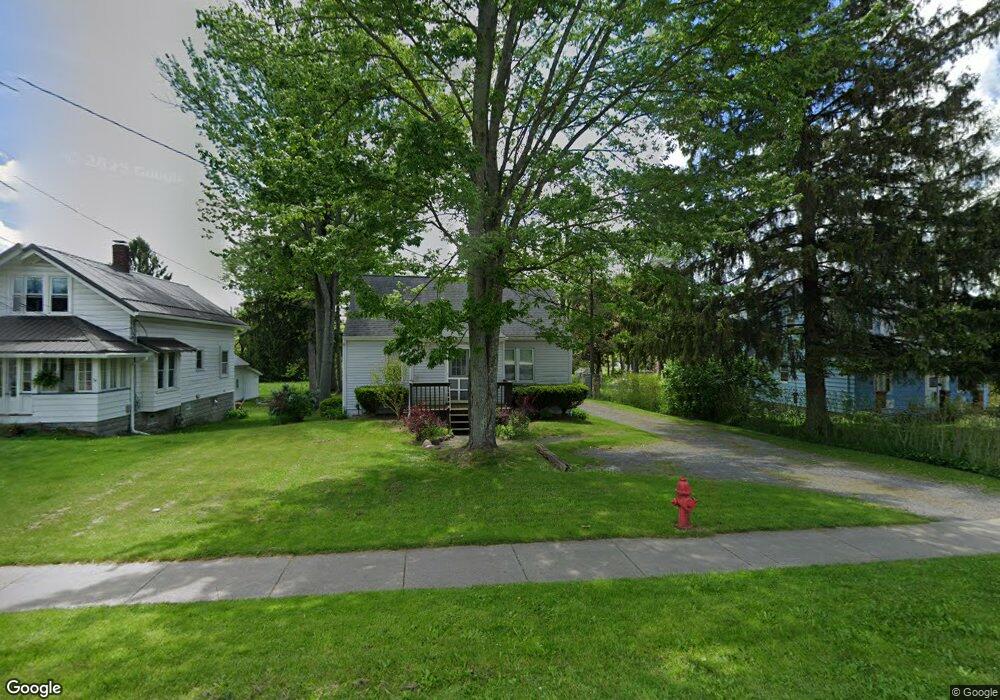
16081 E High St Middlefield, OH 44062
Estimated Value: $161,000 - $251,000
4
Beds
1
Bath
1,280
Sq Ft
$150/Sq Ft
Est. Value
About This Home
This home is located at 16081 E High St, Middlefield, OH 44062 and is currently estimated at $191,666, approximately $149 per square foot. 16081 E High St is a home located in Geauga County with nearby schools including Jordak Elementary School, Cardinal Middle School, and Cardinal High School.
Ownership History
Date
Name
Owned For
Owner Type
Purchase Details
Closed on
Oct 30, 2023
Sold by
Mac Five Llc
Bought by
Mighton Aaron
Current Estimated Value
Home Financials for this Owner
Home Financials are based on the most recent Mortgage that was taken out on this home.
Original Mortgage
$135,000
Outstanding Balance
$132,011
Interest Rate
7.19%
Mortgage Type
New Conventional
Estimated Equity
$59,655
Purchase Details
Closed on
Jan 1, 1990
Bought by
Husman Keith
Create a Home Valuation Report for This Property
The Home Valuation Report is an in-depth analysis detailing your home's value as well as a comparison with similar homes in the area
Home Values in the Area
Average Home Value in this Area
Purchase History
| Date | Buyer | Sale Price | Title Company |
|---|---|---|---|
| Mighton Aaron | -- | None Listed On Document | |
| Husman Keith | -- | -- |
Source: Public Records
Mortgage History
| Date | Status | Borrower | Loan Amount |
|---|---|---|---|
| Open | Mighton Aaron | $135,000 |
Source: Public Records
Tax History
| Year | Tax Paid | Tax Assessment Tax Assessment Total Assessment is a certain percentage of the fair market value that is determined by local assessors to be the total taxable value of land and additions on the property. | Land | Improvement |
|---|---|---|---|---|
| 2024 | $1,366 | $34,230 | $10,500 | $23,730 |
| 2023 | $1,343 | $34,230 | $10,500 | $23,730 |
| 2022 | $1,284 | $27,020 | $8,750 | $18,270 |
| 2021 | $1,286 | $27,020 | $8,750 | $18,270 |
| 2020 | $1,328 | $27,020 | $8,750 | $18,270 |
| 2019 | $1,303 | $24,500 | $8,750 | $15,750 |
| 2018 | $651 | $24,500 | $8,750 | $15,750 |
| 2017 | $1,303 | $24,500 | $8,750 | $15,750 |
| 2016 | $1,185 | $25,450 | $8,750 | $16,700 |
| 2015 | $1,061 | $25,450 | $8,750 | $16,700 |
| 2014 | $1,061 | $25,450 | $8,750 | $16,700 |
| 2013 | $1,050 | $25,450 | $8,750 | $16,700 |
Source: Public Records
Map
Nearby Homes
- 16008 Button St
- 14706 Steeplechase Dr
- 15868 Kenwood Dr
- 16298 Weathervane Dr
- 15648 Elmwood St
- 15660 Georgia Rd
- 15100 Timber Ridge Dr
- 15229 Timber Ridge Dr
- V/L High Pointe Cir
- 15142 Sawgrass Ln
- 15243 Woodsong Dr
- 15143 Woodsong Dr
- 15791 Madison Rd
- 16310 Madison Rd
- 15720 Jug Rd
- 13105 Madison Rd
- 16765 Old State Rd
- 13137 Old State Rd
- 13888 Goodwin St
- 8070 Parkman Mesopotamia Rd
- 16085 E High St
- 16073 E High St
- 16067 E High St
- 16095 E High St
- 14964 Rainbow Dr
- 16074 E High St
- 16061 E High St
- 16061 E High St
- 16068 E High St
- 16060 E High St
- 16107 E High St
- 16051 E High St
- 14959 Thompson Ave
- 16054 E High St
- 16112 E High St
- 14967 Thompson Ave
- 16054/1605 E High St
- 16052 E High St Unit down
- 16052 E High St
- 14973 Thompson Ave
Your Personal Tour Guide
Ask me questions while you tour the home.