NOT LISTED FOR SALE

16084 S Highway 265 West Fork, AR 72774

Estimated Value: $284,294

16 Acres
$17,549 Price per Acre
705,672 Sq Ft Lot

Last Sold January 22, 2019

Last sale price $58,000 $30 Per Sq Ft

Est. 390% increase in value since last sale

Current estimated payment $1,613/month

173 Days on Market

Highlights

  • Home fronts a creek
  • Creek or Stream
  • Partially Fenced Property
  • Partially Wooded Lot

About This Lot

As of January 2019

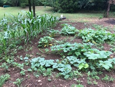
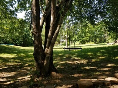
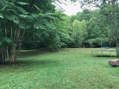
16.2 acres partially cleared on paved highway. Minutes from town. Water & electric on property w/existing septic - Also perk test available for second building site. $500.00 due with accepted offer escrow.

Last Agent to Sell the Property

Dave Layman

The Griffin Company Commercial Division-Springdale License #EB78825-D01 Listed on: 07/02/2018

Last Buyer's Agent

Susan Nemec

Coldwell Banker Harris McHaney & Faucette-Rogers License #SA00081067

Property Details

Property Type

  • Land

Est. Annual Taxes

  • $416

Lot Details

  • 16.2 Acre Lot
  • Home fronts a creek
  • Property fronts a highway
  • Creek or Stream
  • Rural Setting
  • Partially Fenced Property
  • Wire Fence
  • Sloped Lot
  • Partially Wooded Lot
  • Landscaped with Trees

Home Design

  • Mixed Use

Location

  • Outside City Limits

Utilities

  • Propane
  • Septic Tank

Property Details

Property Type

Land

Est. Annual Taxes

$416

Lot Details

0

Listing Details

  • Property Sub Type: Mixed Use
  • Prop. Type: Land
  • Lot Size Acres: 16.2
  • Road Frontage Type: Highway, Main Thoroughfare, Public Road
  • Road Surface Type: Paved
  • Subdivision Name: N/A
  • Directions: I-49 S to West Fork exit, right on 170, then right on Hwy 156. 4.3 miles to Hogeye. South on Hwy 265 4.2 miles to property on left.
  • ResoPropertyType: Land
  • Property Sub Type Additional: Mixed Use
  • Special Features: None

Interior Features

  • Possible Use: Agricultural, Recreational, Residential

Exterior Features

  • Fencing: Partial, Wire
  • Lot Features: Hardwood Trees, None, Outside City Limits, Rural Lot, Sloped, Wooded, Stream/Creek
  • Topography: Sloping
  • Waterfront Features: Creek
  • Disclosures: Flood Plain Disclosure

Utilities

  • Sewer: Septic Tank
  • Utilities: Propane
  • Water Source: Public

Schools

  • Junior High Dist: West Fork

Lot Info

  • Zoning: N
  • ResoLotSizeUnits: Acres

Tax Info

  • Tax Annual Amount: 74.0
  • Tax Block: .
  • Tax Lot: .

Ownership History

Date Name Owned For Owner Type

Purchase Details

Closed on
Oct 23, 2020
Sold by
Riverside Estates Of Goshen Llc
Bought by
Teaster Kenneth and Mccorkindale Amanda
Total Days on Market
173
Current Estimated Value
$284,294

Purchase Details

Listed on
Jul 2, 2018
Closed on
Dec 10, 2018
Sold by
Crane Logan D and Crane Julia M
Bought by
Grgogan Mark
Seller's Agent
Dave Layman
The Griffin Company Commercial Division-Springdale
Buyer's Agent
Susan Nemec
Coldwell Banker Harris McHaney & Faucette-Rogers
List Price
$99,000
Sold Price
$58,000
Premium/Discount to List
-$41,000
-41.41%

Home Financials for this Owner

Home Financials are based on the most recent Mortgage that was taken out on this home.
Avg. Annual Appreciation
23.84%

Purchase Details

Listed on
Apr 15, 2016
Closed on
Jun 15, 2017
Sold by
Skelton Ingles Susan D Boothe
Bought by
Crane Logan D and Crane Julia M
Seller's Agent
Dave Layman
Mathias Real Estate
Buyer's Agent
Dave Layman
The Griffin Company Commercial Division-Springdale
List Price
$59,500
Sold Price
$45,000
Premium/Discount to List
-$14,500
-24.37%

Home Financials for this Owner

Home Financials are based on the most recent Mortgage that was taken out on this home.
Avg. Annual Appreciation
17.07%

Purchase Details

Listed on
Apr 15, 2016
Closed on
Jun 7, 2017
Sold by
Boothe Christopher Lee and Boothe Melissa
Bought by
Sketon Inges Susan D Boothe
Seller's Agent
Dave Layman
Mathias Real Estate
Buyer's Agent
Dave Layman
The Griffin Company Commercial Division-Springdale
List Price
$59,500
Sold Price
$45,000
Premium/Discount to List
-$14,500
-24.37%

Purchase Details

Closed on
Nov 12, 2007
Sold by
Boothe Christopher Lee and Boothe Paula M
Bought by
Skelton Ingles Susan D Boothe

Purchase Details

Closed on
Mar 14, 2005
Sold by
Skelton Ingles Susan D Boothe
Bought by
Boothe Christopher L and Boothe Paula M

Purchase Details

Closed on
Sep 30, 1994
Bought by
Boothe Susan D

Purchase Details

Closed on
May 12, 1994
Bought by
Glezen William and Glezen Sylvia

Purchase Details

Closed on
Mar 12, 1988
Bought by
Boothe Susan D

Purchase Details

Closed on
Jan 1, 1985
Bought by
Mcnaughton Donald M and Mcnaughton Terry L
Source: Public Records

Similar Property in West Fork, AR

  • 13.32 acres Delgado Rd, West Fork, AR 72774

    $270,000

    • Land
    • 13 Acres
    • $20,270 per Acre
    • 13.32 acres Delgado Rd
    • West Fork, AR

    15 miles south of the University of Arkansas, 13+/- acres with incredible mountain top views! You can enjoy nature, peace and privacy in the Boston Mountains without sacrificing reasonable commute times. Multiple building sites w/soil test, notable outcroppings, beautiful native stone, and abundant wildlife. 19 miles to Devil's Den State Park. 17 miles to Lake Fork Smith State Park. Only 2 miles

    Angela Thompson Fathom Realty

    Section Image

Range of Values:

Collateral Analytics

Collateral Analytics Collateral Analytics AVMs (Automated Valuation Model) employ a number of statistical approaches combined with neighborhood-specific comparable selection guarantees the most up-to-date and precise valuations.

Not Available

Collateral Analytics does not have data for the current month. Please view the chart for historical values.

ICE

ICE Mortgage Technology ICE Mortgage Technology’s AVM (Automated Valuation Model) is a state-of-the-art online residential property valuation tool that provides a quick and accurate estimate of the value of almost any home in the U.S.

Not Available

ICE Mortgage Technology does not have data for the current month. Please view the chart for historical values.

First American

First American First American Data & Analytics’ next-generation AVM combines unrivaled data assets with a blended ensemble of valuation models to produce highly accurate, reliable valuations you can trust.

Not Available

First American does not have data for the current month. Please view the chart for historical values.

Quantarium

Quantarium Quantarium’s valuation service, repeatedly proven the industry’s most accurate and comprehensive, is supercharged with a self-learning and auto-tuning AI engine that continually becomes smarter and more accurate as it processes daily inputs from the industry’s leading RE data lake.

Not Available

Quantarium does not have data for the current month. Please view the chart for historical values.

Average Value
Not Available
List Price
Sold Price
Create a Home Valuation Report for This Property
The Home Valuation Report is an in-depth analysis detailing your home's value as well as a comparison with similar homes in the area

Home Values in the Area

Source: Public Records

Average Home Value in this Area


Source: Public Records

Purchase History

Date Buyer Sale Price Title Company
Teaster Kenneth $85,000 Realty Title & Closing Servi
Grgogan Mark $58,000 Lenders Title Co
Crane Logan D $45,000 Advantage Title & Escrow
Sketon Inges Susan D Boothe -- Advantage Title & Escrow
Skelton Ingles Susan D Boothe -- None Available
Boothe Christopher L -- --
Boothe Susan D -- --
Glezen William -- --
Boothe Susan D -- --
Mcnaughton Donald M -- --
Source: Public Records

Mortgage History

Date Status Borrower Loan Amount
Previous Owner Boothe Christopher $20,284
Source: Public Records

Property History

Date Event Price Change Sq Ft Price
01/22/2019 01/22/19 Sold $58,000 -41.4% $30 / Sq Ft
12/23/2018 12/23/18 Pending -- -- --
07/02/2018 07/02/18 For Sale $99,000 +120.0% $51 / Sq Ft
06/15/2017 06/15/17 Sold $45,000 -24.4% $23 / Sq Ft
05/16/2017 05/16/17 Pending -- -- --
04/15/2016 04/15/16 For Sale $59,500 -- $31 / Sq Ft
Source: Northwest Arkansas Board of REALTORS®

Tax History Compared to Growth

Source: Public Records

Tax History

Year Tax Paid Tax Assessment Tax Assessment Total Assessment is a certain percentage of the fair market value that is determined by local assessors to be the total taxable value of land and additions on the property. Land Improvement
2024 $416 $31,100 $9,310 $21,790
2023 $454 $31,100 $9,310 $21,790
2022 $515 $17,410 $2,810 $14,600
2021 $515 $17,410 $2,810 $14,600
2020 $445 $9,390 $2,810 $6,580
2019 $410 $7,420 $2,350 $5,070
2018 $74 $7,420 $2,350 $5,070
2017 $346 $7,420 $2,350 $5,070
2016 $383 $7,420 $2,350 $5,070
2015 $355 $7,420 $2,350 $5,070
2014 $328 $5,900 $2,170 $3,730
Source: Public Records

Agents Affiliated with this Home

See All Agents

Map

Source: Northwest Arkansas Board of REALTORS®

MLS Number: 1084166

Northwest Arkansas Board of REALTORS®

APN: 412-01961-000