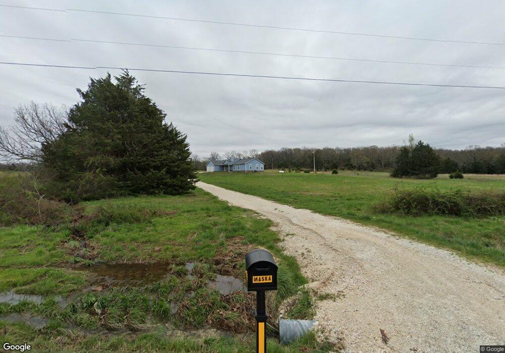
16087 Malico Mountain Rd West Fork, AR 72774
Estimated Value: $427,000 - $760,574
Studio
2
Baths
800
Sq Ft
$668/Sq Ft
Est. Value
About This Home
This home is located at 16087 Malico Mountain Rd, West Fork, AR 72774 and is currently estimated at $534,394, approximately $667 per square foot. 16087 Malico Mountain Rd is a home located in Washington County with nearby schools including West Fork Elementary School, West Fork Middle School, and West Fork High School.
Ownership History
Date
Name
Owned For
Owner Type
Purchase Details
Closed on
Sep 30, 2021
Sold by
Maska Steven R and Maska Dianne M
Bought by
Maska Timothy and Maska Hannah
Current Estimated Value
Home Financials for this Owner
Home Financials are based on the most recent Mortgage that was taken out on this home.
Original Mortgage
$284,800
Interest Rate
2.8%
Mortgage Type
Construction
Purchase Details
Closed on
Nov 1, 2011
Sold by
Kordsmeier Eugene and Kordsmeier Debbie
Bought by
Maska Steven R and Maska Dianne M
Home Financials for this Owner
Home Financials are based on the most recent Mortgage that was taken out on this home.
Original Mortgage
$140,800
Interest Rate
4.13%
Mortgage Type
Purchase Money Mortgage
Purchase Details
Closed on
Jan 1, 1985
Bought by
Ramey Ben L
Create a Home Valuation Report for This Property
The Home Valuation Report is an in-depth analysis detailing your home's value as well as a comparison with similar homes in the area
Purchase History
| Date | Buyer | Sale Price | Title Company |
|---|---|---|---|
| Maska Timothy | -- | None Listed On Document | |
| Maska Steven R | $180,000 | Lenders Title Company | |
| Ramey Ben L | -- | -- |
Source: Public Records
Mortgage History
| Date | Status | Borrower | Loan Amount |
|---|---|---|---|
| Closed | Maska Timothy | $284,800 | |
| Previous Owner | Maska Steven R | $140,800 |
Source: Public Records
Tax History
| Year | Tax Paid | Tax Assessment Tax Assessment Total Assessment is a certain percentage of the fair market value that is determined by local assessors to be the total taxable value of land and additions on the property. | Land | Improvement |
|---|---|---|---|---|
| 2025 | $1,842 | $77,930 | $10,380 | $67,550 |
| 2024 | $1,844 | $77,930 | $10,380 | $67,550 |
| 2023 | $1,830 | $77,930 | $10,380 | $67,550 |
| 2022 | $1,889 | $49,600 | $3,870 | $45,730 |
| 2021 | $1,803 | $49,740 | $4,010 | $45,730 |
| 2020 | $1,724 | $49,740 | $4,010 | $45,730 |
| 2019 | $1,648 | $39,910 | $3,480 | $36,430 |
| 2018 | $1,673 | $39,910 | $3,480 | $36,430 |
| 2017 | $187 | $40,030 | $3,600 | $36,430 |
| 2016 | $1,919 | $5,980 | $3,600 | $2,380 |
| 2015 | $332 | $5,980 | $3,600 | $2,380 |
| 2014 | $323 | $5,780 | $3,280 | $2,500 |
Source: Public Records
Map
Nearby Homes
- 00 Hubbard Rd
- 14682 Director Rd
- 15337 Stagecoach Rd
- 16977 Holcombe School Rd
- 16891 Holcombe School Rd
- 16175 Cove Creek N
- 16175 N Cove Creek Wc 21 Rd
- 16380 Cove Creek Rd N
- 14774 Cove Creek Rd N
- tbd Lot 2 N Cove Creek Wc 21 Rd
- 18403 S Highway 170
- 14753 Cove Creek Rd N
- tbd Lot 3 N Cove Creek Wc 21 Rd
- TBD Zinnamon Church Rd
- 18544 Bug Scuffle Rd
- TBD Blue Mountain Rd
- 14516 Friendship Church Rd
- 14931 Friendship Church Rd
- 000 Union Star Rd
- 14463 Friendship Church Rd
- 16252 Malico Mountain Rd
- 16092 Malico Mountain Rd
- 16412 Malico Mountain Rd
- 16512 Malico Mountain Rd
- 16030 Malico Mountain Rd
- 16091 Malico Mountain Rd
- 16508 Malico Mountain Rd
- Lota Onda Mtn Rd (Cr213)
- Lotb Onda Mtn Rd (Cr213)
- 16774 Malico Mountain Rd
- 16565 Malico Mountain Rd
- 16238 Onda Mountain Rd
- 16248 Onda Mountain Rd
- 0 Malico Mountain
- tbd Malico Mountain Rd
- 13358 Durango Rd
- 0 Malico Mountain Rd
- 14770 Malico Mountain Rd
- 55Ac Malico Mountain Rd
- 0 County Road 29
Your Personal Tour Guide
Ask me questions while you tour the home.