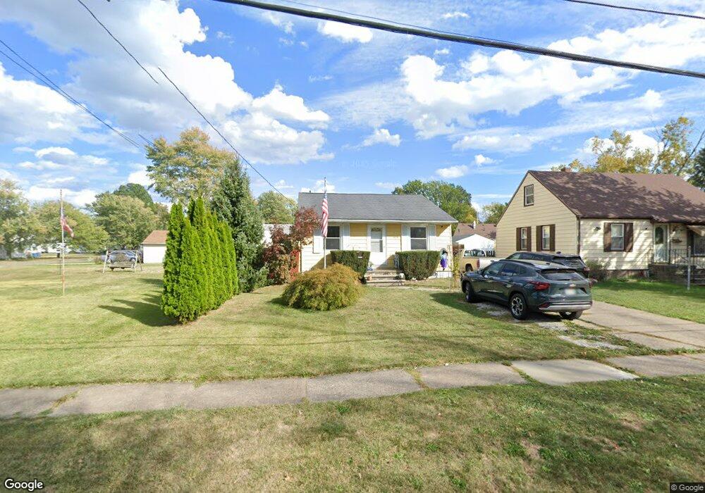
1609 Euclid Ave Lorain, OH 44052
Estimated Value: $110,486 - $122,000
2
Beds
1
Bath
832
Sq Ft
$142/Sq Ft
Est. Value
About This Home
This home is located at 1609 Euclid Ave, Lorain, OH 44052 and is currently estimated at $117,872, approximately $141 per square foot. 1609 Euclid Ave is a home located in Lorain County with nearby schools including Larkmoor Elementary School, Longfellow Middle School, and Lorain High School.
Ownership History
Date
Name
Owned For
Owner Type
Purchase Details
Closed on
Jun 13, 2019
Sold by
Lorain County Land Reutilization Corp
Bought by
Rutherford Karen
Current Estimated Value
Purchase Details
Closed on
Aug 10, 2004
Sold by
Comstock Tracy S and Comstock Robert
Bought by
Rutherford William A and Robinson Karen L
Home Financials for this Owner
Home Financials are based on the most recent Mortgage that was taken out on this home.
Original Mortgage
$79,000
Interest Rate
6.1%
Mortgage Type
Purchase Money Mortgage
Purchase Details
Closed on
Mar 19, 2003
Sold by
Estate Of Susan Diane Morgan
Bought by
Comstock Tracy S
Create a Home Valuation Report for This Property
The Home Valuation Report is an in-depth analysis detailing your home's value as well as a comparison with similar homes in the area
Home Values in the Area
Average Home Value in this Area
Purchase History
| Date | Buyer | Sale Price | Title Company |
|---|---|---|---|
| Rutherford Karen | -- | None Available | |
| Rutherford William A | $79,000 | -- | |
| Comstock Tracy S | -- | -- |
Source: Public Records
Mortgage History
| Date | Status | Borrower | Loan Amount |
|---|---|---|---|
| Previous Owner | Rutherford William A | $79,000 |
Source: Public Records
Tax History Compared to Growth
Tax History
| Year | Tax Paid | Tax Assessment Tax Assessment Total Assessment is a certain percentage of the fair market value that is determined by local assessors to be the total taxable value of land and additions on the property. | Land | Improvement |
|---|---|---|---|---|
| 2024 | $1,161 | $28,168 | $3,164 | $25,004 |
| 2023 | $1,004 | $19,492 | $3,770 | $15,722 |
| 2022 | $995 | $19,492 | $3,770 | $15,722 |
| 2021 | $995 | $19,492 | $3,770 | $15,722 |
| 2020 | $950 | $16,170 | $3,130 | $13,040 |
| 2019 | $945 | $16,170 | $3,130 | $13,040 |
| 2018 | $954 | $16,170 | $3,130 | $13,040 |
| 2017 | $963 | $15,530 | $3,420 | $12,110 |
| 2016 | $955 | $15,530 | $3,420 | $12,110 |
| 2015 | $901 | $15,530 | $3,420 | $12,110 |
| 2014 | $856 | $14,790 | $3,260 | $11,530 |
| 2013 | $850 | $14,790 | $3,260 | $11,530 |
Source: Public Records
Map
Nearby Homes
- 1619 New Mexico Ave
- 2947 Colorado Ave
- 2922 Eastlawn St
- 1330 Pennsylvania Ave
- 0 New Hampshire Ave
- 0 New Hampshire Ave
- 1623 Nevada Ave
- 1605 Ohio Ave
- 0 Eastlawn St Unit 5106705
- 3427 Crehore St
- 2236 Randall St
- 2149 Hancock St
- 2817 Mckinley St
- 0 Root Rd
- 2279 Adams St
- 805 Euclid Ave
- 2417 G St
- 1273 Michigan Ave
- 1943 G St
- 1330 Maryland Ave
- 1611 Euclid Ave
- 1601 Euclid Ave
- 1617 Euclid Ave
- 1608 Pennsylvania Ave
- 1604 Pennsylvania Ave
- 1612 Pennsylvania Ave
- 1600 Pennsylvania Ave
- 1606 Euclid Ave
- 1620 Pennsylvania Ave
- 1625 Euclid Ave
- 1614 Euclid Ave
- 2938 Randall St
- 1525 Euclid Ave
- 1620 Euclid Ave
- 1526 Pennsylvania Ave
- 1624 Pennsylvania Ave
- 1629 Euclid Ave
- 1628 Pennsylvania Ave
- 1522 Pennsylvania Ave
- 1626 Euclid Ave