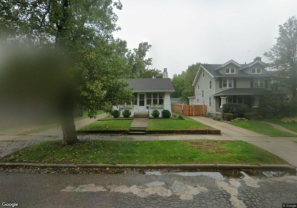
1609 N Washington Ave Royal Oak, MI 48067
Estimated Value: $271,000 - $314,000
3
Beds
1
Bath
928
Sq Ft
$311/Sq Ft
Est. Value
About This Home
This home is located at 1609 N Washington Ave, Royal Oak, MI 48067 and is currently estimated at $288,160, approximately $310 per square foot. 1609 N Washington Ave is a home located in Oakland County with nearby schools including Northwood Elementary School, Royal Oak Middle School, and Royal Oak High School.
Ownership History
Date
Name
Owned For
Owner Type
Purchase Details
Closed on
May 1, 2024
Sold by
Schofield Donna M
Bought by
Donna M Schofield Living Trust and Schofield
Current Estimated Value
Purchase Details
Closed on
Jan 22, 1998
Sold by
Walsh David M
Bought by
Schofield Donna M
Home Financials for this Owner
Home Financials are based on the most recent Mortgage that was taken out on this home.
Original Mortgage
$113,900
Interest Rate
6.95%
Purchase Details
Closed on
Aug 18, 1995
Sold by
Longe Bruce P
Bought by
Walsh David M
Create a Home Valuation Report for This Property
The Home Valuation Report is an in-depth analysis detailing your home's value as well as a comparison with similar homes in the area
Home Values in the Area
Average Home Value in this Area
Purchase History
| Date | Buyer | Sale Price | Title Company |
|---|---|---|---|
| Donna M Schofield Living Trust | -- | None Listed On Document | |
| Schofield Donna M | $134,000 | -- | |
| Walsh David M | $103,700 | -- |
Source: Public Records
Mortgage History
| Date | Status | Borrower | Loan Amount |
|---|---|---|---|
| Previous Owner | Schofield Donna M | $113,900 |
Source: Public Records
Tax History Compared to Growth
Tax History
| Year | Tax Paid | Tax Assessment Tax Assessment Total Assessment is a certain percentage of the fair market value that is determined by local assessors to be the total taxable value of land and additions on the property. | Land | Improvement |
|---|---|---|---|---|
| 2024 | $2,313 | $112,270 | $0 | $0 |
| 2022 | $2,733 | $99,120 | $0 | $0 |
| 2020 | $2,247 | $86,180 | $0 | $0 |
| 2018 | $2,733 | $75,310 | $0 | $0 |
| 2017 | $2,627 | $75,310 | $0 | $0 |
| 2015 | -- | $66,280 | $0 | $0 |
| 2014 | -- | $62,780 | $0 | $0 |
| 2011 | -- | $64,750 | $0 | $0 |
Source: Public Records
Map
Nearby Homes
- 122 Euclid Ave
- 1821 N Washington Ave
- 1828 N Lafayette Ave
- 1833 N Washington Ave
- 719 W 12 Mile Rd
- 1028 Edgewood Dr
- 320 Catalpa Dr
- 227 W Houstonia Ave
- 307 Marlin Ave
- 606 Catalpa Dr
- 912 Woodsboro Dr
- 127 La Plaza Ct
- 508 W Houstonia Ave
- 334 Marlin Ave
- 2115 Marywood Dr
- 410 Crane Ave
- 512 Marlin Ave
- 528 Marlin Ave
- 817 Magnolia Ave
- 3316 Vinsetta Blvd
- 1615 N Washington Ave
- 1603 N Washington Ave
- 1528 Crooks Rd
- 1529 N Washington Ave
- 1619 N Washington Ave
- 319 Waverley Ave
- 1526 Crooks Rd
- 1604 Crooks Rd
- 323 Waverley Ave
- 1606 N Washington Ave
- 1629 N Washington Ave
- 1602 N Washington Ave
- 1616 N Washington Ave
- 000 Dewey St
- 0 Dewey St
- 1610 Crooks Rd
- 1612 N Washington Ave
- 1526 N Washington Ave
- 327 Waverley Ave Unit Bldg-Unit
- 327 Waverley Ave