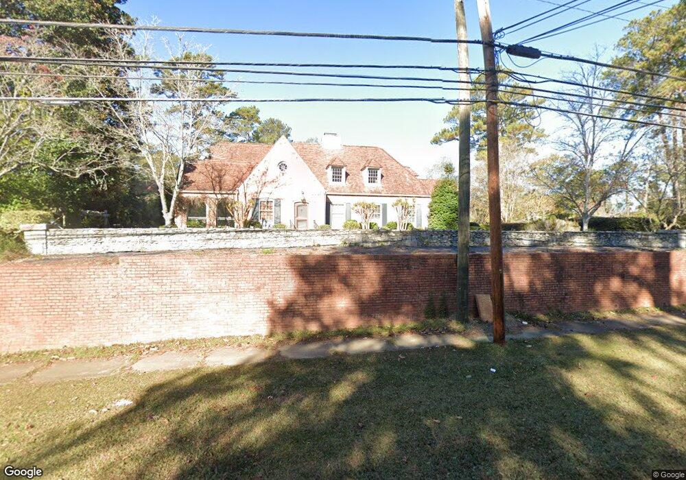
1609 Us Highway 29 West Point, GA 31833
Estimated Value: $349,000 - $523,000
4
Beds
5
Baths
3,604
Sq Ft
$115/Sq Ft
Est. Value
About This Home
This home is located at 1609 Us Highway 29, West Point, GA 31833 and is currently estimated at $413,114, approximately $114 per square foot. 1609 Us Highway 29 is a home located in Troup County with nearby schools including West Point Elementary School, Long Cane Elementary School, and Berta Weathersbee Elementary School.
Ownership History
Date
Name
Owned For
Owner Type
Purchase Details
Closed on
Jun 21, 2018
Sold by
Federal National Mortgage Association
Bought by
Mccarden Willie B
Current Estimated Value
Purchase Details
Closed on
Jul 6, 2017
Bought by
Federal National Mtg Associati
Purchase Details
Closed on
Jul 5, 2017
Sold by
Gooding Robert William
Bought by
Wells Fargo Bank Na
Purchase Details
Closed on
Sep 8, 2000
Sold by
Hamilton Ancel A and Hamilton Cheryl A
Bought by
Gooding Robert William Etal
Purchase Details
Closed on
Jun 5, 1995
Sold by
Maxwell Estelle
Bought by
Hamilton Ancel A and Hamilton Cheryl A
Purchase Details
Closed on
Jan 2, 1962
Bought by
Maxwell Estelle
Purchase Details
Closed on
Jan 1, 1960
Create a Home Valuation Report for This Property
The Home Valuation Report is an in-depth analysis detailing your home's value as well as a comparison with similar homes in the area
Home Values in the Area
Average Home Value in this Area
Purchase History
| Date | Buyer | Sale Price | Title Company |
|---|---|---|---|
| Mccarden Willie B | -- | -- | |
| Federal National Mtg Associati | $225,400 | -- | |
| Wells Fargo Bank Na | $225,400 | -- | |
| Gooding Robert William Etal | $275,000 | -- | |
| Hamilton Ancel A | $159,900 | -- | |
| Maxwell Estelle | -- | -- | |
| -- | -- | -- |
Source: Public Records
Tax History Compared to Growth
Tax History
| Year | Tax Paid | Tax Assessment Tax Assessment Total Assessment is a certain percentage of the fair market value that is determined by local assessors to be the total taxable value of land and additions on the property. | Land | Improvement |
|---|---|---|---|---|
| 2025 | $4,934 | $150,880 | $12,560 | $138,320 |
| 2024 | $4,934 | $141,000 | $12,560 | $128,440 |
| 2023 | $3,121 | $1,087 | $0 | $1,087 |
| 2022 | $3,718 | $135,200 | $10,040 | $125,160 |
| 2021 | $4,078 | $135,200 | $10,040 | $125,160 |
| 2020 | $3,466 | $135,200 | $10,040 | $125,160 |
| 2019 | $4,631 | $153,560 | $10,040 | $143,520 |
| 2018 | $4,425 | $146,720 | $10,040 | $136,680 |
| 2017 | $4,308 | $144,840 | $11,840 | $133,000 |
| 2016 | $4,162 | $139,971 | $11,840 | $128,131 |
| 2015 | $4,208 | $141,251 | $13,120 | $128,131 |
| 2014 | $4,216 | $141,308 | $13,120 | $128,188 |
| 2013 | -- | $134,866 | $11,684 | $123,182 |
Source: Public Records
Map
Nearby Homes
- 508 Pine St
- 1903 Ridgewood Dr
- 1505 Wisteria Dr
- 0 Ga Highway 0116 Unit 10619139
- 1599 Highway 29
- 1008 E 12th St
- 0 Sunset Dr Unit 10451831
- 1410 Roper Ave
- 1314 4th Ave
- 0 Arrowhead Dr Unit 10451860
- 713 Avenue H
- 1007 4th Ave
- 804 E 6th St
- 509 Cleveland St
- 712 4th Ave
- 311 E 4th St
- 1508 N 4th Ave
- 4517 Georgia 18
- 4509 Georgia 18
- 4523 Georgia 18
- 1700 Malco Dr
- 406 Sheppard St
- 1702 Malco Dr
- 1704 Malco Dr
- 404 Sheppard St
- 1606 Us Highway 29
- 1701 Malco Dr
- 1608 Us Highway 29
- 1610 Us Highway 29
- 1604 Us Highway 29
- 1703 Malco Dr
- 1603 Us Highway 29 Unit 284/5
- 1603 Us Highway 29 Unit 284/5
- 1603 Us Highway 29
- 1603 Us Highway 29
- 1603 Us Highway 29
- 1603 Us Highway 29
- 1603 Us Highway 29
- 1603 Us Highway 29
- 1603 Us Highway 29