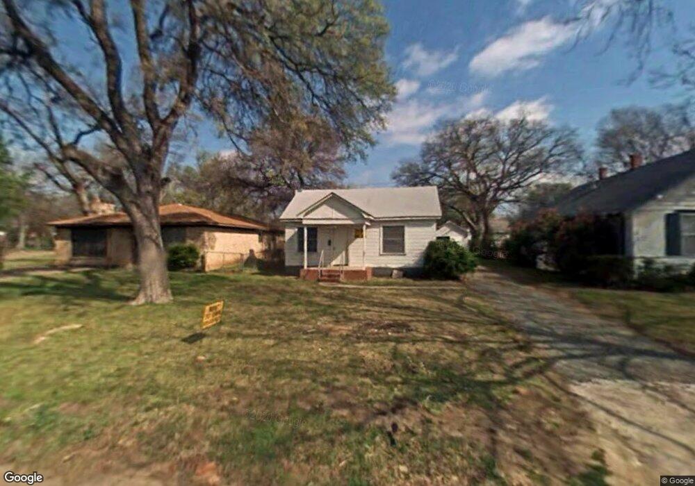
1609 W Bond St Denison, TX 75020
Estimated Value: $165,677 - $203,000
--
Bed
--
Bath
1,330
Sq Ft
$139/Sq Ft
Est. Value
About This Home
This home is located at 1609 W Bond St, Denison, TX 75020 and is currently estimated at $184,339, approximately $138 per square foot. 1609 W Bond St is a home located in Grayson County with nearby schools including Mayes Elementary School, Scott Middle School, and Denison High School.
Ownership History
Date
Name
Owned For
Owner Type
Purchase Details
Closed on
May 14, 2008
Sold by
Equity Trust Company
Bought by
Ratliff Rachel Delaney
Current Estimated Value
Home Financials for this Owner
Home Financials are based on the most recent Mortgage that was taken out on this home.
Original Mortgage
$16,000
Interest Rate
4.84%
Mortgage Type
Seller Take Back
Purchase Details
Closed on
Jan 29, 2007
Sold by
Dunn Linda Kay Allen and Conner Richard
Bought by
Equity Trust Co and Clint Medford Ira
Create a Home Valuation Report for This Property
The Home Valuation Report is an in-depth analysis detailing your home's value as well as a comparison with similar homes in the area
Home Values in the Area
Average Home Value in this Area
Purchase History
| Date | Buyer | Sale Price | Title Company |
|---|---|---|---|
| Ratliff Rachel Delaney | -- | None Available | |
| Equity Trust Co | -- | None Available |
Source: Public Records
Mortgage History
| Date | Status | Borrower | Loan Amount |
|---|---|---|---|
| Previous Owner | Ratliff Rachel Delaney | $16,000 |
Source: Public Records
Tax History Compared to Growth
Tax History
| Year | Tax Paid | Tax Assessment Tax Assessment Total Assessment is a certain percentage of the fair market value that is determined by local assessors to be the total taxable value of land and additions on the property. | Land | Improvement |
|---|---|---|---|---|
| 2025 | $1,887 | $149,258 | -- | -- |
| 2024 | $3,152 | $135,689 | $0 | $0 |
| 2023 | $1,538 | $123,354 | $0 | $0 |
| 2022 | $2,664 | $112,140 | $0 | $0 |
| 2021 | $2,250 | $89,218 | $20,250 | $68,968 |
| 2020 | $2,241 | $84,949 | $15,000 | $69,949 |
| 2019 | $2,254 | $86,478 | $12,450 | $74,028 |
| 2018 | $2,066 | $74,459 | $7,800 | $66,659 |
| 2017 | $1,912 | $69,714 | $6,975 | $62,739 |
| 2016 | $1,738 | $63,596 | $4,200 | $59,396 |
| 2015 | $1,165 | $56,479 | $3,150 | $53,329 |
| 2014 | $1,528 | $54,084 | $3,150 | $50,934 |
Source: Public Records
Map
Nearby Homes
- 1601 W Bond St
- 1721 W Walker St Unit A and B
- 2900 W Morton St
- 3130 W Morton St
- 3030 W Morton St
- 1700 W Morton St
- 3300 W Morton St
- 1505 W Johnson St
- 1905 W Morton St Unit 6
- 1905 W Morton St Unit 5
- 1905 W Morton St Unit 17
- 1905 W Morton St Unit 20
- 1905 W Morton St Unit 7
- 1320 W Morton St
- 1915 W Bond St
- 1609 W Woodard St
- 916 Leeper Dr
- 1309 W Morton St
- 1985 W Bond St
- 727 W Parnell St
- 1615 W Bond St
- 1605 W Bond St
- 1619 W Bond St
- 1623 W Bond St
- 1610 W Walker St
- 1612 W Walker St
- 1600 W Walker St
- 1627 W Bond St
- 1616 W Walker St
- 1531 W Bond St
- 1610 W Bond St
- 1612 W Bond St
- 1604 W Bond St
- 1614 W Bond St
- 602 N Bush Ave
- 1622 W Bond St
- 1527 W Bond St
- 1630 W Walker St
- 1626 W Bond St
- 1523 W Bond St