Estimated Value: $288,134 - $351,000
3
Beds
1
Bath
1,440
Sq Ft
$219/Sq Ft
Est. Value
About This Home
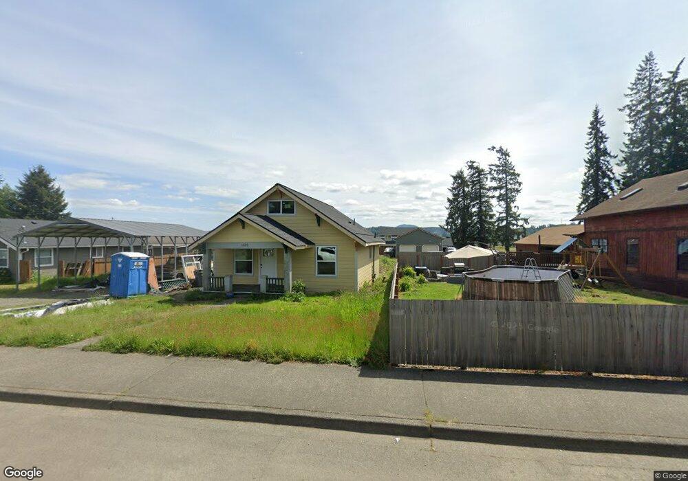
This home is located at 1609 W Main St, Elma, WA 98541 and is currently estimated at $315,284, approximately $218 per square foot. 1609 W Main St is a home located in Grays Harbor County with nearby schools including Elma Elementary School, Elma Middle School, and Elma High School.
Ownership History
Date
Name
Owned For
Owner Type
Purchase Details
Closed on
Oct 17, 2008
Sold by
The Secretary Of Housing & Urban Develop
Bought by
Baskett Andrew Charles
Current Estimated Value
Home Financials for this Owner
Home Financials are based on the most recent Mortgage that was taken out on this home.
Original Mortgage
$89,269
Outstanding Balance
$57,831
Interest Rate
5.9%
Mortgage Type
FHA
Estimated Equity
$257,453
Purchase Details
Closed on
Apr 14, 2008
Sold by
National City Mortgage
Bought by
The Secretary Of Housing & Urban Develop
Purchase Details
Closed on
Sep 4, 2007
Sold by
Neighbour Dorinda J
Bought by
National City Mortgage
Create a Home Valuation Report for This Property
The Home Valuation Report is an in-depth analysis detailing your home's value as well as a comparison with similar homes in the area
Home Values in the Area
Average Home Value in this Area
Purchase History
| Date | Buyer | Sale Price | Title Company |
|---|---|---|---|
| Baskett Andrew Charles | -- | Coast Title | |
| The Secretary Of Housing & Urban Develop | -- | Coast Title | |
| National City Mortgage | $121,711 | Coast Title |
Source: Public Records
Mortgage History
| Date | Status | Borrower | Loan Amount |
|---|---|---|---|
| Open | Baskett Andrew Charles | $89,269 |
Source: Public Records
Tax History Compared to Growth
Tax History
| Year | Tax Paid | Tax Assessment Tax Assessment Total Assessment is a certain percentage of the fair market value that is determined by local assessors to be the total taxable value of land and additions on the property. | Land | Improvement |
|---|---|---|---|---|
| 2025 | $1,897 | $198,686 | $64,581 | $134,105 |
| 2023 | $1,717 | $167,156 | $64,581 | $102,575 |
| 2022 | $1,479 | $132,625 | $51,665 | $80,960 |
| 2021 | $1,585 | $132,625 | $51,665 | $80,960 |
| 2020 | $1,358 | $142,937 | $47,579 | $95,358 |
| 2019 | $1,091 | $119,502 | $32,813 | $86,689 |
| 2018 | $1,251 | $105,054 | $32,813 | $72,241 |
| 2017 | $1,168 | $91,162 | $32,813 | $58,349 |
Source: Public Records
Map
Nearby Homes
- 1515 W Waldrip St
- 1509 W Waldrip St
- 1716 W Young St
- 107 Cascade Ct
- 17 Dry Creek Ct
- 302 W Martin St
- 12 W Hobble Creek
- 8 W Hobble Creek
- 408 N 11th St
- 402 N 10th St
- 622 W Young St
- 630 N 11th St
- 1 Dolce Ln
- 4 Dakota Ln
- 117 Heritage Dr
- 220 W Anderson St
- 0 XXX N 3rd St
- 0 W Pine St
- 116 Hillcrest Dr
- 1190 Monte Elma Rd