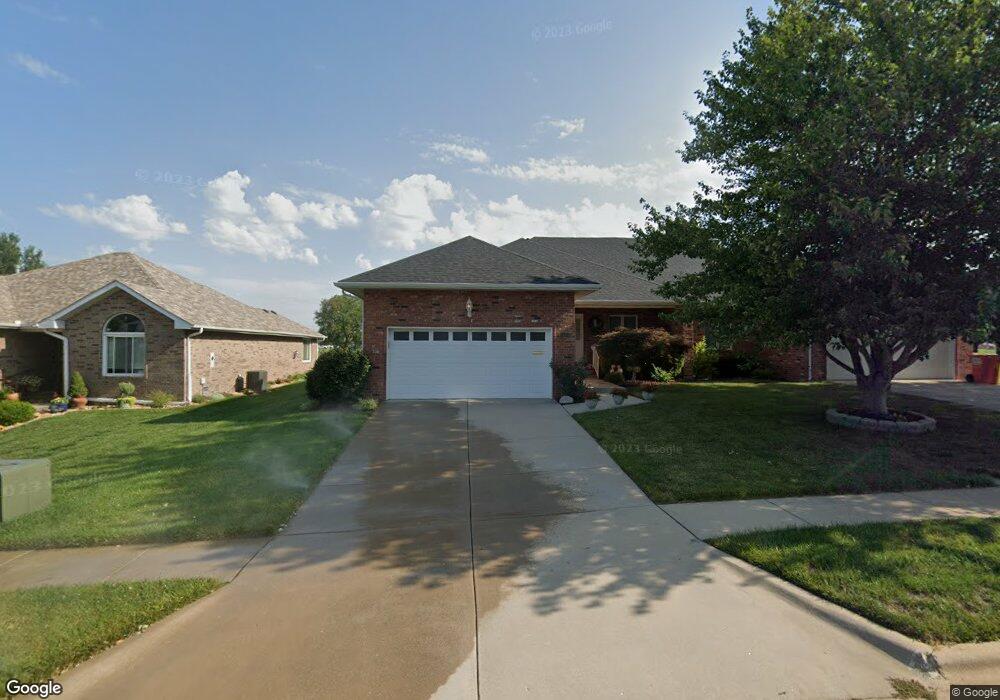
1609 W Swallow St Springfield, MO 65810
Southwest Springfield NeighborhoodEstimated Value: $257,131 - $322,000
2
Beds
2
Baths
1,640
Sq Ft
$173/Sq Ft
Est. Value
About This Home
This home is located at 1609 W Swallow St, Springfield, MO 65810 and is currently estimated at $283,033, approximately $172 per square foot. 1609 W Swallow St is a home located in Greene County with nearby schools including Gray Elementary School, Wilson's Creek Intermediate School, and Cherokee Middle School.
Ownership History
Date
Name
Owned For
Owner Type
Purchase Details
Closed on
Apr 11, 2008
Sold by
Neill Phyllis K
Bought by
Porter Neil F and June Porter M
Current Estimated Value
Home Financials for this Owner
Home Financials are based on the most recent Mortgage that was taken out on this home.
Original Mortgage
$134,000
Outstanding Balance
$85,501
Interest Rate
6.11%
Mortgage Type
Purchase Money Mortgage
Estimated Equity
$197,532
Create a Home Valuation Report for This Property
The Home Valuation Report is an in-depth analysis detailing your home's value as well as a comparison with similar homes in the area
Home Values in the Area
Average Home Value in this Area
Purchase History
| Date | Buyer | Sale Price | Title Company |
|---|---|---|---|
| Porter Neil F | -- | None Available |
Source: Public Records
Mortgage History
| Date | Status | Borrower | Loan Amount |
|---|---|---|---|
| Open | Porter Neil F | $134,000 |
Source: Public Records
Tax History
| Year | Tax Paid | Tax Assessment Tax Assessment Total Assessment is a certain percentage of the fair market value that is determined by local assessors to be the total taxable value of land and additions on the property. | Land | Improvement |
|---|---|---|---|---|
| 2025 | $1,670 | $33,520 | $4,560 | $28,960 |
| 2024 | $1,495 | $27,870 | $3,420 | $24,450 |
| 2023 | $1,487 | $27,870 | $3,420 | $24,450 |
| 2022 | $1,323 | $24,230 | $3,420 | $20,810 |
| 2021 | $1,323 | $24,230 | $3,420 | $20,810 |
| 2020 | $1,336 | $23,390 | $3,420 | $19,970 |
| 2019 | $1,298 | $23,390 | $3,420 | $19,970 |
| 2018 | $1,300 | $23,430 | $3,420 | $20,010 |
| 2017 | $1,287 | $22,650 | $3,420 | $19,230 |
| 2016 | $1,241 | $22,650 | $3,420 | $19,230 |
| 2015 | $1,230 | $22,650 | $3,420 | $19,230 |
| 2014 | $1,209 | $22,100 | $3,420 | $18,680 |
Source: Public Records
Map
Nearby Homes
- 1922 W Woodhaven St Unit Lot 42
- 1924 W Woodhaven St Unit Lot 43
- 1914 W Woodhaven St Unit Lot 38
- 1910 W Woodhaven St Unit Lot 36
- 1912 W Woodhaven St Unit Lot 37
- 4441 S Lafontaine Ave
- 4530 S Shady Lane Ct
- 2175 W Glen Gary Ct
- 2177 W Glen Gary Ct
- 2021 W Kingsley St
- 2065 W Buena Vista St
- 1658 W Riverside St
- 3860 S Parklane Ave
- 4491 S Park Ave
- 2301 W Camino Alto St
- 4825 S Sydney Ave
- 2325 W Camino Alto St
- 1233 W Highland St
- 1658 W Caleb Ct
- 4782 S Turnberry Ave
- 1615 W Swallow St
- 1605 W Swallow St
- 1619 W Swallow St
- 1625 W Swallow St
- 4319 S Kansas Ave
- 1629 W Swallow St
- 1618 W Swallow St
- 1622 W Swallow St
- 1635 W Swallow St
- 1628 W Swallow St
- 1632 W Swallow St
- 1639 W Swallow St
- 1645 W Swallow St
- 1642 W Swallow St
- 1651 W Swallow St
- 4323 S Meadowbrook Ave
- 4317 S Meadowbrook St
- 4349 S Kansas Ave
- 1661 W Swallow St
- 1657 W Swallow St
Your Personal Tour Guide
Ask me questions while you tour the home.