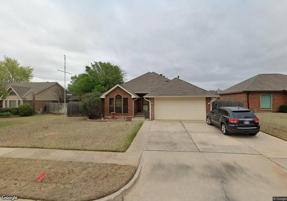
1609 War Bird Dr Norman, OK 73071
Northeast Norman NeighborhoodEstimated Value: $229,157 - $248,000
3
Beds
2
Baths
1,552
Sq Ft
$153/Sq Ft
Est. Value
About This Home
This home is located at 1609 War Bird Dr, Norman, OK 73071 and is currently estimated at $237,539, approximately $153 per square foot. 1609 War Bird Dr is a home located in Cleveland County with nearby schools including Jefferson Elementary School, Longfellow Middle School, and Norman North High School.
Ownership History
Date
Name
Owned For
Owner Type
Purchase Details
Closed on
Jul 17, 2025
Sold by
Linda Kay Cutsinger Living Trust and Krohmer Harriet Suzanne
Bought by
Krohmer Properties Llc
Current Estimated Value
Purchase Details
Closed on
Aug 21, 2023
Sold by
Bower Hadley H
Bought by
Bower Lora A
Purchase Details
Closed on
Apr 14, 2022
Sold by
Cutsinger Linda K
Bought by
Linda Kay Cutsinger Living Trust
Purchase Details
Closed on
Apr 12, 2022
Sold by
Cutsinger Linda K
Bought by
Linda Kay Cutsinger Living Trust
Purchase Details
Closed on
Feb 27, 2004
Sold by
Fisher Lawrence M
Bought by
Cutsinger Thomas A and Cutsinger Linda K
Create a Home Valuation Report for This Property
The Home Valuation Report is an in-depth analysis detailing your home's value as well as a comparison with similar homes in the area
Home Values in the Area
Average Home Value in this Area
Purchase History
| Date | Buyer | Sale Price | Title Company |
|---|---|---|---|
| Krohmer Properties Llc | -- | None Listed On Document | |
| Bower Lora A | -- | None Listed On Document | |
| Linda Kay Cutsinger Living Trust | -- | None Listed On Document | |
| Linda Kay Cutsinger Living Trust | -- | None Listed On Document | |
| Cutsinger Thomas A | $114,500 | -- |
Source: Public Records
Tax History
| Year | Tax Paid | Tax Assessment Tax Assessment Total Assessment is a certain percentage of the fair market value that is determined by local assessors to be the total taxable value of land and additions on the property. | Land | Improvement |
|---|---|---|---|---|
| 2024 | $2,029 | $17,942 | $3,959 | $13,983 |
| 2023 | $1,972 | $17,420 | $3,254 | $14,166 |
| 2022 | $1,833 | $16,912 | $3,178 | $13,734 |
| 2021 | $873 | $16,420 | $3,221 | $13,199 |
| 2020 | $1,775 | $15,941 | $2,640 | $13,301 |
| 2019 | $1,806 | $15,941 | $2,640 | $13,301 |
| 2018 | $1,751 | $15,942 | $2,640 | $13,302 |
| 2017 | $1,770 | $15,942 | $0 | $0 |
| 2016 | $1,799 | $15,942 | $2,640 | $13,302 |
Source: Public Records
Map
Nearby Homes
- 1705 Oriole Ct
- 1617 Wilderness Dr
- 1716 Wilderness Dr
- 00 Daisy Ln
- 117 Crawford Ct Unit 117 & 119
- 1909 Chandelier Dr Unit 1909 1911
- 1706 N Peters Ave
- 809 Oliver St
- 714 Oliver St
- 309 Falcon Ct
- 108 E Dale St
- 109 E Hayes St
- 415 E Frank St
- 114 W Himes St
- 2418 Weatherford Dr
- 301 Wichita Dr
- 1514 Eisenhower Rd
- 2428 9th Ave NE
- 1216 Newbury Dr
- 2517 Weatherford Dr
- 1605 War Bird Dr
- 1617 War Bird Dr
- 1601 War Bird Dr
- 1608 Heron Dr
- 1612 Heron Dr
- 1608 War Bird Dr
- 1604 Heron Dr
- 1621 War Bird Dr
- 1612 War Bird Dr
- 1616 Heron Dr
- 1604 War Bird Dr
- 1600 Heron Dr
- 1616 War Bird Dr
- 1600 War Bird Dr
- 1620 Heron Dr
- 1620 War Bird Dr
- 1517 War Bird Dr
- 1516 War Bird Dr
- 1624 Heron Dr