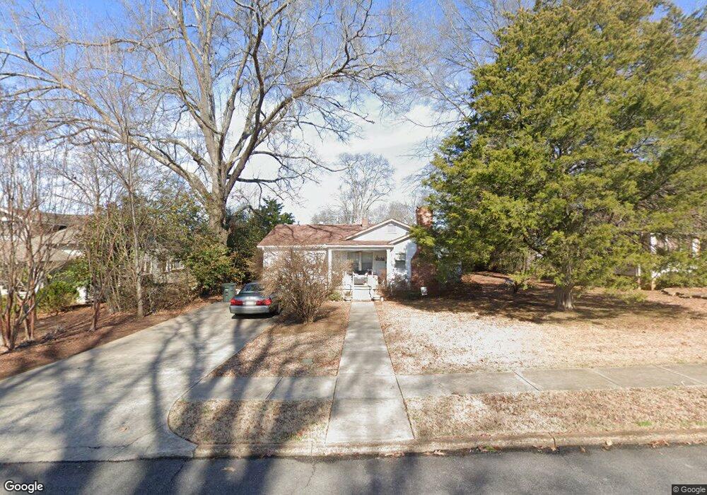
1609 Ward Ave NE Huntsville, AL 35801
Lincoln Mill District NeighborhoodEstimated Value: $281,000 - $399,000
--
Bed
--
Bath
1,422
Sq Ft
$242/Sq Ft
Est. Value
About This Home
This home is located at 1609 Ward Ave NE, Huntsville, AL 35801 and is currently estimated at $343,864, approximately $241 per square foot. 1609 Ward Ave NE is a home with nearby schools including Blossomwood Elementary School, Huntsville Junior High School, and Huntsville High School.
Ownership History
Date
Name
Owned For
Owner Type
Purchase Details
Closed on
Nov 26, 2007
Sold by
The Estates Of Dollie S Kennemer And Jam
Bought by
Dagostino Lisa A
Current Estimated Value
Home Financials for this Owner
Home Financials are based on the most recent Mortgage that was taken out on this home.
Original Mortgage
$116,000
Outstanding Balance
$73,499
Interest Rate
6.32%
Mortgage Type
New Conventional
Estimated Equity
$270,365
Create a Home Valuation Report for This Property
The Home Valuation Report is an in-depth analysis detailing your home's value as well as a comparison with similar homes in the area
Home Values in the Area
Average Home Value in this Area
Purchase History
| Date | Buyer | Sale Price | Title Company |
|---|---|---|---|
| Dagostino Lisa A | -- | -- |
Source: Public Records
Mortgage History
| Date | Status | Borrower | Loan Amount |
|---|---|---|---|
| Open | Dagostino Lisa A | $116,000 |
Source: Public Records
Tax History Compared to Growth
Tax History
| Year | Tax Paid | Tax Assessment Tax Assessment Total Assessment is a certain percentage of the fair market value that is determined by local assessors to be the total taxable value of land and additions on the property. | Land | Improvement |
|---|---|---|---|---|
| 2024 | $2,555 | $44,060 | $22,120 | $21,940 |
| 2023 | $2,555 | $44,060 | $22,120 | $21,940 |
| 2022 | $1,980 | $34,140 | $15,140 | $19,000 |
| 2021 | $1,674 | $28,860 | $12,800 | $16,060 |
| 2020 | $1,589 | $27,400 | $12,800 | $14,600 |
| 2019 | $1,589 | $27,400 | $12,800 | $14,600 |
| 2018 | $1,590 | $27,420 | $0 | $0 |
| 2017 | $1,590 | $27,420 | $0 | $0 |
| 2016 | $1,219 | $21,020 | $0 | $0 |
| 2015 | $1,219 | $21,020 | $0 | $0 |
| 2014 | $1,172 | $20,200 | $0 | $0 |
Source: Public Records
Map
Nearby Homes
- 1622 Beirne Ave NE
- 1414 Beirne Ave NE
- 1733 Beirne Ave NE
- 1610 Wellman Ave NE
- 1608 Humes Ave NE
- 1441 Oshaughnessy Ave
- 1512 Humes Ave NE
- 1504 Humes Ave NE
- 1222 Beirne Ave NE
- 1 Maysville Rd SE
- 1313 Oshaughnessy Ave NE
- 1405 Randolph Ave SE
- 211 Knollridge Cir SE
- 213 Knollridge Cir SE
- 1701 Toll Gate Rd SE
- 1611 Wells Ave SE
- 103 Dill St SE
- 1120 Pratt Ave NE
- 1120 Oshaughnessy Ave NE
- 117 Knollridge Dr
- 1603 Ward Ave NE
- 1615 Ward Ave NE
- 1619 Ward Ave NE
- 1606 Ward Ave NE
- 1523 Ward Ave NE
- 1616 Beirne Ave NE
- 1604 Beirne Ave NE
- 1612 Beirne Ave NE Unit B
- 1612 Beirne Ave NE Unit A
- 1608 Beirne Ave NE
- 1608 Ward Ave NE
- 1612 Ward Ave NE
- 1618 Beirne Ave NE
- 1602 Ward Ave NE
- 1612 B Beirne Ave NE Unit B
- 1612 B Beirne Ave NE
- 1610 Ward Ave NE
- 1622 Ward Ave NE
- 1524 Ward Ave NE Unit Garage 3
- 1524 Ward Ave NE Unit 1/2