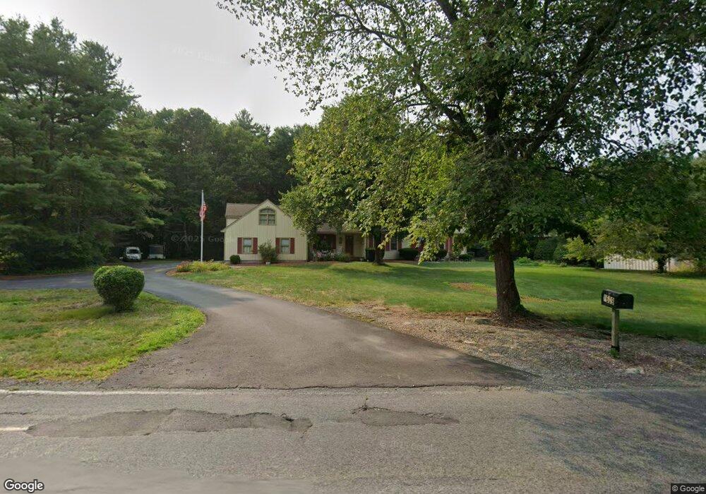
1609 West St Mansfield, MA 02048
Estimated Value: $873,015 - $966,000
4
Beds
3
Baths
3,202
Sq Ft
$283/Sq Ft
Est. Value
About This Home
This home is located at 1609 West St, Mansfield, MA 02048 and is currently estimated at $906,254, approximately $283 per square foot. 1609 West St is a home located in Bristol County with nearby schools including Everett W. Robinson Elementary School, Jordan/Jackson Elementary School, and Harold L. Qualters Middle School.
Ownership History
Date
Name
Owned For
Owner Type
Purchase Details
Closed on
Nov 22, 2017
Sold by
Curtis Frederick A and Curtis Linda A
Bought by
Frederick & L Curtis Ret
Current Estimated Value
Purchase Details
Closed on
Feb 4, 1988
Sold by
The Broderick Corp
Bought by
Curtis Frederick A
Home Financials for this Owner
Home Financials are based on the most recent Mortgage that was taken out on this home.
Original Mortgage
$140,000
Interest Rate
10.6%
Mortgage Type
Purchase Money Mortgage
Create a Home Valuation Report for This Property
The Home Valuation Report is an in-depth analysis detailing your home's value as well as a comparison with similar homes in the area
Home Values in the Area
Average Home Value in this Area
Purchase History
| Date | Buyer | Sale Price | Title Company |
|---|---|---|---|
| Frederick & L Curtis Ret | -- | -- | |
| Curtis Frederick A | $200,000 | -- |
Source: Public Records
Mortgage History
| Date | Status | Borrower | Loan Amount |
|---|---|---|---|
| Previous Owner | Curtis Frederick A | $320,000 | |
| Previous Owner | Curtis Frederick A | $81,500 | |
| Previous Owner | Curtis Frederick A | $122,000 | |
| Previous Owner | Curtis Frederick A | $140,000 |
Source: Public Records
Tax History Compared to Growth
Tax History
| Year | Tax Paid | Tax Assessment Tax Assessment Total Assessment is a certain percentage of the fair market value that is determined by local assessors to be the total taxable value of land and additions on the property. | Land | Improvement |
|---|---|---|---|---|
| 2025 | $10,186 | $773,400 | $243,000 | $530,400 |
| 2024 | $9,902 | $733,500 | $243,000 | $490,500 |
| 2023 | $9,450 | $670,700 | $243,000 | $427,700 |
| 2022 | $9,032 | $595,400 | $224,900 | $370,500 |
| 2021 | $3 | $593,900 | $196,900 | $397,000 |
| 2020 | $3,884 | $573,900 | $187,500 | $386,400 |
| 2019 | $8,312 | $546,100 | $156,200 | $389,900 |
| 2018 | $8,082 | $531,800 | $149,000 | $382,800 |
| 2017 | $2,416 | $516,900 | $144,700 | $372,200 |
| 2016 | $7,127 | $462,500 | $137,800 | $324,700 |
| 2015 | $6,910 | $445,800 | $137,800 | $308,000 |
Source: Public Records
Map
Nearby Homes
- 24 Maverick Dr
- 150 Gilbert St
- 4 Buckskin Dr
- 196 Donald Tennant Cir
- 11 Landry Ave
- 116 George St
- 255 Mckeon Dr
- 115 Westfield Dr
- 5 Old Wood Rd
- 16 Treasure Island Rd
- 15 Old Wood Rd
- 57 Vine St
- 406 South St
- 176 Elm St
- 11 Buckthorn Ln
- 28 Messenger St
- Lot 5 Jeffrey Dr
- 451R Gilbert St
- Lot 2 Jeffrey Dr
- 9 Oak Dr