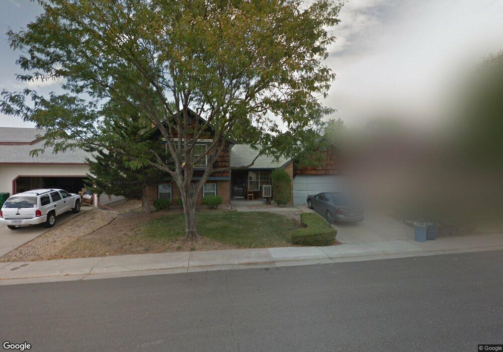
16093 E Exposition Dr Aurora, CO 80017
Centre Pointe NeighborhoodEstimated Value: $434,000 - $442,000
4
Beds
2
Baths
1,717
Sq Ft
$255/Sq Ft
Est. Value
About This Home
This home is located at 16093 E Exposition Dr, Aurora, CO 80017 and is currently estimated at $438,645, approximately $255 per square foot. 16093 E Exposition Dr is a home located in Arapahoe County with nearby schools including Tollgate Elementary School of Expeditionary Learning, Mrachek Middle School, and Gateway High School.
Ownership History
Date
Name
Owned For
Owner Type
Purchase Details
Closed on
Mar 7, 2016
Sold by
Portley Alice F
Bought by
Ibrahim Adeboye S and Ibrahim Oluwaseyi A
Current Estimated Value
Purchase Details
Closed on
Nov 2, 1990
Sold by
Macrorie Carol A Macrorie Chris
Bought by
Portley Alice F Jr Portley Nathan
Purchase Details
Closed on
Jul 31, 1987
Sold by
Conversion Arapco
Bought by
Macrorie Carol A Macrorie Chris
Purchase Details
Closed on
Mar 1, 1983
Sold by
Conversion Arapco
Bought by
Conversion Arapco
Purchase Details
Closed on
Dec 16, 1982
Bought by
Conversion Arapco
Create a Home Valuation Report for This Property
The Home Valuation Report is an in-depth analysis detailing your home's value as well as a comparison with similar homes in the area
Home Values in the Area
Average Home Value in this Area
Purchase History
| Date | Buyer | Sale Price | Title Company |
|---|---|---|---|
| Ibrahim Adeboye S | $245,000 | Chicago Title Co | |
| Portley Alice F Jr Portley Nathan | -- | -- | |
| Macrorie Carol A Macrorie Chris | -- | -- | |
| Conversion Arapco | -- | -- | |
| Conversion Arapco | -- | -- |
Source: Public Records
Tax History
| Year | Tax Paid | Tax Assessment Tax Assessment Total Assessment is a certain percentage of the fair market value that is determined by local assessors to be the total taxable value of land and additions on the property. | Land | Improvement |
|---|---|---|---|---|
| 2025 | $2,806 | $27,888 | -- | -- |
| 2024 | $2,722 | $29,286 | -- | -- |
| 2023 | $2,722 | $29,286 | $0 | $0 |
| 2022 | $2,310 | $23,005 | $0 | $0 |
| 2021 | $2,384 | $23,005 | $0 | $0 |
| 2020 | $2,356 | $22,630 | $0 | $0 |
| 2019 | $2,344 | $22,630 | $0 | $0 |
| 2018 | $1,900 | $17,964 | $0 | $0 |
| 2017 | $1,652 | $17,964 | $0 | $0 |
| 2016 | $736 | $15,665 | $0 | $0 |
| 2015 | $710 | $15,665 | $0 | $0 |
| 2014 | -- | $10,459 | $0 | $0 |
| 2013 | -- | $10,750 | $0 | $0 |
Source: Public Records
Map
Nearby Homes
- 16064 E Exposition Dr
- 648 S Kalispell Way
- 15875 E Custer Dr
- 844 S Joplin Cir
- 16255 E Alaska Place Unit 1
- 491 S Kalispell Way Unit 305
- 619 S Norfolk Way
- 588 S Mobile Place
- 477 S Memphis Way Unit 11
- 467 S Memphis Way Unit 17
- 16001 E Alaska Place Unit 7
- 16001 E Alaska Place Unit 1
- 471 S Kalispell Way Unit 101
- 16201 E Dakota Place Unit H
- 1024 S Mobile St
- 752 S Granby Cir
- 858 S Granby Cir
- 1092 S Granby Way
- 1121 S Joplin St
- 17095 E Alameda Pkwy
- 16063 E Exposition Dr
- 16105 E Exposition Dr
- 616 S Laredo Cir
- 614 S Laredo Cir
- 16033 E Exposition Dr
- 618 S Laredo Cir
- 630 S Kittredge St
- 16106 E Exposition Dr
- 612 S Laredo Cir
- 16003 E Exposition Dr
- 16165 E Exposition Dr
- 16136 E Exposition Dr
- 16034 E Exposition Dr
- 610 S Laredo Cir
- 16166 E Exposition Dr
- 16004 E Exposition Dr
- 729 S Laredo Cir
- 615 S Laredo Cir
- 731 S Laredo Cir
- 613 S Laredo Cir
Your Personal Tour Guide
Ask me questions while you tour the home.