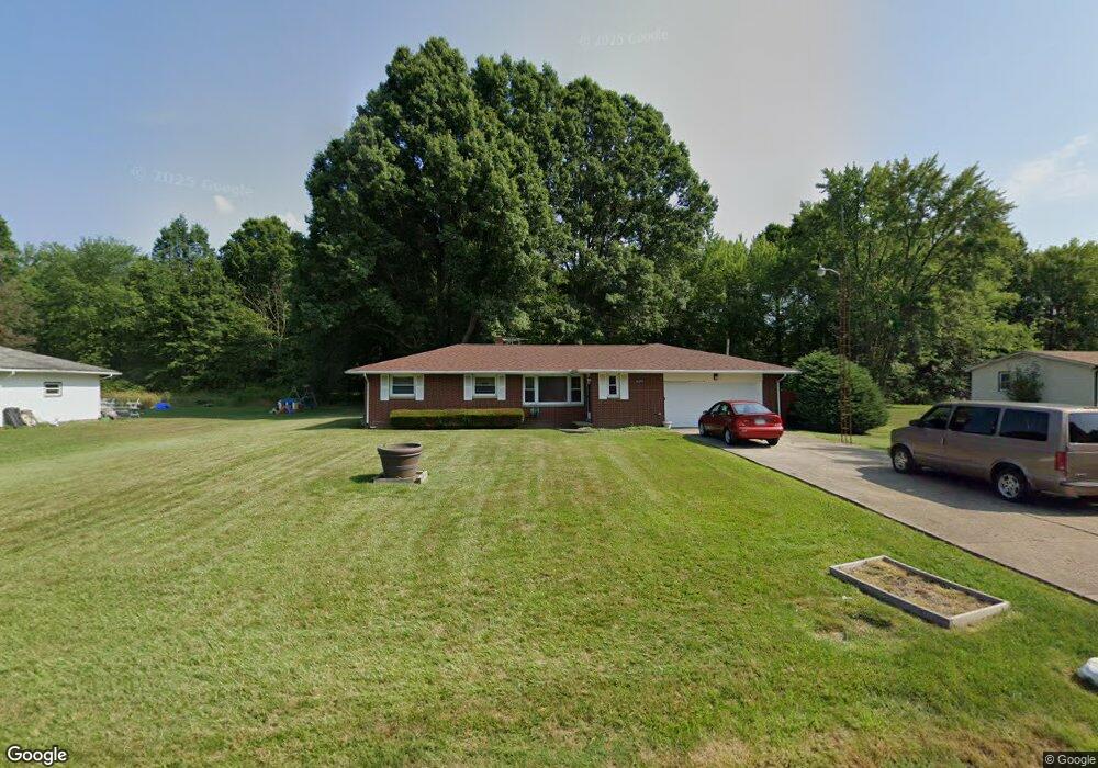
16099 Elbrook St NE Alliance, OH 44601
Estimated Value: $155,000 - $205,000
3
Beds
2
Baths
1,138
Sq Ft
$160/Sq Ft
Est. Value
About This Home
This home is located at 16099 Elbrook St NE, Alliance, OH 44601 and is currently estimated at $182,466, approximately $160 per square foot. 16099 Elbrook St NE is a home located in Stark County with nearby schools including Alliance Early Learning School, Alliance Intermediate School at Northside, and Alliance Middle School.
Ownership History
Date
Name
Owned For
Owner Type
Purchase Details
Closed on
Apr 17, 2006
Sold by
Edwards Cedric C
Bought by
Jenkins Delores
Current Estimated Value
Home Financials for this Owner
Home Financials are based on the most recent Mortgage that was taken out on this home.
Original Mortgage
$127,991
Outstanding Balance
$74,060
Interest Rate
6.48%
Mortgage Type
FHA
Estimated Equity
$108,406
Purchase Details
Closed on
Jan 14, 1997
Sold by
Nicholson Delores
Bought by
Edwards Cedric C
Home Financials for this Owner
Home Financials are based on the most recent Mortgage that was taken out on this home.
Original Mortgage
$64,800
Interest Rate
7.58%
Mortgage Type
New Conventional
Create a Home Valuation Report for This Property
The Home Valuation Report is an in-depth analysis detailing your home's value as well as a comparison with similar homes in the area
Home Values in the Area
Average Home Value in this Area
Purchase History
| Date | Buyer | Sale Price | Title Company |
|---|---|---|---|
| Jenkins Delores | $130,000 | Barristers Title Agency | |
| Edwards Cedric C | $36,313 | -- |
Source: Public Records
Mortgage History
| Date | Status | Borrower | Loan Amount |
|---|---|---|---|
| Open | Jenkins Delores | $127,991 | |
| Previous Owner | Edwards Cedric C | $64,800 |
Source: Public Records
Tax History Compared to Growth
Tax History
| Year | Tax Paid | Tax Assessment Tax Assessment Total Assessment is a certain percentage of the fair market value that is determined by local assessors to be the total taxable value of land and additions on the property. | Land | Improvement |
|---|---|---|---|---|
| 2025 | -- | $56,140 | $23,240 | $32,900 |
| 2024 | -- | $56,140 | $23,240 | $32,900 |
| 2023 | $1,471 | $34,440 | $7,560 | $26,880 |
| 2022 | $1,480 | $34,440 | $7,560 | $26,880 |
| 2021 | $1,482 | $34,440 | $7,560 | $26,880 |
| 2020 | $1,387 | $29,820 | $6,510 | $23,310 |
| 2019 | $1,370 | $29,820 | $6,510 | $23,310 |
| 2018 | $1,376 | $29,820 | $6,510 | $23,310 |
| 2017 | $1,298 | $26,050 | $4,800 | $21,250 |
| 2016 | $1,306 | $26,050 | $4,800 | $21,250 |
| 2015 | $1,262 | $26,050 | $4,800 | $21,250 |
| 2014 | $1,219 | $23,740 | $4,380 | $19,360 |
| 2013 | $605 | $23,740 | $4,380 | $19,360 |
Source: Public Records
Map
Nearby Homes
- 15995 Elbrook St NE
- 11310 Webb Ave NE
- 11344 Walnut Ave NE
- 11680 Walnut Ave NE
- 652 N Webb Ave
- 263 Franklin Ave
- 124 E Wayne St
- 710 N Freedom Ave
- 608 N Freedom Ave
- 1214 Jersey St
- 361 E Main St
- 142 S Seneca Ave
- 15789 Coalbank St NE
- 356 E Broadway St
- V/L S Fredeom Ave
- 442 S Liberty Ave
- 15520 Coalbank St NE
- 14723 Bolton St NE
- 432 S Linden Ave
- 163 W Market St
- 16075 Elbrook St NE
- 16115 Elbrook St NE
- 16053 Elbrook St NE
- 11474 Solar Ave NE
- 11491 Solar Ave NE
- 11534 Jennings Rd NE
- 11481 Solar Ave NE
- 11460 Jennings Rd NE
- 16011 Elbrook St NE
- 11453 Solar Ave NE
- 11434 Jennings Rd NE
- 11480 Holly Ave NE
- 11480 Holly Ave NE
- 11595 Jennings Rd NE
- 11431 Solar Ave NE
- 11411 Jennings Rd NE
- 15970 Elbrook St NE
- 16078 Longwood St NE
- 11621 Jennings Rd NE
- 11520 Webb Ave NE