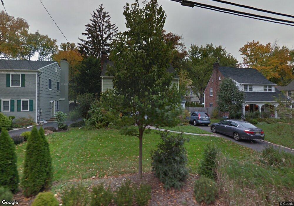
161 Ashland Rd Summit, NJ 07901
Estimated Value: $1,082,000 - $1,515,000
Studio
--
Bath
1,756
Sq Ft
$692/Sq Ft
Est. Value
About This Home
This home is located at 161 Ashland Rd, Summit, NJ 07901 and is currently estimated at $1,214,562, approximately $691 per square foot. 161 Ashland Rd is a home located in Union County with nearby schools including L C Johnson Summit Middle School, Summit Sr High School, and Oak Knoll School of the Holy Child.
Ownership History
Date
Name
Owned For
Owner Type
Purchase Details
Closed on
Aug 15, 2003
Sold by
Siler Jennifer Medick
Bought by
Shultz David and Shultz Margarita
Current Estimated Value
Home Financials for this Owner
Home Financials are based on the most recent Mortgage that was taken out on this home.
Original Mortgage
$433,000
Outstanding Balance
$198,975
Interest Rate
6.22%
Estimated Equity
$1,015,587
Purchase Details
Closed on
Sep 1, 2000
Sold by
Benedicto Alfred D and Benedicto Marian R
Bought by
Medick Siler Jennifer H
Home Financials for this Owner
Home Financials are based on the most recent Mortgage that was taken out on this home.
Original Mortgage
$425,000
Interest Rate
8.37%
Create a Home Valuation Report for This Property
The Home Valuation Report is an in-depth analysis detailing your home's value as well as a comparison with similar homes in the area
Home Values in the Area
Average Home Value in this Area
Purchase History
| Date | Buyer | Sale Price | Title Company |
|---|---|---|---|
| Shultz David | $619,000 | -- | |
| Medick Siler Jennifer H | $425,000 | -- |
Source: Public Records
Mortgage History
| Date | Status | Borrower | Loan Amount |
|---|---|---|---|
| Open | Shultz David | $433,000 | |
| Previous Owner | Medick Siler Jennifer H | $425,000 | |
| Previous Owner | Medick Siler Jennifer H | $662,000 |
Source: Public Records
Tax History
| Year | Tax Paid | Tax Assessment Tax Assessment Total Assessment is a certain percentage of the fair market value that is determined by local assessors to be the total taxable value of land and additions on the property. | Land | Improvement |
|---|---|---|---|---|
| 2025 | $14,214 | $326,300 | $176,200 | $150,100 |
| 2024 | $14,119 | $326,300 | $176,200 | $150,100 |
| 2023 | $14,119 | $326,300 | $176,200 | $150,100 |
| 2022 | $13,975 | $326,300 | $176,200 | $150,100 |
| 2021 | $14,086 | $326,300 | $176,200 | $150,100 |
| 2020 | $14,227 | $326,300 | $176,200 | $150,100 |
| 2019 | $14,243 | $326,300 | $176,200 | $150,100 |
| 2018 | $14,152 | $326,300 | $176,200 | $150,100 |
| 2017 | $14,243 | $326,300 | $176,200 | $150,100 |
| 2016 | $14,034 | $326,300 | $176,200 | $150,100 |
| 2015 | $13,760 | $326,300 | $176,200 | $150,100 |
| 2014 | $13,404 | $326,300 | $176,200 | $150,100 |
Source: Public Records
Map
Nearby Homes
- 67 Tulip St
- 61 Tulip St
- 64 Tulip St
- 40 Prospect St
- 62 Mountain Ave
- 709 Springfield Ave Unit One
- 709 Springfield Ave Unit 4
- 709 Springfield Ave Unit 2
- 709 Springfield Ave Unit 3
- 68 New England Ave Unit 18
- 34 Ascot Way
- 25 Division Ave
- 16 Little Wolf Rd
- 65 Seven Oaks Dr
- 14 Skylark Rd
- 20 Pittsford Way
- 29 Ashwood Ave
- 1 Irving Place
- 24 Franklin Place
- 157 Grant Ave
- 157 Ashland Rd
- 163 Ashland Rd
- 11 Glen Oaks Ave
- 153 Ashland Rd
- 169 Ashland Rd
- 15 Glen Oaks Ave
- 9 Glen Oaks Ave
- 160 Ashland Rd
- 7 Glen Oaks Ave
- 17 Glen Oaks Ave
- 171 Ashland Rd
- 168 Ashland Rd
- 158 Ashland Rd
- 145 Ashland Rd
- 5 Glen Oaks Ave
- 175 Ashland Rd
- 21 Glen Oaks Ave
- 172 Ashland Rd
- 146 Ashland Rd
- 150 Ashland Rd
Your Personal Tour Guide
Ask me questions while you tour the home.