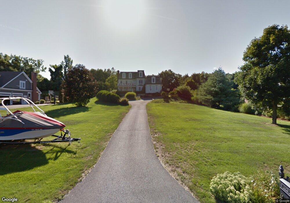
161 Bluff Point Rd South Glastonbury, CT 06073
South Glastonbury NeighborhoodEstimated Value: $908,000 - $1,039,142
4
Beds
3
Baths
3,503
Sq Ft
$281/Sq Ft
Est. Value
About This Home
This home is located at 161 Bluff Point Rd, South Glastonbury, CT 06073 and is currently estimated at $985,381, approximately $281 per square foot. 161 Bluff Point Rd is a home located in Hartford County with nearby schools including Nayaug Elementary School, Gideon Welles School, and Smith Middle School.
Ownership History
Date
Name
Owned For
Owner Type
Purchase Details
Closed on
May 24, 1996
Sold by
Balf Co
Bought by
Peterson Robert and Peterson Janette
Current Estimated Value
Create a Home Valuation Report for This Property
The Home Valuation Report is an in-depth analysis detailing your home's value as well as a comparison with similar homes in the area
Home Values in the Area
Average Home Value in this Area
Purchase History
| Date | Buyer | Sale Price | Title Company |
|---|---|---|---|
| Peterson Robert | $120,000 | -- |
Source: Public Records
Mortgage History
| Date | Status | Borrower | Loan Amount |
|---|---|---|---|
| Closed | Peterson Robert | $290,000 | |
| Closed | Peterson Robert | $300,000 |
Source: Public Records
Tax History Compared to Growth
Tax History
| Year | Tax Paid | Tax Assessment Tax Assessment Total Assessment is a certain percentage of the fair market value that is determined by local assessors to be the total taxable value of land and additions on the property. | Land | Improvement |
|---|---|---|---|---|
| 2025 | $18,578 | $565,900 | $162,700 | $403,200 |
| 2024 | $18,069 | $565,900 | $162,700 | $403,200 |
| 2023 | $17,549 | $565,900 | $162,700 | $403,200 |
| 2022 | $17,359 | $465,400 | $134,500 | $330,900 |
| 2021 | $17,369 | $465,400 | $134,500 | $330,900 |
| 2020 | $17,173 | $465,400 | $134,500 | $330,900 |
| 2019 | $16,922 | $465,400 | $134,500 | $330,900 |
| 2018 | $16,754 | $465,400 | $134,500 | $330,900 |
| 2017 | $15,471 | $413,100 | $108,600 | $304,500 |
| 2016 | $15,037 | $413,100 | $108,600 | $304,500 |
| 2015 | $14,913 | $413,100 | $108,600 | $304,500 |
| 2014 | $14,727 | $413,100 | $108,600 | $304,500 |
Source: Public Records
Map
Nearby Homes
- 287 Main St
- 20 Nessa Way
- 33 Brookwood Dr Unit D
- 1605 Briarwood Ct Unit 1605
- 2843 Main St
- 1 Hillside Ave
- 2 Carillon Dr Unit D
- 37 Carillon Dr Unit A
- 185 Foote Rd
- 5 Northbridge
- 2369 Main St
- 4 Lower Heatherwood
- 4 Lower Heatherwood Unit 4
- 40 Grimes Rd
- 58 Cedar Terrace
- 91 Highview Dr
- 9 Tryon Farm Rd Unit 9
- 30 Southgate Dr Unit 30
- 994 Main St
- 74 Grimes Rd
- 171 Bluff Point Rd
- 141 Bluff Point Rd
- 183 Bluff Point Rd
- 152 Bluff Point Rd
- 168 Bluff Point Rd
- 131 Bluff Point Rd
- 195 Bluff Point Rd
- 134 Bluff Point Rd
- 439 Tryon St
- 640 Tryon St
- 178 Bluff Point Rd
- 22 Tryon St Unit 22
- 22 Tryon St Unit FARMS
- 89 Taylor Town Rd
- 190 Bluff Point Rd
- 207 Bluff Point Rd
- 123 Bluff Point Rd
- 200 Bluff Point Rd
- 80 Taylor Town Rd
- 217 Bluff Point Rd